
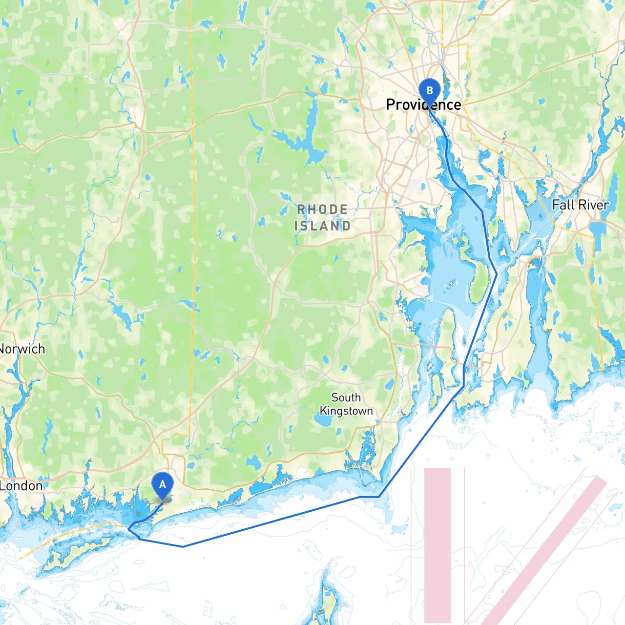
Pilotage Plan from Pawcatuck, CT to Providence, RI
Starting Point: Pawcatuck, CT Coordinates: -71.8417, 41.3338
Begin your adventure at the serene Pawcatuck River, which offers a lovely departure point. As you depart, keep an eye out for local fishing boats and remember to give them a wide berth. The river's winding nature provides lovely scenery, but stay alert to the local traffic as you navigate toward your destination.
Waypoints and Notable Landmarks As you head north, the first significant point is the Westerly Town Beach nearby, providing a scenic backdrop for a photo op. Next, you'll want to pass the serene Watch Hill Point in Rhode Island, a notable landmark recognized for its picturesque lighthouse and beautiful coastal views. From here, you'll also have a great view of the notable Watch Hill Yacht Club, signaling you're on the right track.
Navigating onward, keep a lookout for Block Island Sound, which you will skirt as you approach your destination. While it's tempting to take a closer look at Block Island, which is just southwest, it's best to stay focused on your route for this trip.
Hazards and Cautions Watch for marine traffic and shifting sandbars as you make your way through the southern Rhode Island coast. Areas like Napatree Point and the breachway should be treated with caution, especially at low tide—keep a close eye on your charts. Always check local tidal guides, as they can shift quickly in this area.
Points of Interest and Shelter Options Should the weather turn inclement, consider heading into Charlestown Breachway, which offers a safe harbor and beautiful surroundings to wait out a storm. The nearby Ninigret Pond also provides a tranquil area for shelter and a chance to enjoy kayaking or paddleboarding on calmer days.
As you approach Providence, the Point Judith Lighthouse makes a striking mark. It's a great point to take one last break and reflect on your journey before entering the final leg.
Navigational Considerations and Aids Be sure to stay informed of local navigational aids like buoys and beacons, particularly as you move near the Sakonnet River and the Narragansett Bay. Familiarize yourself with the following navigational aids along the way:
Keep track of local regulations, especially as you get closer to Providence. This area can be busy with commercial shipping traffic; keep a steady watch to ensure a safe passage through any congested waters.
Finally, consider utilizing boating apps to enhance your trip, focusing on navigation and safety. Recommended apps include savvy navvy, which provides excellent chart plotting and route planning tools, alongside local weather updates, and Navionics for detailed marine charts.
Arrival Point: Providence, RI Coordinates: -71.4023, 41.8175
As you navigate into Providence, you'll find a lively coastal city with a vibrant waterfront. The city hosts a range of attractions, making it a wonderful destination for both seasoned mariners and casual boaters alike. Take the time to explore local dining, parks, and rich history—though as always, stay aware of the water traffic and regulations while you enjoy your time ashore.
This route not only offers a safe way to travel but also highlights the beauty and charm of southern New England's coastline. Perfect for recreational boaters who appreciate a mix of natural beauty, navigational challenges, and vibrant local culture. Ensuring safety without sacrificing enjoyment, you’re set for a memorable journey on the water.