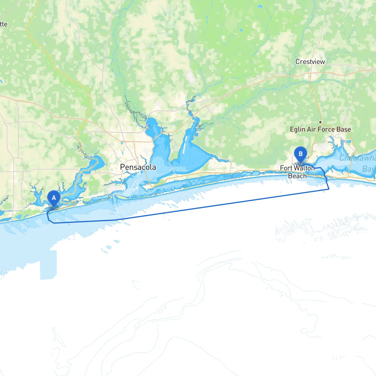
Pilotage Plan: Orange Beach, Alabama to Fort Walton Beach, Florida
Departure: Orange Beach, Alabama
- Coordinates: Long -87.5325 / Lat 30.2849
- Overview: Orange Beach is a beautiful spot to start your journey, renowned for its white sandy beaches and vibrant maritime activities. Before you set sail, make sure to have your charts, safety gear, and personal flotation devices ready.
Initial Route & Notable Hazards As you depart, head west-southwest along the Intracoastal Waterway (ICW). The initial leg of your journey may take you past busy marinas, so it's essential to stay alert for incoming vessels, especially those transiting in and out of the numerous docks. Following the markers for the ICW is crucial as this channel is well-marked but can be narrow in some sections.
Shelter Options Along the Route
- Terry Cove: A quick detour to Terry Cove offers a reliable shelter if weather turns inclement. The cove is protected from most wind directions and provides a tranquil spot to ride out a storm.
- Wolf Bay: This large bay is another ideal stop for temporary shelter, and it’s accessible via the ICW. The scenic setting allows you to take a break if needed.
Points of Interest
- Gulf State Park: Just before you reach the county line separating Alabama and Florida, make a stop at Gulf State Park. This park offers beautiful trails, fishing opportunities, and picnic areas. It's a great place to stretch your legs and enjoy nature.
- Orange Beach Marina: A bustling hub of activity with restaurants and shops. If you have time, grab a bite, refuel, or explore the local maritime shops.
Navigational Aids As you navigate the ICW, pay close attention to the following aids:
- Green and Red Markers: Keep a close eye on the navigation markers, which indicate safe passage. Remember the right-hand rule: red markers to starboard when you’re heading upstream (or to the east).
- Buoy
- 38: Be cautious around buoy #38 and surrounding shallow areas, especially at low tide; they can shift on occasion and require careful navigation.
Local Regulations Be aware of local speed limits along the ICW. Many areas have reduced speeds to minimize environmental impact and boat traffic congestion. It’s particularly vital to maintain a slow speed in the vicinity of marinas and fishing spots.
Arrival: Fort Walton Beach, Florida
- Coordinates: Long -86.6065 / Lat 30.4268
- Overview: As you approach Fort Walton Beach, enjoy the magnificent view of the coastline from the water. The destination offers vibrant attractions, including beautiful beaches, historical sites, and cultural amenities. Be sure to check in with local dockmaster services for berthing availability upon arrival.
Suitable Boater Profile
This route is perfect for recreational boaters seeking a mix of scenic cruising and opportunities to enjoy nature and local attractions. The sheltered bays provide peace of mind in case of sudden weather changes, making it ideal for both novice and experienced boaters. As with all boating excursions, prioritizing safety over fun is paramount.
Recommended Boating Apps
For navigation and safety, I recommend using savvy navvy alongside marine charts and local weather apps. These tools will aid in charting your course, monitoring the weather, and ensuring you adhere to all navigational regulations.
With this plan, you'll not only savor the beauty of Alabama's coastline, but you'll also have the proper tools and insights to navigate safely. Enjoy your journey from Orange Beach to Fort Walton Beach!