
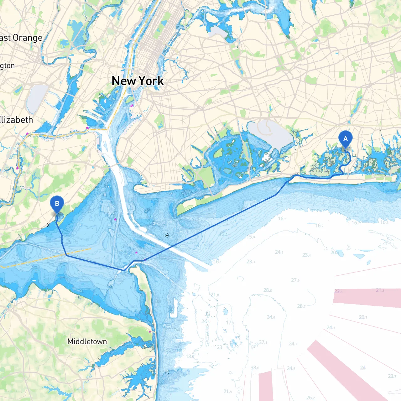
Embarking on a journey from Oceanside to Staten Island is both exhilarating and accessible, making it an ideal route for recreational boaters looking for a mix of scenic waterways, safe harbors, and engaging points of interest. This route is particularly well-suited for intermediate to advanced boaters familiar with coastal navigation, as it traverses busy maritime areas and requires attentiveness to navigation aids and local regulations.
As you depart from Oceanside, prepare for your initial leg of the journey, keeping an eye on the weather and tide conditions. The Hempstead Bay offers a delightful start to your trip. Before pushing off, make sure to set your navigation systems to avoid heavy traffic zones and watch for local fishing boats within the bay.
Important Navigational Aids: Watch for buoys marking the channel, particularly the entrance to Jones Inlet which can be a little tricky depending on tides. The Jones Inlet Light (GPS Coordinates: 40.5869° N, 73.5581° W) is an excellent marker for safe passage.
Points of Interest: Keep an eye out for the scenic views of the Rockaway Peninsula and enjoy the beach vibes. This area can also be a hub for recreational activities like kayaking and paddleboarding if you wish for a quick stop.
Navigational Tips: Constantly monitor your VHF radio for important communications from the New York Harbor Traffic and be aware of commercial traffic, including ferries, cargo ships, and recreational vessels. Use your GPS to align with recognized channels and remain vigilant for navigation buoys and markers, particularly the Ambrose Channel buoys.
Local Navigation Regulations: As you approach Staten Island, ensure you comply with the local navigation rules, especially regarding speed limits within bay areas and keeping clear of designated shipping lanes. The Staten Island ferry route is notably busy.
Arrival at Staten Island: The main point of entry is at St. George, where you're greeted with panoramic views of the Manhattan skyline. As you dock, consider visiting the Staten Island Museum or take a stroll at the Snug Harbor Cultural Center.
1. Life Jackets: Ensure all passengers are equipped with U.S. Coast Guard-approved life jackets.2. Weather Checks: Regularly check weather forecasts before and during the trip.3. Emergency Preparedness: Equip your boat with a first-aid kit, flares, fire extinguishers, and a fully charged cellphone or radio for emergencies.4. Know Your Limits: Be aware of your boat’s capabilities and your own skills, especially when it comes to handling busy waterways.
This trip from Oceanside to Staten Island is not just a cruise; it's an engaging maritime experience filled with various sights and safe ports, making for a memorable journey on the water. Plan accordingly, navigate responsibly, and enjoy your adventure!