
Pilotage Plan: Oak Bluffs, Massachusetts to Nantucket, Massachusetts
Overview of the Journey
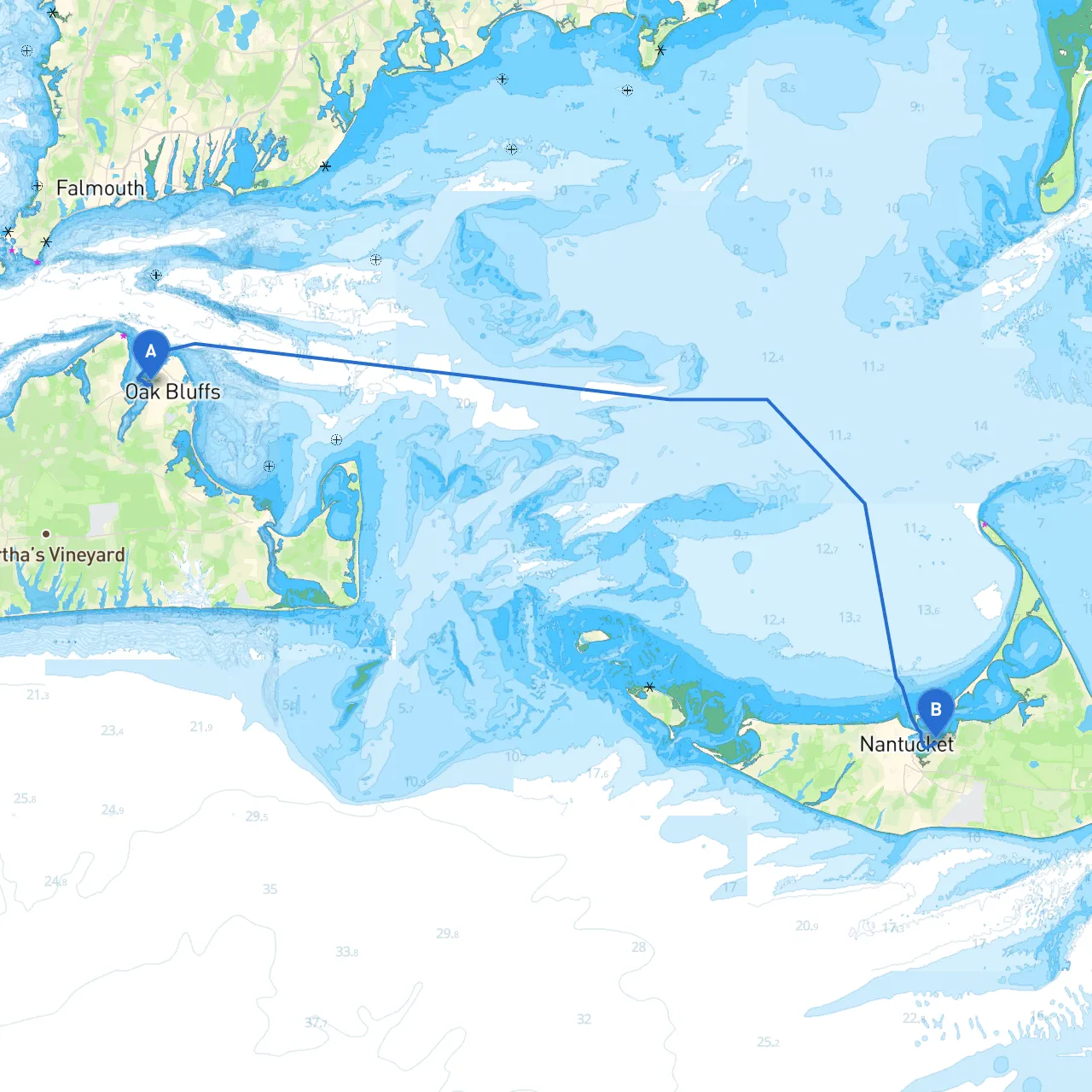
Embarking on a journey from Oak Bluffs to Nantucket offers more than just a destination; it's an experience filled with the stunning natural beauty of the Atlantic, picturesque coastal towns, and rich maritime history. This trip is especially suitable for intermediate to advanced boaters, given its moderate distances and navigational challenges. The distance is approximately 25 nautical miles, with a typical travel time of 3 to 4 hours under good conditions.
Necessary Preparations
Before setting sail, ensure that you have an updated nautical chart covering this route, as well as electronic navigation tools. Aside from savvy navvy, consider using apps such as Navionics and MarineTraffic for precise positioning and live conditions updates. Always check local weather forecasts and tidal information to ensure a safe passage—this area is prone to rapid weather changes.
Route Breakdown
Starting Point: Oak Bluffs, Massachusetts
When you leave from Oak Bluffs, you’ll want to navigate carefully among the Martha’s Vineyard ferries. Be on the lookout for the following navigational aids, ensuring to stay clear of their paths:
Point of Interest: Edgartown
As you make your way east from Oak Bluffs, consider taking a slight detour into Edgartown Harbor. This charming town is famous for its whaling history and stunning 19th-century architecture. It’s an excellent spot for a quick lunch on shore or just a moment to stretch your legs before continuing onward. The harbor is adequate for a short stop; however, be cautious of the potential for challenging currents near the entrance.
Hazards Along the Route
Leaving Edgartown, steer towards the south of Chappaquiddick Island. Be mindful of the waters around:
Shelter Options: Tisbury Great Pond and Other Bays
Should the weather suddenly turn for the worse, Tisbury Great Pond provides a potential refuge. It’s accessible via the cut through the barrier beach at the northwest end, which can be useful during storms. It’s crucial to ensure that your draft is appropriate as it's a shallow area and may require caution.
Entering Nantucket Harbor
As you approach Nantucket, be sure to identify the "Nantucket Light" on Brant Point, which serves as a great navigational aid. This is your sign that you are nearing your destination. The harbor can be busy, so adhere to local navigation rules:
Conclusion
This route from Oak Bluffs to Nantucket is not only a safe passage for intermediate sailors, but also a captivating experience in maritime culture and scenic beauty. With provision for various shelters along the way, attention to navigational aids and local regulations, this trip can be both enjoyable and secure. Ideal for boaters looking to explore the New England coast, you will find the journey to be enriching and memorable while prioritizing safety and preparedness. Safe travels and enjoy your adventure on the water!