
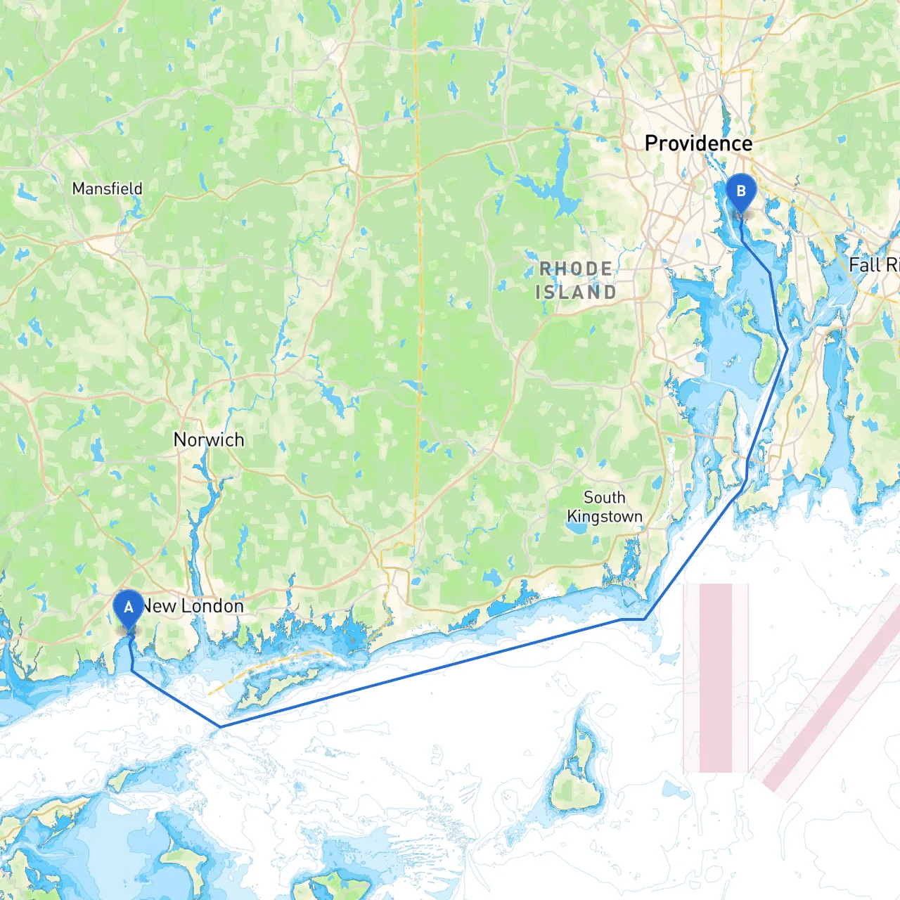
Your voyage begins from Niantic, a charming coastal town known for its stunning waterfront views. As you cast off, be sure to familiarize yourself with the local navigational aids. Pay attention to the Niantic River Bridge (49' clearance) located south of your starting point—it's essential since it marks the transition from the river to the open waters of Long Island Sound.
Point of Interest: Before you leave, consider stopping at the historic Niantic Lighthouse, which stands sentinel at the mouth of the river. It's a lovely backdrop for photos and a reminder of the navigational past.
As you make your way out of the river, head eastward across Long Island Sound. The expanse of water offers beautiful views but also necessitates keen awareness of weather conditions. Always check conditions prior to departure, as sudden squalls can occur in the afternoons, especially in the summer.
Safety Tip: Ensure the boat is equipped with proper safety gear—life jackets, flares, and a VHF radio. Keep an eye on your local NOAA weather updates (or your preferred marine weather app) to avoid potential storms.
Once you’ve crossed into open water, maintain a course that aligns with the major navigational aids marking the safe channels. Avoid isolated shallows and the many rocks dotting the coastline. You will want to pass north of the Cow Pasture Shoal and south of the North Dumpling lighthouse for safe navigation.
As you proceed, there are several notable bays and harbors that serve as potential shelters in case of inclement weather:
Notable Landmark: Keep an eye out for the picturesque Hammonasset State Park as you navigate. It's a great place to drop anchor for a swim or picnic if time allows.
As you approach the Rhode Island state line, the landscape changes. Once you cross into Rhode Island waters, the current may become stronger so adjust your speed accordingly. Make sure to adjust your charts and follow the navigational marks leading into the Providence River.
Navigational aids such as buoys will be listing the channel, and you’ll encounter the historic Fox Point Hurricane Barrier—an impressive engineering feat you won't want to miss.
Local Hazards: The Providence River can be tricky due to busy traffic, especially during peak season. Keep a vigilant watch for ferries and larger vessels navigating this commercial area.
As you enter East Providence, there are a couple of marinas where you can dock, such as the East Bay Boat Company or Riverside Marina. Make sure to look out for any local restrictions regarding speed limits and no-wake zones as you navigate near populated areas.
Point of Interest in East Providence: Once you moor up, explore nature trails at the nearby Haines Memorial State Park. It's a great local attraction that allows you to stretch your legs after a day on the water.
This route from Niantic to East Providence is suitable for experienced boaters familiar with navigating coastal waters and those who appreciate the scenic beauty of New England. The combination of beautiful sights, potential stopovers for respite, and shelter in reputed bays makes this trip both safe and enjoyable.
For the best experience, consider employing navigation apps like Savvy Navvy or NOAA's Weather app to keep track of your course and the elements. Enjoy safe cruising, and bring plenty of water, sunscreen, and good music!