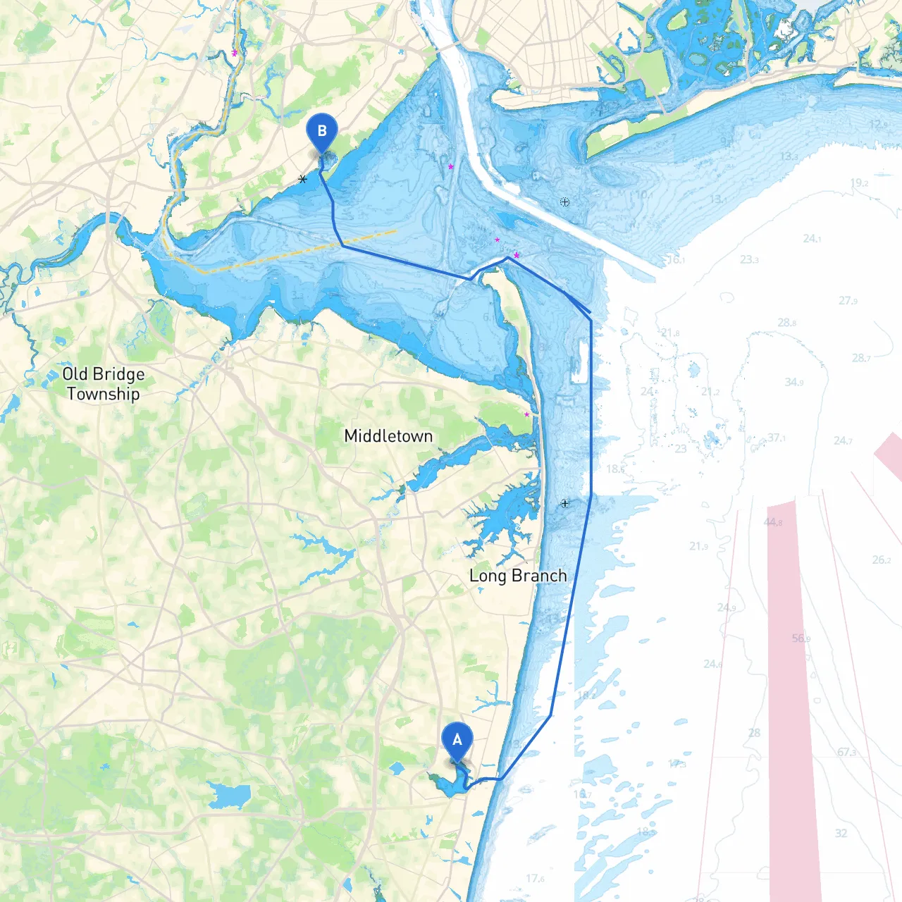
Pilotage Plan from Neptune Township, NJ to Staten Island, NY
Starting Point: Neptune Township, New Jersey Ending Point: Staten Island, New York
The journey from Neptune Township to Staten Island spans approximately 35 nautical miles and offers a rich tapestry of coastal scenery along the way. This pilotage plan is particularly well-suited for intermediate boaters, as it showcases a balance of navigation challenges and tranquil waters. With careful routing, it provides opportunities to enjoy the stunning New Jersey coastline while maintaining a focus on safety throughout the trip.
Departure: Neptune Township Before setting sail, ensure you have updated weather forecasts and tide information. The best time to embark on this journey is during slack tide or on a rising tide to take advantage of favorable currents.
Weather Considerations The coastal weather can change rapidly. Always monitor the marine forecast. If conditions appear poor, know the nearby sheltered bays.
1. Barnegat Inlet As you head northward towards the inlet, you will find a vibrant area full of recreational activities. Barnegat Lighthouse serves as a picturesque landmark, and it's an excellent spot to anchor for sightseeing. Here, local fishing and crabbing can add some thrills to your trip.
2. Sandy Hook Bay Just after Barnegat, you will enter Sandy Hook Bay, which offers several coves for shelter in case of inclement weather. Sandy Hook itself is a beautiful area with undeveloped beaches and wildlife. It's worth a stop for a picnic or a swim. The historic Sandy Hook Lighthouse is also a delightful view.
3. Raritan Bay Moving north past the parklands, you will find Raritan Bay. Pay attention to the navigational aids marked on your chart, particularly the Raritan River light and any buoyage indicating safe channels.
Navigational Aids Utilize nautical charts and electronic navigation tools like GPS and savvy navvy, which provides routes, real-time data points, and hazard warnings. Key aids on this route include:
Local Regulations It's important to be aware of local regulations, particularly in designated wildlife areas near the bays where speed limits are enforced to protect marine animals. Always maintain a safe distance from large commercial vessels as well, particularly in the crowded Raritan Bay.
In case of adverse weather, here are some recommended bays for seeking shelter:
This route to Staten Island not only serves as a practical coastal transit but also unveils the beauty of New Jersey’s maritime landscape. It strikes a balance between enjoying the journey and maintaining safety, making it an ideal adventure for those looking to expand their boating skills in varied conditions. Make sure you have your life jackets, flares, and communication devices ready before setting out, and keep your eyes on the water for changing conditions. With a carefully marked course and delightful stops along the way, this cruise promises a memorable experience on the water.