
Pilotage Plan: Nassau, The Bahamas to Compass Cay, BAH, BS
Overview of the Journey Embarking from Nassau, you’re setting off on an incredible journey through the stunning waters of The Bahamas, with the destination of Compass Cay beckoning for exploration. This trip is well-suited for experienced boaters who can navigate the open waters, yet it’s also accessible for less experienced captains who wish to enjoy beautiful scenery and vibrant marine life. As we plan this route, safety will remain our top priority, with plenty of options for shelter, points of interest, and navigational aids along the way.
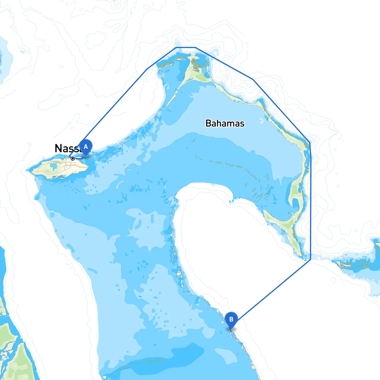
Leg 1: From Nassau to Allen’s Cay (Approx. 35 nautical miles) Your journey begins in Nassau, where you’ll want to check the weather and ensure your vessel is equipped for the trip. Utilizing your GPS will be essential as you navigate through the waters heading north. Be on watch for the famous “Nassau Harbor” buoys as you exit the harbor.
As you cruise towards Allen's Cay, keep an eye out for the channel markers guiding you safely through the banks. This area presents a few hazards, notably scattered rocks and coral outcrops, so maintaining a careful lookout is critical. The navigational aids along this stretch, including the Allen's Cay Lighthouse, will be beneficial.
Safety Tip: If weather conditions look unfavorable—particularly concerning wind or swells—consider taking refuge at Rose Island, a nice stop-over where you can find shelter in more protected bays.
Leg 2: Allen’s Cay to Exuma Cays Land and Sea Park (Approx. 25 nautical miles) After a brief stop at Allen’s Cay, known for its friendly iguanas and stunning beaches, you’ll head towards the Exuma Cays Land and Sea Park. The vibrant ecosystem here is a haven for snorkeling, diving, and exploring beautiful cays.
Navigating through this park requires awareness of the established mooring fields since anchoring is prohibited to protect the delicate marine habitats. Look out for local regulations or closures in the park to support conservation efforts. This is an ideal place to stretch your legs and enjoy some outdoor activities before you proceed.
Safety Tip: Make sure to have current maps on hand while navigating through this area.
Leg 3: Exuma Cays to Compass Cay (Approx. 15 nautical miles) The final leg of your journey takes you to Compass Cay. As you near your destination, keep an eye on the markers leading into the harbor. There is a well-established mooring field here, and the friendly locals are generally willing to assist with docking.
Once anchored, you can experience one of the highlights of your trip—swimming with nurse sharks! Compass Cay itself is a small but picturesque spot with some limited amenities, adding to the charm of an off-the-beaten-path experience. Also, while at Compass, don't miss the stunning views from the surrounding cays—an extraordinary opportunity for photography or simply taking in the sunset.
Useful Apps for Your Journey While your navigation equipment should be your primary tool, adopting companion apps will greatly enhance your experience.
1. Savvy Navvy - This app is essential for route planning and real-time weather conditions, equipped with up-to-date charts for The Bahamas’ waters.2. Navionics - Great for charts and navigational aids.3. Windy - To monitor weather updates, particularly wind and storm conditions, which can change rapidly here.
Conclusion This pilotage plan from Nassau to Compass Cay is a splendid journey tailored for experienced sailors who appreciate the beauty of The Bahamas, with sufficient opportunities for safe havens and intriguing stops. The open waters and clear skies will provide an unforgettable backdrop as you navigate toward your destination, ensuring a trip filled with both adventure and serenity. Always remember, the heart of a successful journey lies in preparation and diligence, particularly when it comes to cruising safe waters. Happy sailing!