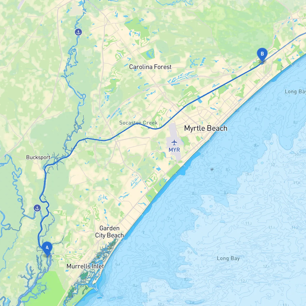
Pilotage Plan from Murrells Inlet, South Carolina to Myrtle Beach, South Carolina
Route Overview This delightful coastal journey is perfect for recreational boaters seeking scenic views and some adventure. The trip from Murrells Inlet to Myrtle Beach is roughly 15 nautical miles, making it a day trip suitable for experienced cruisers and novice boater alike, enhancing both skills and comfort on the water.
Starting Point: Murrells Inlet
Hazards & Navigational Aids As you leave the inlet, be cautious of:
Navigational Aids: Look for buoys and markers leading you out. The channel is well-marked, but it helps to stay alert and be prepared for any sudden changes in water conditions.
Inlet to Waccamaw River Upon exiting Murrells Inlet, head northeast toward the entrance of the Waccamaw River. This navigable waterway is crucial as it serves not only as a travel path to Myrtle Beach but also provides natural beauty that’s a joy to explore.
Points of Interest:
Navigational Considerations:
Destination: Myrtle Beach
Navigational Aids & Local Regulations:
This route is perfect for family outings or leisurely coffee cruises on weekends. The mix of natural beauty along the Waccamaw River and the bustling atmosphere of Myrtle Beach provides a full day of experiences without the rush. Your journey can be a wonderful combination of relaxation and mild adventure, taking you through serene surroundings while keeping safety paramount.
As for useful apps, don’t forget to download savvy navvy for outstanding charting and navigation support. Other apps to consider include Navionics and iNavX for additional navigation aids. Whichever you choose, ensure your devices are charged and that you have offline options set just in case.
Finally, always remember to check the weather forecast before leaving the dock, and ensure that you have life jackets on board for all passengers. Enjoy your adventure on the water, and stay safe while making lasting memories!