
Pilotage Plan for a Boat Trip from Montauk, NY to Providence, RI
Overview
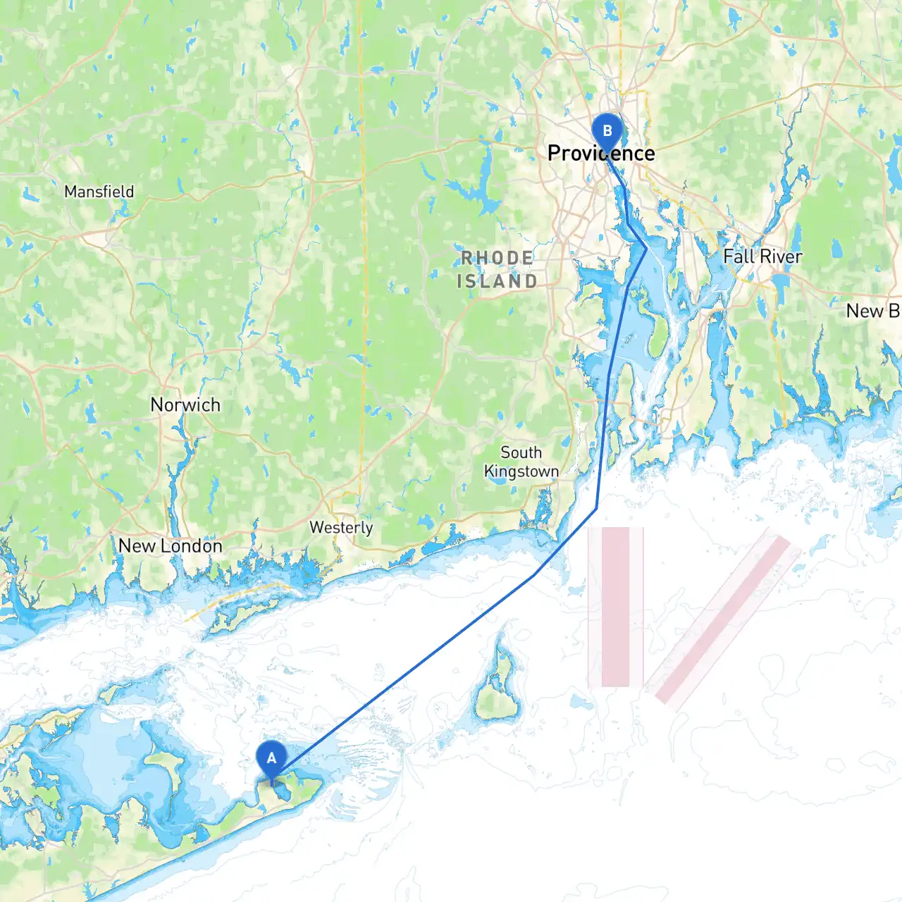
Your journey from Montauk, NY to Providence, RI offers a blend of scenic coastlines, charming harbors, and vital navigational landmarks. This trip is perfect for experienced coastal cruisers, but it’s suitable for skilled recreational boaters too, as long as they prepare adequately and monitor weather conditions. Safety is paramount, and understanding the local navigation regulations will enhance your experience.
Route Segmentation and Important Considerations
As you set off from Montauk, pay attention to the local regulation surrounding boat traffic, especially in the busy harbor. Montauk is known for the Montauk Point Lighthouse which is a famous landmark, perfect for a quick photo opportunity before heading out into the Atlantic. The lighthouse can be a reliable reference point as you proceed eastward.
Head northeast from Montauk Point Lighthouse toward Block Island Sound. You’ll be traveling approximately 12 nautical miles across open water. Keep an eye on your nautical charts for shipping traffic, particularly from larger vessels heading to and from Long Island Sound. Use aids such as the South Fork of Long Island Buoys to help guide your path – the NOAA and local marine publications will have up-to-date information about these.
If weather conditions begin to worsen or you wish to explore, take a detour to Block Island. This idyllic spot is a perfect sanctuary with several secluded harbors, such as Great Salt Pond and Old Harbor, which offer protected docking facilities.
Great Salt Pond is especially recommended for overnight stays where you can explore the island's charm, including its trails, beaches, and local boutiques, perfect for a relaxing break.
After leaving Block Island, set your course towards the Rhode Island mainland. You’ll be heading to Point Judith, an important navigation point characterized by its breakwater and lighthouse. This area features significant boat traffic, so keep a vigilant watch as you approach. The entrance to Point Judith Harbor is well-marked, but proceed with caution, considering tides and currents which can create unpredictable conditions.
From Point Judith, you will enter Narragansett Bay, a hub of maritime activity that leads you towards Providence. This area is graced with scenic views and rich maritime history. As you navigate the bay, be mindful of local yacht clubs, sailing schools, and other vessels, especially in busy seasons.
As you near Providence, you will enter the Providence River. The river is well-marked with numerous navigational aids. Keep an eye out for the I-195 Bridge and the iconic Industrial National Park buildings, which guide you towards downtown Providence.
To dock, you have several options like the Providence Maritime Center or the nearby docks catered to visiting crafts. Once docked, you can explore the vibrant city, visit WaterFire, and enjoy the culinary delights Providence has to offer.
Safety Considerations
Consider downloading applications like:
In summary, this trip from Montauk to Providence is loaded with opportunities for discovery and safety. By adhering to these navigational guidelines and taking advantage of the points of refuge along the way, you can ensure not only a smoother sailing experience but also a joyful exploration of the New England coastline. Enjoy your journey!