Pilotage Plan: Monmouth Beach, NJ to Brooklyn, NY
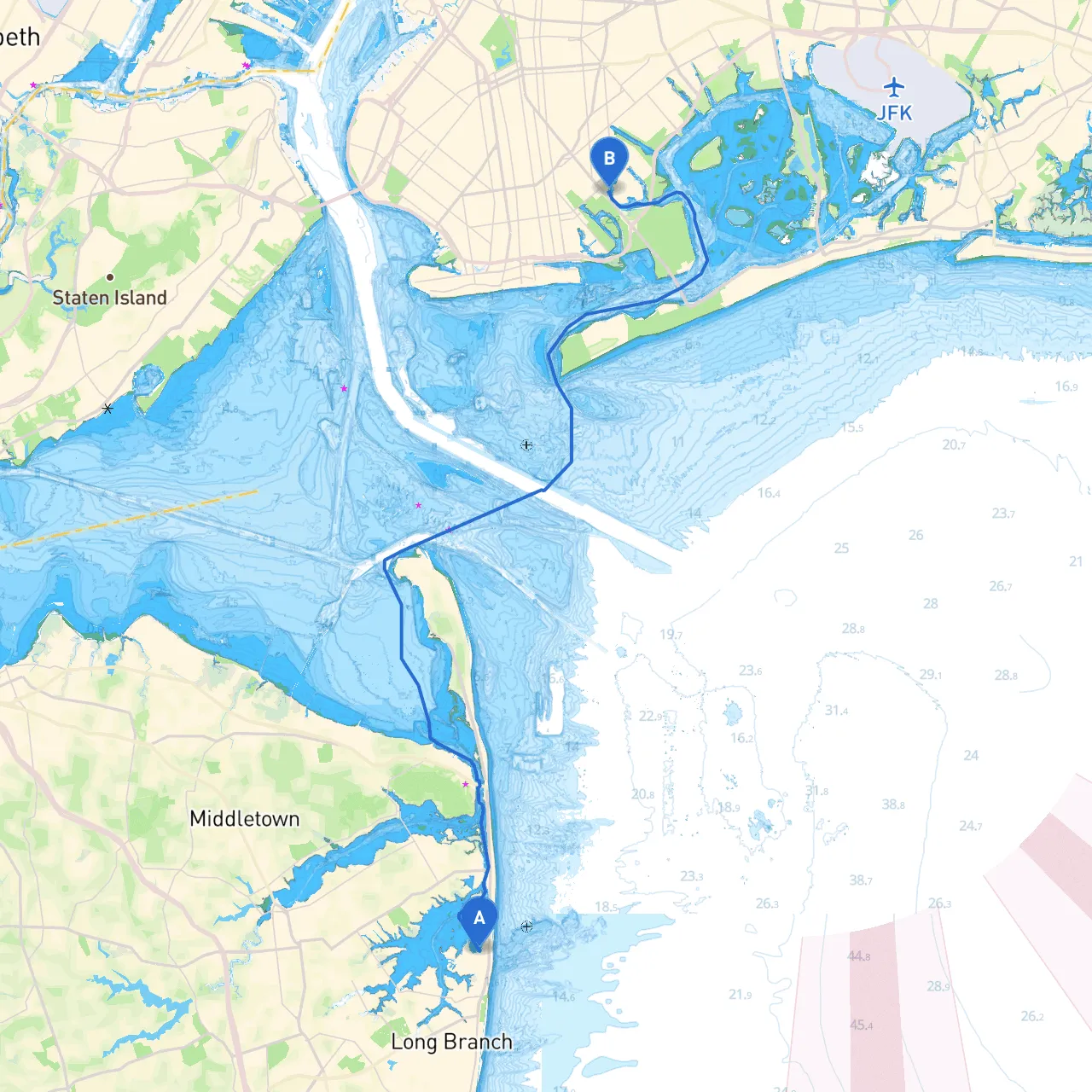
Route Overview:The journey from Monmouth Beach, NJ, to Brooklyn, NY, offers a scenic blend of coastal navigation and urban exploration, perfect for intermediate to advanced boaters. This trip spans approximately 25 nautical miles along the beautiful New Jersey coast and the bustling waters around New York City.
Planning Your Departure:Begin your trip at Monmouth Beach, located right along the picturesque Shrewsbury River, surrounded by lovely waterfront properties and stunning views of the Atlantic. Before departure, ensure you check the weather and tide reports, as both can significantly impact your journey.
Leg 1: Monmouth Beach to Sandy Hook Bay
- Distance: ~5 nautical miles
- As you set off, keep clear of navigation hazards such as submerged rocks and shallow areas; it's advisable to follow the marked channel eastward towards Sandy Hook Bay.
- The Sandy Hook Lighthouse, an iconic landmark, will guide you into the bay. Here, you can explore the historical site and enjoy the surrounding nature reserve. Sandy Hook offers adequate shelter should weather conditions change abruptly, with safe mooring options provided at the various marinas.
Leg 2: Sandy Hook Bay to Raritan Bay
- Distance: ~6 nautical miles
- Upon entering Raritan Bay, it's vital to pay attention to the traffic density, as this is a busy passage frequented by both commercial and recreational vessels. Utilize navigational aids like the Raritan River Lights and pay heed to the busy shipping lanes.
- Consider a short stop at the Atlantic Highlands, where you can find quaint shops and waterfront dining.
Leg 3: Raritan Bay to the East River
- Distance: ~7 nautical miles
- Navigate towards the Verrazano-Narrows Bridge. This area has strong tidal currents; staying aware of your vessel's speed and course is crucial. The bridge itself offers a spectacular view and a great photo opportunity.
- During this stretch, the weather can present challenges, so a contingency plan for shelter at nearby marinas or approaches to the lower part of the bay is advisable.
Leg 4: Entering New York Harbor and Heading to Brooklyn
- Distance: ~7 nautical miles
- As you approach the mouth of the East River, the bustling sights of New York City unfold before you. Key landmarks include the Statue of Liberty and Governors Island, marking the entrance to a vibrant waterway.
- The East River can experience significant currents and ferry traffic, so stay alert and maintain a safe distance from larger vessels. Recommended points for shelter here include the Brooklyn Marina.
- Depending on your arrival time, you can enjoy some glorious vistas of Manhattan as your destination approaches.
Important Navigational Aids & Regulations:
- Make sure to utilize your charts responsibly; electronic charting tools (like the recommended Savvy Navvy app) and VHF radio for tracking local traffic and weather broadcasts are essential.
- Watch out for No-Wake zones, particularly in crowded areas and marinas. Follow all guidelines set by local authorities, especially when entering busy channels or working harbors.
- Be aware that certain sections near the harbor might require special permits or notifications to be allowed entry, especially during events or construction activities.
Conclusion:This route showcases a stunning mix of natural beauty and urban majesty, ideal for boaters looking for both leisure and adventure. While it caters well to those with more experience, as it navigates busy waters and varying currents, it remains a safe and enjoyable trip with numerous stop-off points to rest and relish the journey. Be prepared, stay safe, and enjoy the breathtaking views along your path from Monmouth Beach to Brooklyn.