
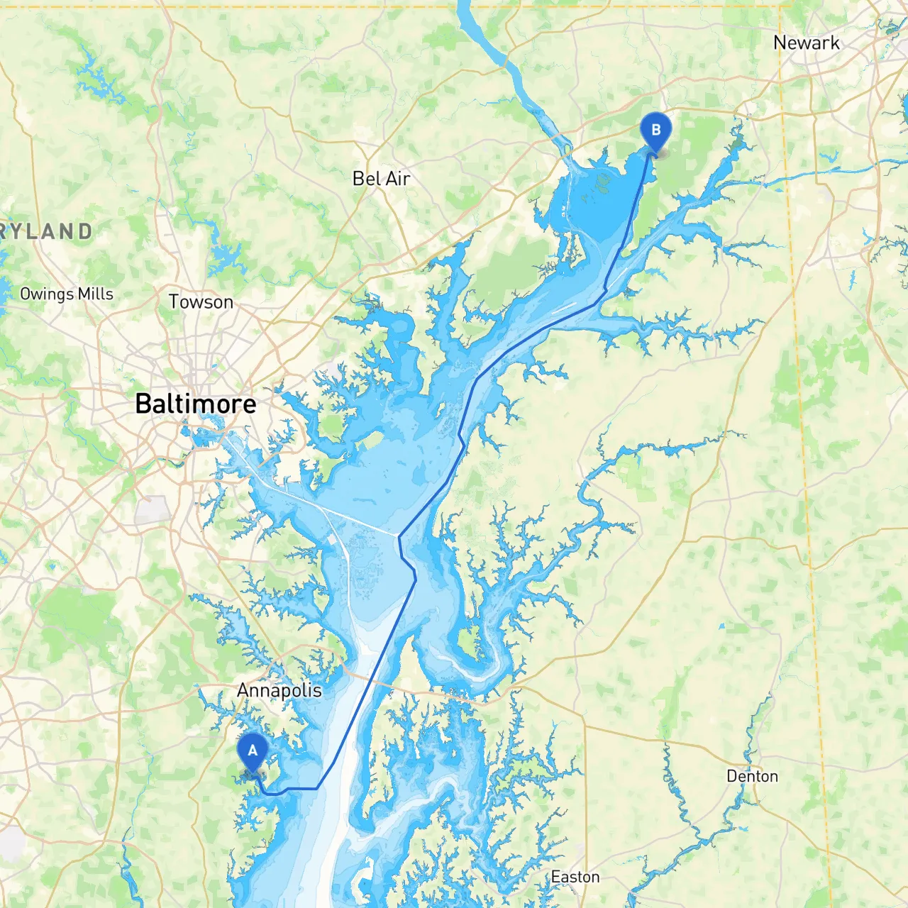
Pilotage Plan from Mayo, Maryland to North East, Maryland
Introduction:Embarking from Mayo, Maryland, to North East, Maryland, offers a delightful blend of scenic views, tranquil waters, and interesting landmarks. This journey spans approximately 27 nautical miles, navigating through the picturesque Chesapeake Bay and its tributaries. This pilotage plan will guide you through a safe and enjoyable voyage, especially suited for boaters who appreciate a mix of nature, culture, and adventure while prioritizing safety.
Route Overview:You will begin your journey in Mayo and proceed through the South River, connecting with the Chesapeake Bay. The route will take you along the eastern shore, allowing for easy access to various natural bays and harbors. Do be prepared for the maritime weather patterns and current flow as you navigate the route.
As you set off from Mayo, head southeast towards the mouth of the South River.
Safety Note: There may be some recreational traffic in this area, so be vigilant and maintain a lookout for other vessels, especially kayakers and paddleboarders, especially in the afternoons.
Staying updated on conditions is vital throughout your voyage. Recommended apps include Savvy Navvy for real-time navigation, along with the U.S. Coast Guard app for safety updates and weather changes. You might also find Navionics beneficial for detailed charts of the bays and rivers.
This journey is perfectly suited for recreational boaters eager to explore the stunning waterfronts, as well as those who respect the importance of seamanship and safety. The mix of open water with the opportunity to explore charming ports along the way makes this an ideal route for a weekend getaway or a day trip.
Preparing adequately ensures not only your safety but also enhances your enjoyment of the wonderful sights along the way. Remember, while this trip is packed with excitement and points of interest, your safety is paramount on the water. Enjoy your voyage!