
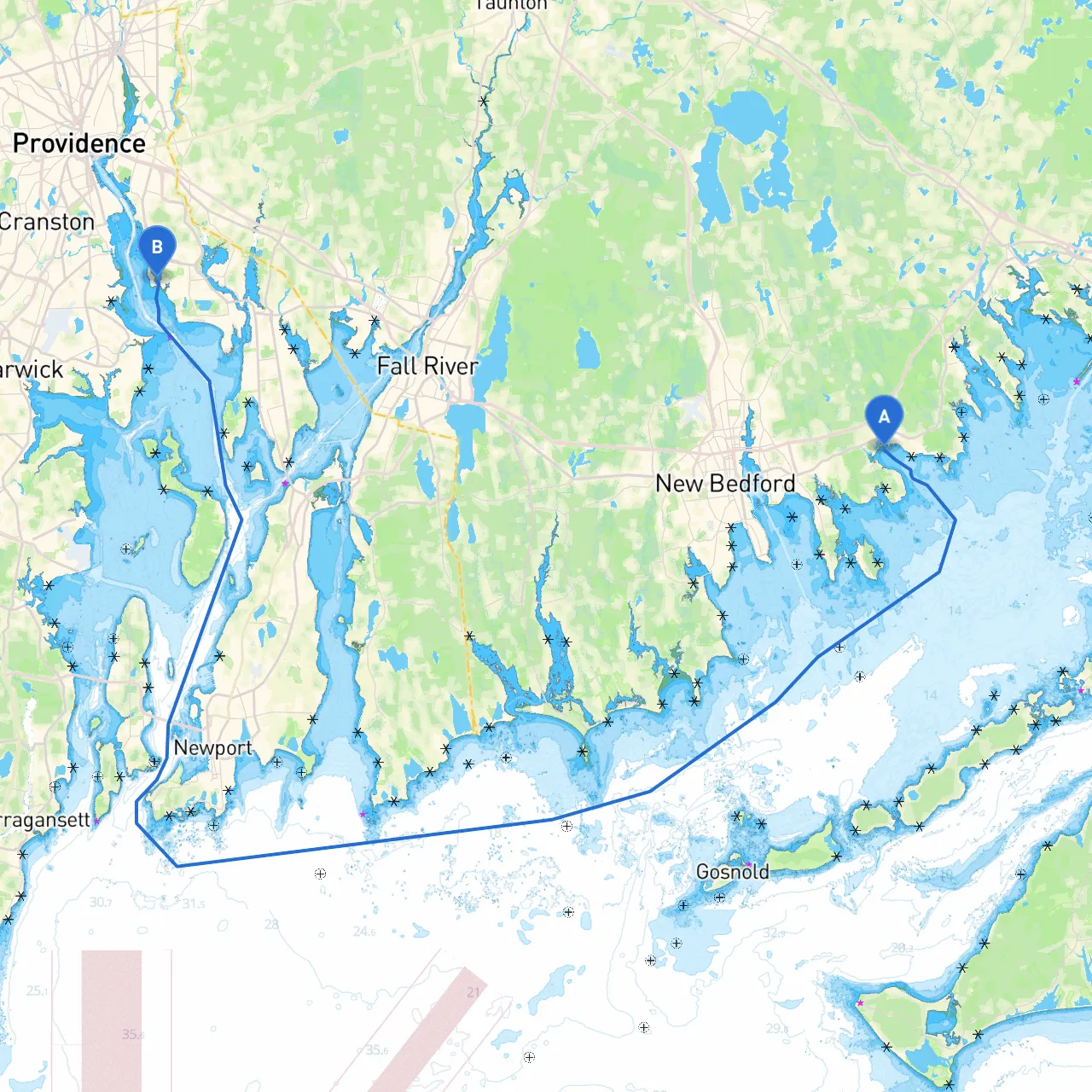
Pilotage Plan: Mattapoisett, Massachusetts to East Providence, Rhode Island
Route Overview:This journey along the southeastern coast of Massachusetts into Rhode Island offers a wonderful blend of scenic views, charming waterfront communities, and practical considerations for safe navigation. Ideal for recreational boaters, from seasoned sailors to families seeking a peaceful escape, this route is well-furnished with navigational aids and shelter options.
Departure from Mattapoisett:Starting your trip at the scenic Mattapoisett Harbor (Coordinates: Long/Lat -70.8166666667, 41.6546666667), take a moment to enjoy the charming village and its quaint marinas. As you set out, be aware of the local fishing vessels and kayakers that frequent the area, especially in the mornings when the harbor is often busy.
Initial Heading:As you exit the harbor, steer generally eastward towards Buzzards Bay. Not long after departure, you will notice New Bedford to your northeast. Ensure you keep a respectful distance from the commercial shipping lanes that run through the bay.
Navigational Aids:As you approach the Buzzards Bay Channel, pay close attention to the buoys and markers — particularly the "C" and "R" lateral buoys which guide vessels safely through this busy navigational corridor. A good practice is to be updated with local charts and weather information via marine apps like Savvy Navvy to avoid any unscheduled surprises.
Shelter Options:If the weather turns inclement while on Buzzards Bay, you can find refuge in several bays:
Points of Interest:As you cross toward the Rhode Island side, consider making a quick stop at Padanaram Harbor. This lovely community offers quaint shops and eateries that focus on local seafood—perfect for a break or a meal.
Approaching East Bay:Once past Mount Hope Bay, prepare to navigate into the East Bay area. Look out for the vibrant skyline of Providence in the distance. The East Bay is known for its scenic waterfront and historic bridges.
Navigational Considerations in East Bay:As you near East Providence, make sure to keep an eye out for the numerous buoys marking the channels. The East Approaches to the Seekonk River provide good access into Providence with markers directing you through this area, ensuring you remain in safe waters.
Arrival in East Providence:Upon reaching East Providence (Coordinates: Long/Lat -71.35455, 41.74805), you will find plenty of docking options at local marinas, which often provide facilities like fuel, bathrooms, and dining options. The waterfront parks are excellent spots to stretch your legs after the journey, providing lush green spaces and views over the water.
Regulatory Adherence:Be sure to respect local speed limits in residential and densely populated areas, along with any no-wake zones, especially as you enter urban waterways. Checking local regulations regarding fishing or any protected zones is also essential for being a responsible boater.
Final Thoughts:This route from Mattapoisett to East Providence beautifully combines the thrill of boat cruising with a set of straightforward navigational challenges, suitable for almost any boater. The potential for a day filled with exploration, relaxation, and connection with nature makes it hard to resist. Rely on apps like Savvy Navvy for trip planning and navigating while enjoying this delightful stretch of the New England coastline. Safe travels!