
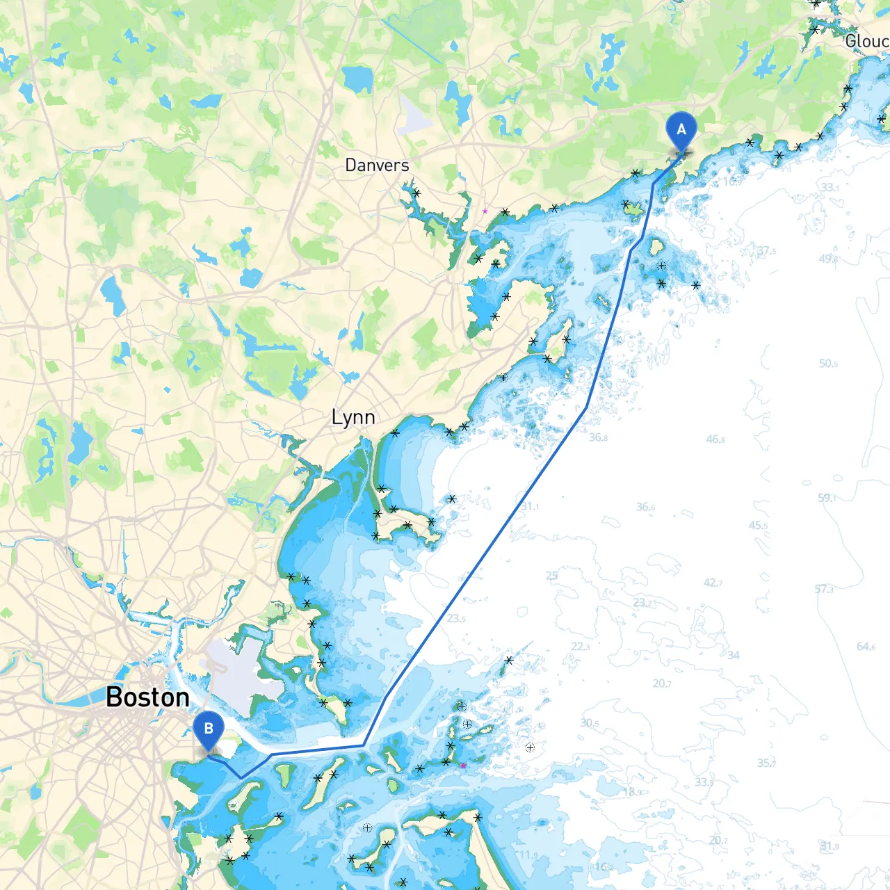
Pilotage Plan: Manchester by the Sea, Massachusetts to South Boston, Massachusetts
Embarking on a boat trip from Manchester by the Sea to South Boston is an excellent journey for seasoned and novice sailors alike. This route offers a wonderful mix of scenic views, bustling urban landscapes, and safe anchorages, making it perfect for those who cherish both safety and adventure. As you gear up for the trip, here’s a detailed guide to help you navigate your way while ensuring a safe and enjoyable journey.
Coordinates: Longitude -70.77275, Latitude 42.5701166667
Manchester by the Sea is a charming seaside town known for its picturesque harbor and coastal beauty. Before you set sail, take a moment to enjoy the local scenery and perhaps stock up on supplies. The town’s harbor provides well-marked navigation systems and local maritime resources to assist your preparations.
Your adventure will take you southeast across the beautiful waters of the Massachusetts coastline, following a path that is both captivating and relatively safe for navigation.
1. Point to Point Navigation: Depart from Manchester's harbor, navigating southward towards the mouth of the Annisquam River. As you leave, be sure to heed the entrance buoys signaling deeper waters away from the shallows.
2. Beverly Harbor: As you pass near Beverly, this is an excellent spot to stop if weather turns suit. The harbor is well-sheltered and offers ample anchorage opportunities. You’ll find a vibrant waterfront and local amenities, making it a great place to refuel and rest.
3. Marblehead Harbor: Continue past Marblehead, where you can take in stunning views of historic architecture and perhaps explore the Marblehead Lighthouse. Should the weather worsen, Marblehead Harbor offers further refuge, with good facilities for boats.
4. Salem Sound: As you enter Salem Sound, be aware of the busy waters and maintain vigilance. The sound is picturesque but also populated with other craft. The area is filled with local history; the proximity to Salem can allow for a short onshore visit should you desire.
5. Misty Waters and the Isles of Shoals: After navigating through Salem Sound, keep an eye on your charts as you reach the Isles of Shoals. These provide stunning views and potentially excellent anchorages, depending on conditions.
6. Entering Boston Harbor: As you approach Boston Harbor, be prepared for some busy traffic. Follow the designated shipping lanes to avoid commercial vessels, paying close attention to navigation markers. The approaches can be confusing, so have your nautical charts updated and accessible.
Coordinates: Longitude -71.02746700684338, Latitude 42.331874894111024
You will find yourself in vibrant South Boston, a bustling area rich in culture and history. The harbor's busy atmosphere provides plenty of opportunities to dock and explore the local amenities.
For a smoother navigation experience, consider using savvy navvy alongside other reputable apps for navigation and weather updates. These tools can significantly enhance your journey by keeping you informed and prepared at every marine mile.
This route offers not only breathtaking views of the Massachusetts coastline but also the thrill of exploring new places while keeping the safety of your crew and vessel as a top priority. Enjoy the journey from Manchester by the Sea to South Boston, and always respect the power of the water!