
Pilotage Plan: Manasota Key, FL to Fort Myers, FL
Segment Overview
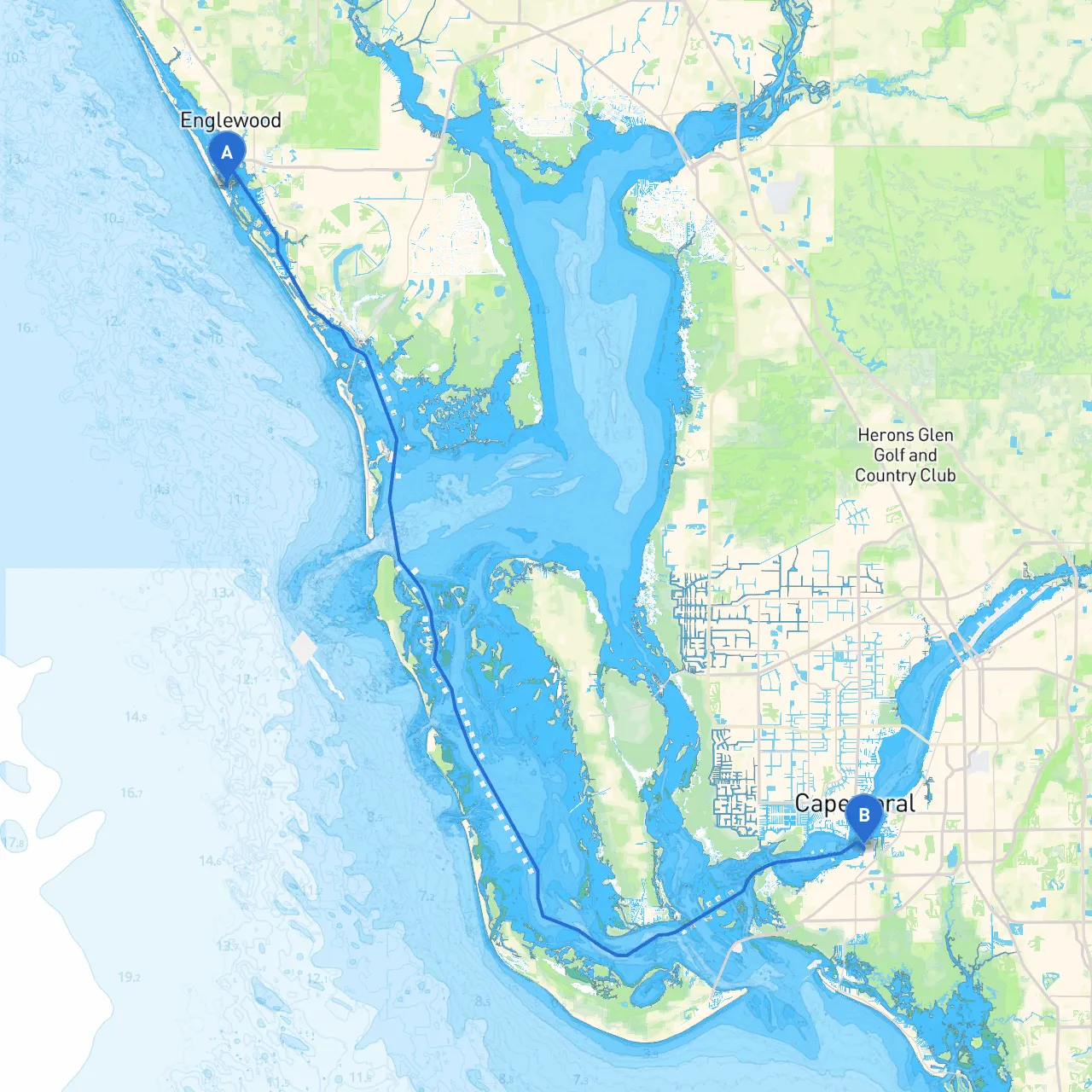
Setting sail from Manasota Key to Fort Myers is not just a journey from Point A to Point B; it’s an exploration filled with natural beauty, opportunities for adventure, and safe havens along the way. This stretch is approximately 30 nautical miles, making it ideal for recreational boaters, weekend explorers, and families. The route primarily lies within the protected waters of the Gulf of Mexico and scenic intracoastal waterways.
Safety First
Before embarking, ensure you have the following safety gear on board:
Area Weather Considerations
Always check the local weather before leaving. The Gulf Coast can present sudden squalls. In case of inclement weather, consider the following safe harbors along the way:
Bays and Safe Harbors
1. Gasparilla Sound: Just south of your departure point, this sound offers protected waters in case conditions worsen.
2. Charlotte Harbor: A significant and more spacious harbor, ideal if you need to find refuge. Keep in mind the nearby town of Punta Gorda has amenities for a restful stop.
3. San Carlos Bay: Approaching Fort Myers, this bay is also a great spot to take shelter if needed, with lovely views and facilities available.
Points of Interest
The route is dotted with tranquil spots and engaging attractions:
Navigational Aids and Considerations
During your journey, keep an eye on several important navigational markers and aids:
1. Marker 14: A crucial waypoint as you exit Lemon Bay toward the mouth of the Gulf. 2. Channel markers at Gasparilla Sound: Be sure to stay within the marked channels to avoid sandy shoals.3. Fort Myers Beach Channel: As you near Fort Myers, precise navigation is important here due to increased recreational and commercial traffic.
Familiarize yourself with local speed limits, particularly in crowded areas, and remain respectful towards wildlife, especially manatee zones—watch for the posted signs and be vigilant in those areas.
Regulations
Check for any local regulations ahead of your trip. Boat registration, fishing licenses (if applicable), and awareness of no-anchor zones near sensitive marine areas are all crucial factors to consider.
Recommended Boating Apps
Utilize GPS and navigation apps to stay on course. I recommend downloading:
Conclusion
This cruise from Manasota Key to Fort Myers offers not just a path to your destination but an enticing journey with splendid sights, opportunities for adventure, and safety in mind. The combination of sheltered bays, engaging landmarks, and well-marked channels makes this route perfect for all types of boaters, especially families looking for a pleasant day out on the water. Happy cruising!