
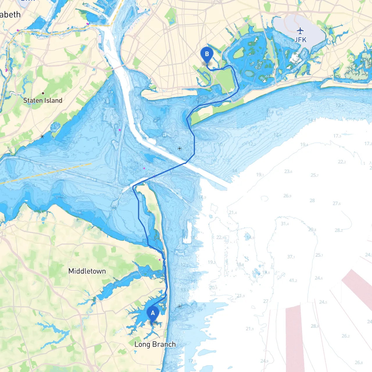
Route OverviewEmbarking from Long Branch, NJ, to Brooklyn, NY is a splendid opportunity for a coastal cruising adventure in a region rich with maritime history. This route spans approximately 25 nautical miles, navigating through varied coastal landscapes and offering access to several safe havens in case of unpredictable weather. Ideal for seasoned boaters, this journey will provide engaging scenery, local attractions, and manageable challenges for those who appreciate the art of piloting.
Section 1: Departure from Long Branch, NJ
As you set sail from Long Branch (coordinates: 40.3261, -73.9956), familiarize yourself with the local marina's facilities and any necessary preparations for departure. The area is bustling with maritime activity, and you'll likely share the waters with fellow boaters. Before you leave, consider checking the latest weather conditions and tide charts, as this can significantly influence your plans.
Navigational Aids: Pay attention to the Long Branch Inlet, with its marked channels leading you safely into the open waters. Maintain a vigilant watch for local fishing boats and recreational vessels, as this area is popular among them.
Points of Interest:
Section 2: Along the Coastline to Sandy Hook Bay
After navigating the open water, you’ll want to steer towards the iconic Sandy Hook Bay. It’s a beautiful. This route provides stunning views of the New Jersey coastline and the serene beaches of Sandy Hook, a barrier peninsula known for its natural beauty.
Hazards to Note: Be wary of the shoals near the entrance of Sandy Hook Bay. They can be tricky, especially at low tide. Always refer to up-to-date charts for depth information and position yourself accordingly.
Shelter Opportunities: Sandy Hook Bay offers excellent shelter in Harbors such as Horseshoe Cove, which is ideal in case of inclement weather.
Points of Interest:
Section 3: Navigating the Raritan Bay
Continuing from Sandy Hook, you will venture through the Raritan Bay. This segment is relatively straightforward, but pay attention to the busy shipping lanes, especially as you approach the Arthur Kill. Use the aids to navigation diligently as they guide you through this busier waterway.
Navigational Aids: Look for the red and green buoys marking channel edges and the prominent Port Reading Range Light and the Battery Point Light, which are crucial for orientation.
Local Regulations: Be cautious of restricted areas with respect to the shipping traffic. Stay clear of the channels marked for larger vessels whenever possible.
Section 4: Entering the New York Harbor
As you draw closer to Brooklyn, the waters will become more populated. This is a bustling area where the waterways serve commercial shipping and recreational boating. Expect an increase in traffic, so maintaining a proper lookout is crucial.
Hazards to Note: Be particularly wary near the Verrazzano-Narrows Bridge. The tidal currents can be quite strong here, and large vessels frequent this channel.
Shelter Opportunities: If conditions worsen, you can find refuge in Sheepshead Bay. This area is well-known for its marinas and is accessible, even for larger vessels.
Points of Interest:
Final Approach: Arrival in Brooklyn, NY
Arriving in Brooklyn at the coordinates (40.6085, -73.9182), take stock of your surroundings and navigate toward your chosen docking facility. With numerous marinas and amenities available, you’ll find plenty of accommodation options for both your vessel and yourself, allowing for easy disembarkation and exploration of this vibrant borough.
Safety Tips: Always have your life jackets on board, as well as a VHF radio for communication. Regularly check your fuel levels and monitor weather updates throughout your journey.
This route is perfect for adventurous boaters who enjoy natural beauty and a bit of nautical heritage. With safety at the forefront, you will surely have a rewarding journey, exploring some of the most scenic parts of the New Jersey and New York coastline. Happy sailing!