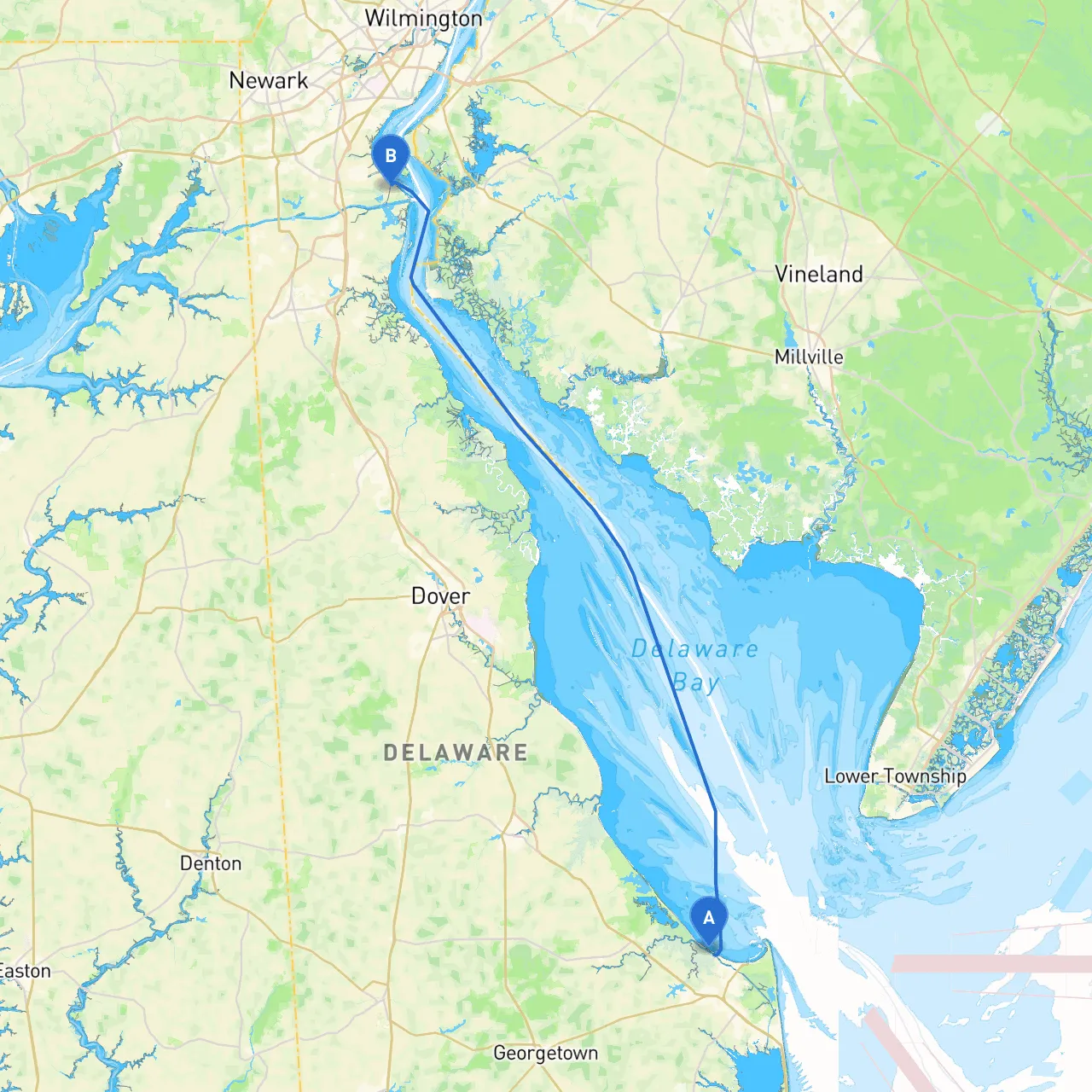
Overview of the Route
This adventure starts in the charming town of Lewes, nestled conveniently near the mouth of the Delaware Bay. Your destination, Delaware City, is significantly more urban but rich in maritime history. The route offers a delightful blend of scenic views, rich wildlife, and historical landmarks, making it an exciting journey for any boater. The trip is particularly suitable for coastal cruisers and those with some experience, as it involves navigating various environmental conditions that can arise along the way.
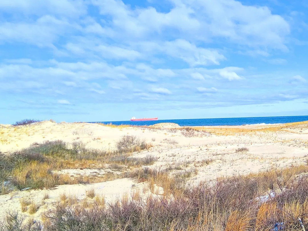
Starting Point: Lewes, DE
Before setting sail, take a moment to enjoy Lewes's picturesque waterfront. The area is filled with cozy restaurants and shops that reflect traditional coastal life. You can also visit the Cape Henlopen State Park nearby, perfect for a quick stretch before you embark.
Leg 1: Lewes to Rehoboth Bay
As you leave Lewes, make sure to head southwest towards Rehoboth Bay. Be mindful of the local fishing boats, which may be present, especially around known fishing areas. This bay provides a safe harbor with several marinas nearby, such as Rehoboth Bay Marina or the scenic Dewey Beach. Should the weather turn, you have the option of sheltering here.
Navigational Aids and Hazards:
Points of Interest:
Leg 2: Exit Rehoboth Bay, East into Delaware Bay
Navigating out of Rehoboth Bay, head out toward the Delaware Bay. Here, the currents can be strong, especially when the tide is ebbing. Monitor the tidal charts closely to time your passage effectively.
Navigational Aids and Hazards:
Shelter Consideration:
Leg 3: Delaware Bay to the C&D Canal
After a careful traverse across the bay, make your way towards the entrance of the Chesapeake & Delaware Canal (C&D Canal). This is a key transitional area connecting the Delaware Bay to the Chesapeake Bay. The canal provides calming waters, making it a delightful stretch of your journey.
Navigational Aids and Hazards:
Leg 4: C&D Canal to Delaware City
As you transition through the C&D Canal, keep a lookout for the numerous historical sites, like Fort Delaware, which was used during the Civil War. The canal is rich in wildlife and an excellent spot for birdwatching.
Navigational Aids and Hazards:
Arrival at Delaware City
Upon reaching Delaware City, take some time to explore the waterfront. This quaint historic city is home to several waterfront parks, as well as Fort Delaware State Park. It's an excellent place to disembark and explore some history, or enjoy some local dining options.
Apps for Navigation:For a smooth trip, consider using smart navigation tools like Navionics and NOAA charts for precise navigational help. Additionally, savvy navvy offers a fantastic user-friendly interface that combines weather forecasts and precise routing information.
Final Thoughts on Safety and Enjoyment
Throughout your journey, always maintain communication equipment and be mindful of weather forecasts. The Atlantic can be unpredictable, and it’s prudent to remain cautious. Be aware of local fishing regulations and navigate respectfully around any commercial traffic.
This boating trip promises both safe navigation and enjoyable experiences. With charming bays, historic landmarks, and opportunities for local activities, it's a wonderful way to explore the waters of Delaware. Happy sailing!