
Pilotage Plan: Kennebunkport, ME to Wells, ME
Starting Point: Kennebunkport, ME (Coordinates: -70.47562028376834, 43.35827438765307) Ending Point: Wells, ME (Coordinates: -70.56355, 43.3201166667)
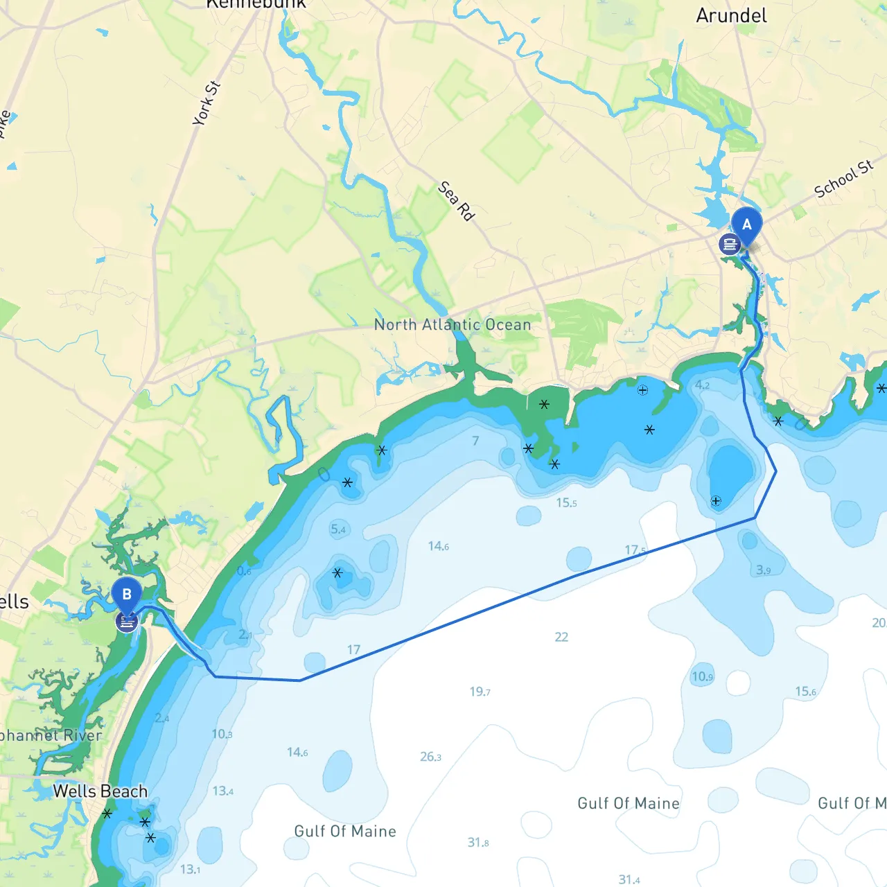
Overview of the Route:
This coastal trip from Kennebunkport to Wells offers a blend of scenic views, notable landmarks, and safe harbors should circumstances require you to adjust your itinerary. It’s particularly well-suited for cruises and recreational boating, featuring calm waters and a moderate distance ideal for both novice and experienced boaters.
Points of Interest Along the Route:
As you depart from the picturesque Kennebunkport, you will cruise along the beautiful southern Maine coastline, showcasing sandy beaches, rocky shorelines, and quaint seaside villages. Points of interest include:
1. Cape Porpoise: A charming fishing village just north of your starting point, famous for its picturesque harbor. It's an excellent spot for a leisurely stroll or a quick bite at a local seafood restaurant.
2. Goose Rocks Beach: Further along, this beach is known for its soft sands and clear waters. It's a wonderful location for a short stop off if conditions permit, giving you a taste of Maine's idyllic coastline.
3. Wells National Estuarine Research Reserve: A fantastic place to pause and enjoy nature. This area offers walking trails and beautiful scenery, ideal for a break from your boating adventure while keeping you in a protected area.
Bays for Shelter:
1. Cape Porpoise Harbor: With plenty of room for anchoring, Cape Porpoise can serve as a great shelter if weather conditions worsen. The harbor is well-marked and offers an unexpected welcome stop.
2. Wells Harbor: This is the most practical shelter that you’ll come across on your journey. It’s a well-protected harbor that allows easy access to amenities and safe anchorage.
Navigation Considerations:
As you navigate, there are several critical navigational aids:
Weather Considerations:
Always check the local weather forecast before setting off. In coastal Maine, conditions can change rapidly, so having a reliable weather-app is vital. Equip your boat with a VHF radio to stay updated on marine conditions and communicate with local authorities if necessary.
Recommended Boating Apps:
Conclusion:
This boating trip from Kennebunkport to Wells promises to be both safe and enjoyable, with a perfect mix of scenic beauty and necessary precautions. Whether you’re looking for relaxation or an adventure on the water, this route provides ample opportunity for exploration and the chance to remain secure should the conditions change. Enjoy your voyage, remain vigilant, and embrace the breathtaking beauty of Southern Maine’s coastline!