
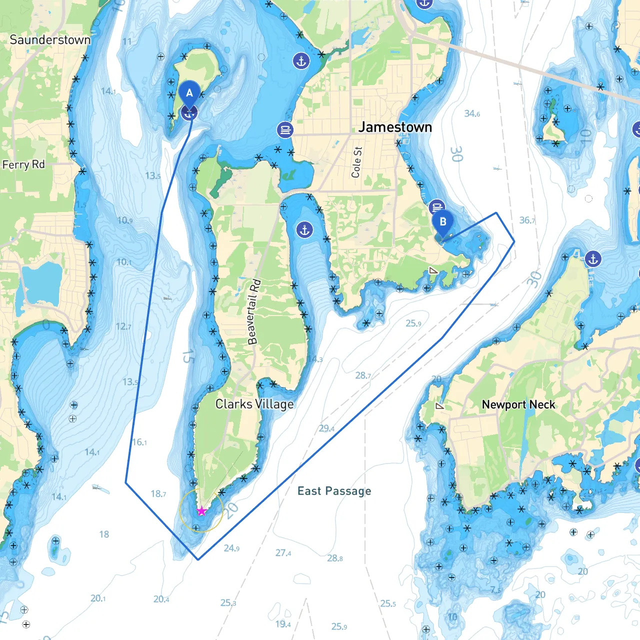
Pilotage Plan: Jamestown, Rhode Island to Jamestown, Rhode Island
Starting Point: Jamestown, RI (Longitude -71.4014, Latitude 41.4988) Ending Point: Jamestown, RI (Longitude -71.3593, Latitude 41.4828)
Overview This short yet scenic route of approximately 6 nautical miles offers a delightful journey will be perfect for recreational boaters looking for both safety and enjoyment. Known for its picturesque landscapes, the waters around Jamestown provide a mixture of charming coastal views, historical landmarks, and serene bays that offer refuge should weather conditions change.
Route Description 1. Departing Jamestown Begin your voyage from the southwestern shoreline of Jamestown. Ensure your vessel is equipped with all necessary safety gear, including life jackets and navigation tools. Set your course to navigate northward toward Dutch Island, keeping a close eye on the associated navigation markers—this is a critical spot for following the safe passage.
2. Navigating Narragansett Bay Once you reach the main channel, you will be heading across the waters of Narragansett Bay. Familiarize yourself with the following navigation aids: - Buoys: Pay special attention to green and red buoys marking the channel's port and starboard sides. These will guide you to stay within the safe navigation area. - Lighthouses: The adjacent lighthouses, such as the Beavertail Lighthouse, are strong visual markers to assist with your navigation.
3. Points of Interest As you sail northward, consider stopping at the following: - Dutch Island: Perfect for a leisurely picnic or a brief exploration of the island's historic structures. It is a great spot to stretch your legs and take in the stunning views. - Fort Wetherill State Park: As you approach the end of your route, you may want to divert slightly to Fort Wetherill, an old military fort with walking trails and beautiful cliffs overlooking the bay.
4. Hazards and Safety Precautions Take care when navigating past areas with underwater structures or rocks. The waters near Fort Wetherill can sometimes have shifting currents, so it’s crucial to stay alert. Monitor local weather forecasts before your journey using trusted sources or boating apps like Savvy Navvy to adjust your plans as necessary.
5. Returning to Jamestown As you make your way back to Jamestown, remain vigilant regarding wind and tide conditions. The wind can pick up in this area, creating choppy waters that may require you to adapt your speed and heading for fluid maneuvering.
Bays for Shelter If adverse weather does roll in, make use of the nearby Mackerel Cove—a classic spot to anchor and wait it out, particularly for smaller craft. The cove offers good protection from winds coming from the south and west.
Final Thoughts This journey, while relatively short, presents an ideal opportunity for both novice and experienced boaters. You'll encounter beautiful scenery and witness the charm of Rhode Island's coastline. The route prioritizes safety with numerous navigation aids and potential shelters, making this more than just a cruise—it's an adventure packed with discovery and tranquility, all the while adhering to prudent boating practices. Be sure to have your navigation apps updated, including Savvy Navvy, to ensure real-time route assistance!