
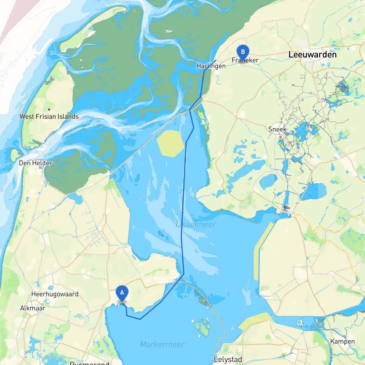
Pilotage Plan: Hoorn, NL to Franeker, NL
Departure: Hoorn, North Holland
Your journey begins in Hoorn, a historic town nestled on the shores of the IJsselmeer. The coordinates for your departure point are 5.0827°E, 52.6410°N. Before setting sail, familiarize yourself with the local port regulations. The entrance to the marina can be busy, particularly in the summer months, so be vigilant for smaller craft and ensure your mooring lines are securely stowed.
Leg 1: Hoorn to Enkhuizen
Route Overview:
As you leave Hoorn, head northeast across the IJsselmeer toward Enkhuizen, approximately 10 nautical miles away. Keep a lookout for the navigation buoys that mark the entry into this large lake. The water can be busy, particularly around the ferry routes, so adhere to the navigation marks.
Hazards and Navigation Aids:
Points of Interest:
Leg 2: Enkhuizen to Medemblik
Route Overview:
From Enkhuizen, set your course for Medemblik, a short hop of about 9 nautical miles to the northwest. As you navigate, consider taking the wider path that skirts around the shallows.
Hazards and Navigation Aids:
Points of Interest:
Leg 3: Medemblik to Hoornerse Meer
Route Overview:
Continuing westward, navigate through the calmer waters of the Hoornse Meer on this leg—approximately 6 nautical miles. This route presents a great chance to enjoy the more tranquil landscapes of the region.
Hazards and Navigation Aids:
Shelter Options:
Leg 4: Hoornerse Meer to Franeker
Final Leg Overview:
The final leg takes you northeast from Hoornerse Meer, heading approximately 14 nautical miles toward Franeker. This part of the journey leads you through the picturesque landscape of Friesland.
Hazards and Navigation Aids:
Arrival in Franeker:
Once you reach Franeker, the town is known for its remarkable history and features laid-back charm. Be sure to visit the notable Universeum, an intriguing combination of science and local lore.
Safety and Regulations
Throughout your trip, ensure that:
While one can navigate using traditional charts, having a reliable boating app can enhance your experience significantly. In addition to general nautical apps, I highly recommend Savvy Navvy. This app offers intuitive route planning, weather updates, and real-time navigational tools that can greatly benefit any sailor.
This carefully curatedPilotage Plan offers a balanced mix of safe navigation, interesting sights, and shelter opportunities. Ideal for cruisers of all skill levels, this route allows you to absorb the tranquil beauty of the Dutch waterways while maintaining a strong focus on safety. Happy sailing!