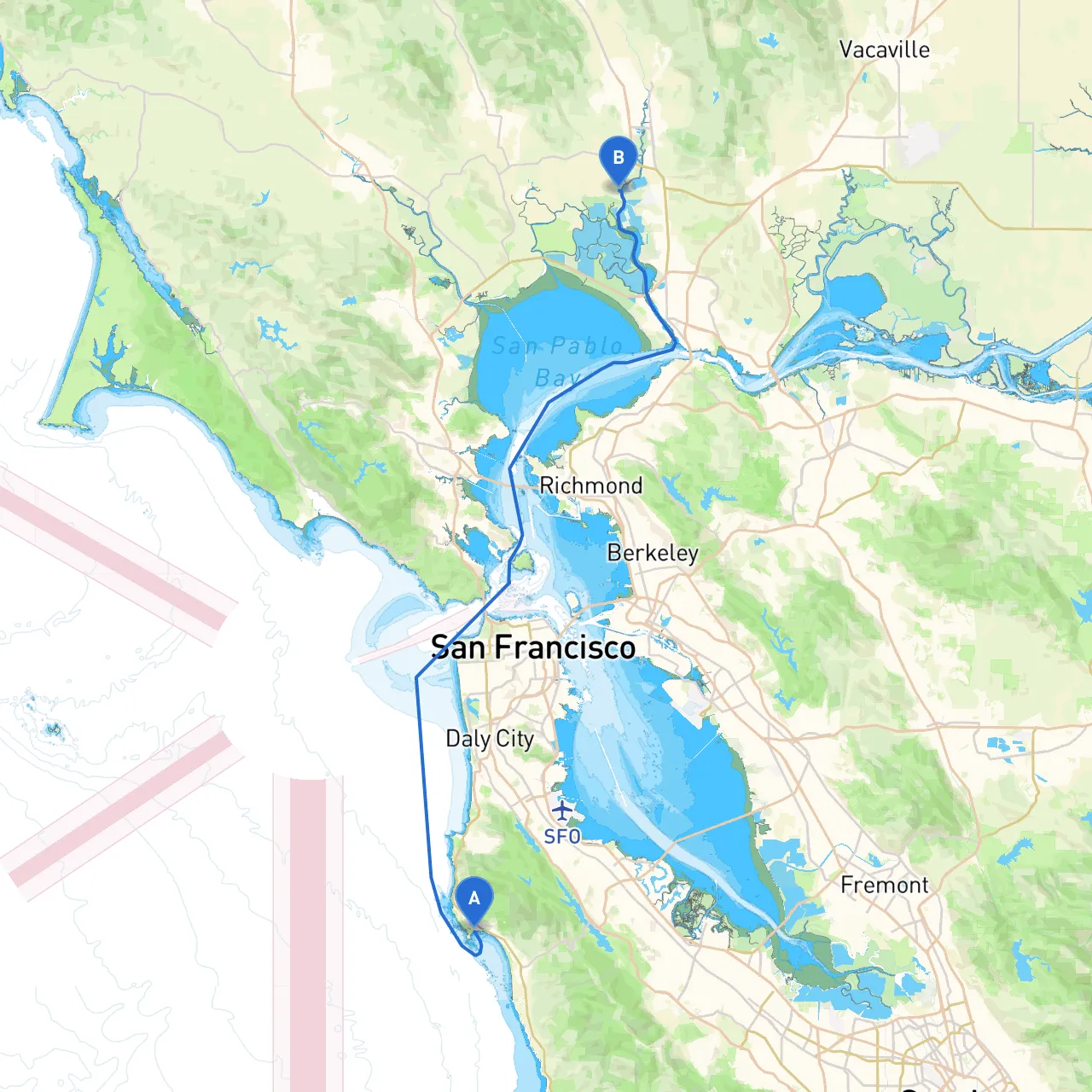
This pilotage plan outlines a beautiful and safe route for boating enthusiasts traveling from Half Moon Bay to Napa, California. The journey takes you through scenic waters, inviting bays for shelter, and a variety of attractions en route, making it a well-rounded trip that combines both adventure and safety. This route is suitable for seasoned boaters as well as those with moderate experience who are keen on learning coastal navigation and enhancing their seamanship.
Coordinates: Long/Lat -122.4909, 37.5030
Setting Sail:As you depart from Half Moon Bay, ensure that your vessel is well-stocked with safety gear, navigational charts, and weather forecasts. Monitor your route using GPS or a nautical chart, and keep a lookout for local fishing traffic and commercial vessels in the harbor, which can be quite active.
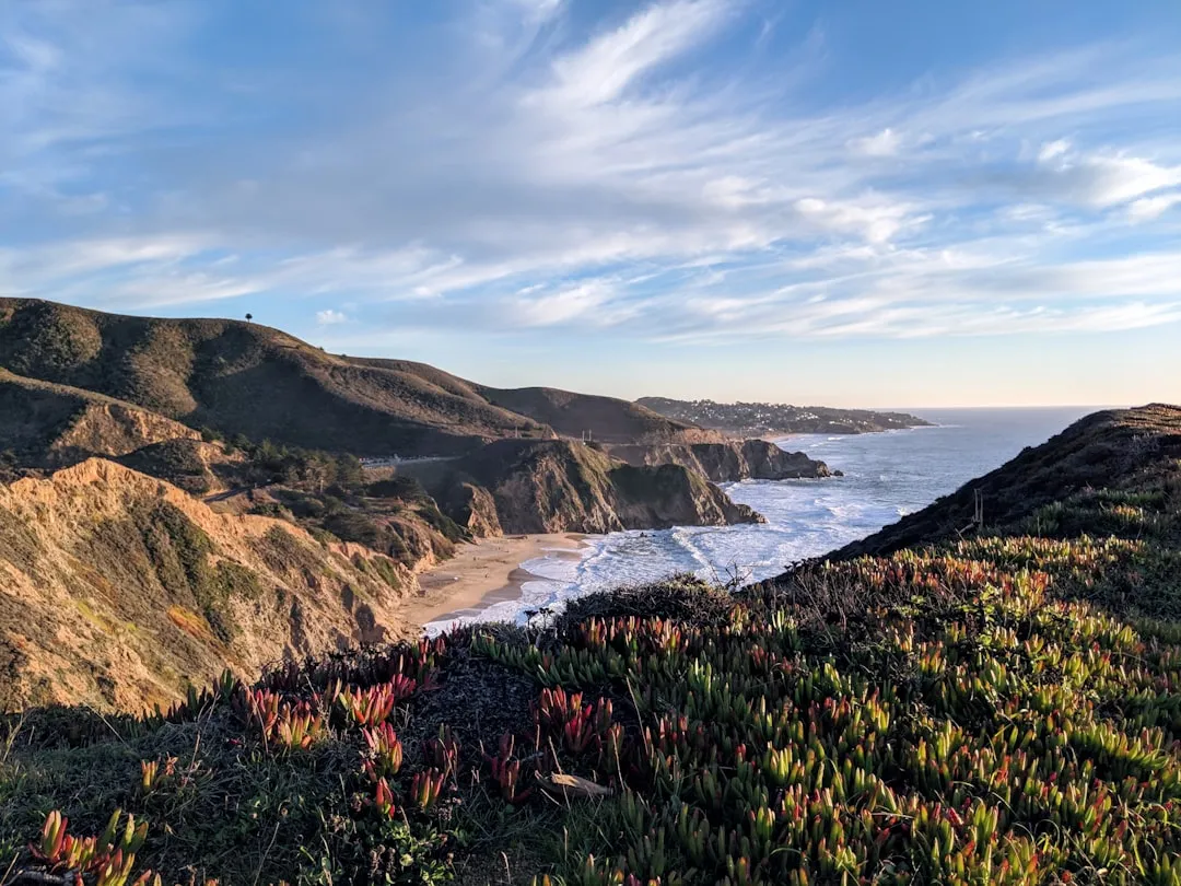
Points of Interest:Before leaving the bay, consider stopping at the dramatic cliffs of the Pacific Coast, the iconic Half Moon Bay Main Street, or the local farmers' market, which is often bustling with local produce and crafts.
Keep in mind the fog that typical Bay Area conditions can bring, especially in the mornings. Be vigilant for potential submerged hazards, including rocks and shifting sands near the harbor entrance. Monitor VHF channel 16 for emergency communications and updates on vessel traffic.
1. Half Moon Bay to Pillar Point Harbor - Distance: Approximately 2 nautical miles - Navigate north along the coast, keeping a safe distance from the surf. - Pillar Point Harbor has ample pier facilities and restaurants should you wish to dock briefly.
2. Pillar Point Harbor to San Francisco Bay Entrance - Distance: Approximately 10 nautical miles - After heading out from Pillar Point, set a course toward the San Francisco Bay entrance. You will soon reach the Golden Gate Bridge, a must-see landmark. - Important Navigational Aids: The Point Bonita Lighthouse and the Presidio, as well as various buoys marking the shipping channels. - Hazards: Be cautious of strong tidal currents and the potential for heavy fog around the Golden Gate.
3. San Francisco Bay - Once you're through the Golden Gate, you will enter San Francisco Bay, navigating towards the Oakland Estuary. - This section allows many opportunities to spot marine wildlife and enjoy notable sights, including Alcatraz Island and the San Francisco skyline.
4. Point Richmond - Distance: Approximately 6 nautical miles - A great place to anchor or take a break—Point Richmond has a charming historic district with restaurants and shops. - Ideal for shelter if weather conditions shift unexpectedly.
5. Over to Napa River - After exiting the Richmond area, set your course for the Napa River. Look for navigational aids like buoys that mark the river entrance. - Stay within marked channels to avoid grounding since the waters can be shallow in areas.
Coordinates: Long/Lat -122.3138, 38.2197
Arrival Activity:Upon reaching Napa, you can dock at various marinas near downtown, allowing you to explore the culinary delights of Napa Valley. The region is famous for its wineries and beautiful vineyards, with many offering tasting rooms and tours.
This route offers a dynamic blend of adventure and relaxation, perfect for boaters looking to explore California’s picturesque coastline while maintaining a strong emphasis on safety and preparedness. Enjoy the journey, take in the views, and embrace the unique experiences that each stop offers!