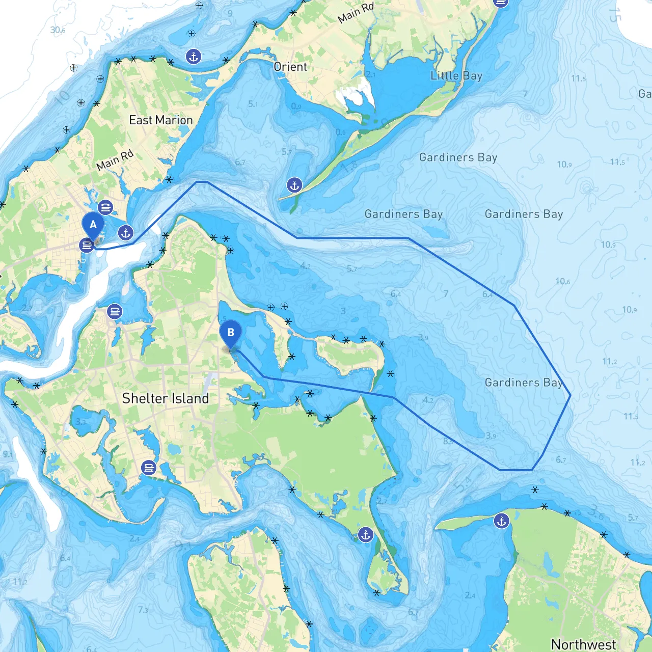
Pilotage Plan: Greenport, NY to Shelter Island, NY
Overview
Embarking on a journey from Greenport to Shelter Island is a delightful passage, offering beautiful scenery and the chance to experience some iconic locations along the way. This route is well-suited for recreational boaters with moderate experience. With its combination of picturesque views, navigational aids, and nearby shelters, this journey emphasizes safe boating practices while providing opportunities for enjoyable stops.
Starting Point: Greenport, NY
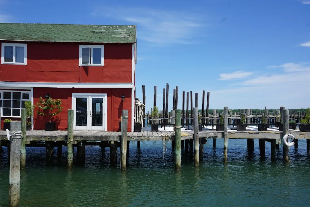
Greenport is a charming village located on the North Fork of Long Island. It’s known for its maritime heritage, quaint shops, and vibrant dining scene. Before setting off, ensure your vessel is well-stocked and equipped with all necessary safety gear—life jackets, flares, fire extinguishers, and a first-aid kit.
Notable Hazards and Considerations:
- Potential for Shallow Waters: Be mindful of shallow areas near the coast, particularly as you exit the Greenport Harbor.
- Navigational Buoys: Pay close attention to the buoys marking the entrance of Greenport Harbor. The region can have strong currents, especially during tidal changes.
Route Highlights and Points of Interest
- Just southeast of the Greenport harbor, a beautiful sight to behold, this uninhabited island is known for birdwatching as it serves as a sanctuary for numerous species. You might even consider anchoring for a picnic break if conditions permit.
2. Shelter Island Sound - As you head southward, you will enter the wide waters of Shelter Island Sound. This area is relatively deep but watch for boat traffic. It’s a prime opportunity for some scenic views as the island looms in the distance.
3. Wades Beach (West Neck Bay) - Once you've navigated around the western side of Shelter Island, consider a short detour to Wades Beach. The beach provides calm waters and a great spot for swimming or picnicking should you want a refreshment break.
4. Shelter Island Village - The village offers shops and dining, ideal for stocking up or grabbing a bite. Not far from the harbor, the Shelter Island Historical Society is a point of interest for history buffs.
Navigational Aids and Safety Considerations
- Channel Markers: Be attentive to the channel markers throughout your voyage. These guideboats safely through what can sometimes be challenging waters, particularly near the entrance to Shelter Island.
- VHF Radio: Regularly monitor VHF channels 16 and any local channels. There may be boating activities or sea conditions to be aware of that could impact your trip.
- Local Regulations: Be aware of speed limits in harbors and estuaries, particularly around Shelter Island, where local wildlife may pose additional navigation restrictions.
- Weather Monitoring: Continuous weather updates are crucial. Conditions can shift, particularly in transitional seasons, so be prepared to seek shelter if necessary.
Conclusion
This journey from Greenport to Shelter Island embodies the serene charm of the Long Island waters. With opportunities to reconnect with nature through beautiful islands, beaches, and sheltered spots, this route should appeal to both recreational and more seasoned boaters looking for a safer journey without sacrificing enjoyment.
Recommended Apps
For seamless navigation and staying informed, consider downloading:- Savvy Navvy - Offers an all-in-one nautical chart plotting and routing experience tailored specifically for boaters.
- Navionics - Provides detailed marine maps and allows you to track your route in real time.
- Windy - Great for checking wind conditions and forecasting to ensure a safe journey.
As you set out on this delightful passage, remember, safety is paramount. Calm waters and blue skies await you, making for an unforgettable boating experience!