Pilotage Plan: Granada, ES to Málaga, ES
Overview
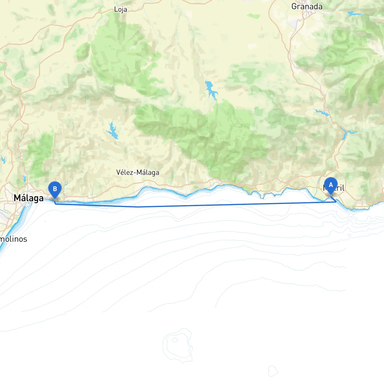
Embarking on this captivating journey from Granada to Málaga offers a blend of stunning coastal scenery, rich cultural heritage, and plenty of opportunities to drop anchor in calm waters. This route is particularly suitable for experienced coastal cruisers looking to explore the beauty of Spain's Mediterranean shoreline while keeping safety as the top priority.
Route Highlights
- Distance: Approximately 70 nautical miles along the coast.
- Duration: Allow at least 1.5 to 2 days of cruising, with stops along the way for safety and enjoyment.
Departure from Granada
Starting Point: Granada, ES (Coordinates: -3.528617620468139, 36.72453096180557)
Granada itself doesn't directly provide maritime access, so be sure to transport your vessel to one of the nearby marinas, such as Almuñécar or La Herradura. Both offer splendid facilities and local amenities.
Notable Features
- Check local weather conditions and tides.
- Explore historical landmarks in Granada, such as the Alhambra and Generalife gardens before setting off if time allows.
Leg One: Granada to La Herradura
Distance: Approx. 10 nautical miles
Bays & Shelters:
- La Herradura Bay: An excellent spot for shelter, known for its calm waters and scenic views. It's a popular anchorage with a lovely beach.
Navigational Aids
- Pay attention to the visibility along this short leg, especially if venturing out in early mornings.
- Ensure you're equipped with updated nautical charts; use radar to detect any fishing vessels or other traffic as you depart.
Points of Interest
- The cliffs and coves offer splendid views, perfect for a leisurely sail. Consider stopping off for a swim or snorkel in the clear waters.
Leg Two: La Herradura to Almuñécar
Distance: Approx. 3 nautical miles
Features and Highlights:
- The journey to Almuñécar is short and charming. Once there, you can enjoy this historic town, famous for its beautiful beaches and the spectacular castle, Castillo de San Miguel.
Shelter Options
- Almuñécar Marina: A safe berth if the weather worsens, with full facilities including fuelling and repair options.
Leg Three: Almuñécar to Nerja
Distance: Approx. 10 nautical miles
Navigational Considerations:
- Be alert to rocky outcrops just offshore. Keep an eye on environmental conditions as local winds can be unpredictable.
- Utilize waypoints marked on charts to navigate into the protected waters of Nerja.
Points of Interest
- The famous Nerja Caves provide an enriching cultural experience, and the beaches here are stunning for a sun-soaked break.
Leg Four: Nerja to Málaga
Distance: Approx. 47 nautical miles
This section is the primary leg towards your destination.
Shelter Bays
- Caleta de Vélez: A potential interim stop that provides a good harbor to weather any sudden changes in weather.
- La Caleta Beach: A nearby beach area if you want to take a quick dip before continuing.
Navigational Aids
- Pay particular attention to navigation buoys and markers along the coast, especially as you approach Málaga.
- Watch for local traffic and fishing boats; this route can get busy, especially during weekends and holidays.
Arrival in Málaga
Destination: Málaga, ES (Coordinates: -4.343968927860259, 36.71465824660054)
As you approach Málaga, consider navigating into the marina, which offers excellent facilities for rest and relaxation after your journey.
Points of Interest in Málaga
- Visit the historic city center or climb up to the Alcazaba and Gibralfaro Castle for breathtaking views over the city and the coast.
Safety Considerations
- Always monitor weather forecasts and pay close attention to any local advisories, especially regarding sea conditions.
- Make sure all safety equipment is in order, including life jackets, first-aid kits, and communication devices.
- Review local regulations around anchorage and mooring in harbors to avoid fines or miscommunication.
Recommended Boating Apps
- Savvy Navvy: Excellent for route planning and navigation.
- Navionics: Offers detailed nautical maps for the area.
- Windy: Great for checking wind and weather info.
- VesselFinder: Useful for tracking other vessels on your route.
This pilotage plan outlines a fantastic boater’s route while prioritizing safety and enjoyment. Enjoy your nautical adventure from Granada to Málaga, savoring each moment on Spain’s beautiful coastline!