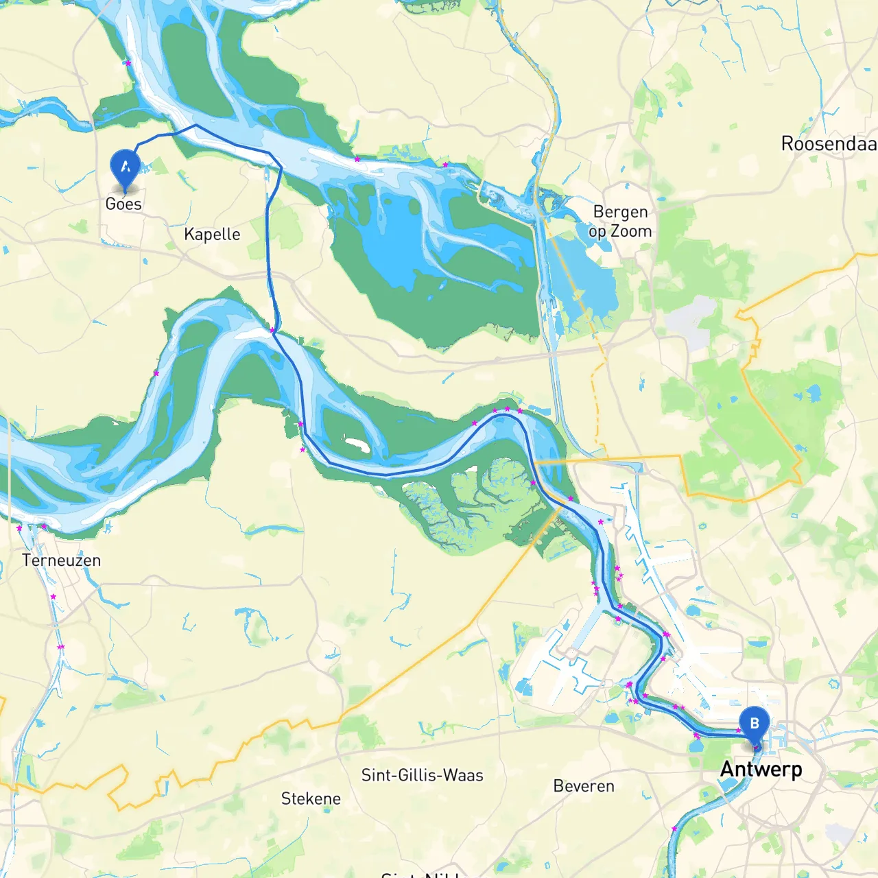
Pilotage Plan: Goes, NL to Antwerpen, BE
Introduction:Embarking on a journey from Goes, Netherlands to Antwerp, Belgium is an exciting way to experience the cultures and landscapes of two vibrant regions. The route traverses inland waterways and is particularly suitable for cruising enthusiasts with moderate skills, thanks to the mostly well-marked channels. This journey provides an excellent mix of scenic beauty, historical sites, and safe anchorages for those seeking a memorable experience on the water.
Starting Point: Goes, NL
- Coordinates: Long 3.8914, Lat 51.5083
- Port Details: Goes is well-equipped with services for boaters, including fuel, provisions, and marine supplies. Before departing, make sure to check the weather forecast and tide tables to ensure a safe voyage.
Route Overview:The overall route to Antwerp covers approximately 45 nautical miles and can be navigated over a couple of days, allowing for leisurely stops and exploration.
Leg 1: Goes to Wemeldinge
- Distance: About 8 nautical miles
- Navigation Considerations: Depart from Goes and navigate the Oosterschelde to reach the Westerschelde. This is a busy shipping channel, so keep an eye on commercial traffic and maintain a proper lookout.
- Points of Interest: The quaint village of Wemeldinge boasts lovely local eateries and beautiful park areas to stretch your legs.
- Shelter Options: The harbor at Wemeldinge is a safe haven for stopping overnight or waiting out rough weather. Facilities are available for boaters, and you can enjoy the serene coastal views.
Leg 2: Wemeldinge to Yerseke
- Distance: Approximately 6 nautical miles
- Navigation Considerations: Continue through the Westerschelde. Watch for buoys and markers. Local fishing vessels are common; navigate with caution.
- Points of Interest: Yerseke is renowned for its oyster farms, and a detour to visit a local seafood restaurant or participate in an oyster-tasting tour could be a fantastic experience.
- Shelter Options: Yerseke has a welcoming marina, perfect for an overnight stop where you can find provisions and local hospitality.
Leg 3: Yerseke to Terneuzen
- Distance: Around 10 nautical miles
- Navigation Considerations: As you approach Terneuzen, pay close attention to the shipping lanes. This leg can get busy due to commercial shipping traffic, so it’s vital to follow all navigation rules and regulations.
- Points of Interest: Terneuzen is noted for its historical landmarks, including the famous “Kalkhaven” waterfront, which you shouldn’t miss.
- Shelter Options: The Terneuzen marina provides excellent docking facilities and is well-protected from wind and chop.
Leg 4: Terneuzen to Ghent (via the Canal)
- Distance: About 20 nautical miles
- Navigation Considerations: Enter the Ghent-Terneuzen Canal; you will encounter some locks. Be sure to confirm lock operating hours, as they can vary. Follow all protocols for locking and communicate clearly with lock personnel.
- Points of Interest: Ghent is a cultural gem, featuring medieval architecture, museums, and vibrant street life. It’s an excellent place to explore for the day.
- Shelter Options: The city has several marinas where you can dock your boat safely for an extended stay.
Leg 5: Ghent to Antwerp
- Distance: Approximately 8 nautical miles
- Navigation Considerations: From Ghent, continue down the tidal waters towards Antwerp. Keep an eye open for commercial traffic as you approach the busy port area.
- Points of Interest: Antwerp itself is a bustling city filled with history, including the impressive Cathedral of Our Lady and the Antwerp Zoo. Make sure to enjoy the thriving diamond district and local cuisine.
- Shelter Options: Antwerp has excellent marina facilities that cater to transient boaters. Make use of these services to enjoy your time in the city.
Safety and Navigation Aids:
- Navigation Aids: Monitor VHF Channel 16 for maritime communication and announcements. Use updated nautical charts and GPS. Apps like Schengen Nav and savvy navvy can be immensely helpful in planning your route and providing real-time navigation support.
- Weather and Tides: Be vigilant about checking local weather patterns and tidal information, especially before entering busy shipping channels.
- Local Regulations: Be aware of any local boating regulations specific to the canals and waterways you’ll traverse. Respect speed limits and noise regulations within mooring areas.
Final Thoughts:This route from Goes to Antwerp perfectly blends safety and adventure, offering a delightful passage through beautiful Dutch and Belgian waterways. With proper precautions and a spirit of exploration, you are bound to have a memorable experience filled with cultural highlights and scenic beauty. Enjoy your journey!