
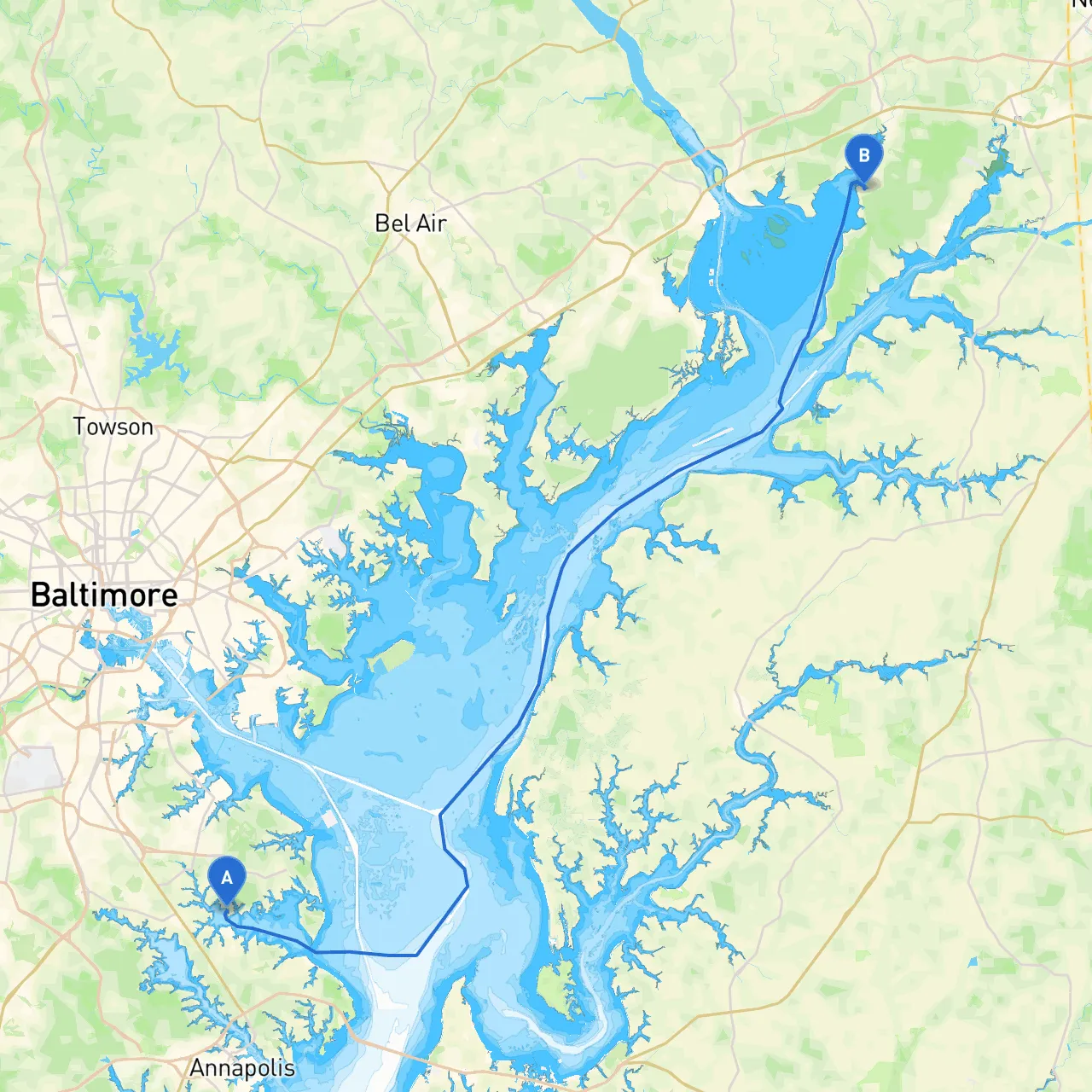
Route OverviewThis boating journey from Glen Burnie to North East, MD offers a scenic and exciting experience, taking you through some of the Chesapeake Bay's most beautiful stretches and notable landmarks. The route is suitable for experienced boaters who are comfortable navigating coastal waters and keen on enjoying both the natural beauty and local attractions along the way.
Starting Point: Glen Burnie, MD
Starting from Glen Burnie, you'll set off into the Patapsco River. As you leave, keep an eye on the navigation buoys marking the river channel to avoid shallow areas. The Patapsco can be bustling with commercial traffic, so vigilance is crucial.
First Leg: Patapsco River to Baltimore Harbor
Navigating your way down the Patapsco, you'll pass the historic Fort McHenry, a crucial symbol of American history. This is not only an interesting spot to take a moment to absorb but also serves as a reminder to adhere to any local boating regulations within this busy harbor area. The Baltimore harbor is bustling with shipping traffic, fishing vessels, and recreational boats, so maintain a safe distance from larger vessels.
Shelter Options: Should inclement weather arise, consider heading towards the nearby Inner Harbor, where you can find safe anchoring and facilities.
Second Leg: Baltimore to Key Bridge
After departing the harbor area, proceed towards the Francis Scott Key Bridge. This section of the trip allows for stunning views of the bridge itself, a vital landmark over the Chesapeake Bay. Be aware of the bridge traffic below—vessels are generally required to keep clear during bridge openings for large ships.
As you navigate this section, remember to pay attention to the channel markers, as they guide you through deeper waters and help you avoid any shallow spots that can easily surprise you.
Third Leg: Entering the Chesapeake Bay
Once you’re clear of the Key Bridge, you’ll enter the vast Chesapeake Bay. Here, you can begin to appreciate the open water. The bay can be subject to changing weather conditions, so constant monitoring of forecasts is essential.
Shelter Options: Anchor in the numerous creeks and inlets along this stretch, especially in areas like Hart-Miller Island, where you can find calm waters and perhaps even a picnic spot ashore.
Navigational Considerations
Pay attention to navigational aids, particularly the buoys that indicate channels and shallows. The Chesapeake Bay is busy with commercial fishing boats, recreational traffic, and shipping lanes, so vigilance is essential. The U.S. Coast Guard also has presence in these waters—be sure to respect any enforcement of local regulations, especially with regard to speed limits and fishing zones.
Fourth Leg: Approaching North East River
As you continue your journey, the entrance to the North East River will come into view. The North East River is a tidal estuary with rich wildlife, making it a picturesque destination. Be advised to consult charts for tidal changes that may affect your approach as this area can have significant currents.
Points of Interest: Here you’ll find North East Town Park, a perfect stopping point for picnics or a stroll along the waterfront. The town itself has charming shops and eateries that encourage local exploration.
Arrival at North East, MD
Arriving in North East provides an opportunity to embrace the local culture and enjoy the waterfront atmosphere. Maintain awareness of the local marina rules, and be respectful of other guests and residents along the waterfront.
To enhance your navigation and stay informed, consider using the following apps:
As you embark on this journey, ensuring safety while enjoying the beauty of the Chesapeake is key. With proper planning and respect for the marine environment, you're in for a delightful and safe adventure along Maryland’s picturesque coast. Enjoy your trip!