
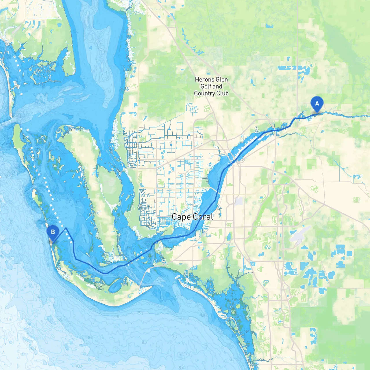
This voyage from Ft. Myers, FL, to Captiva Island, FL, spans approximately 22 nautical miles through the beautiful and dynamic waters of the Gulf of Mexico. This route is particularly suitable for experienced boaters who are well-versed in navigating coastal waters, yet it remains accessible for proficient novice sailors seeking adventure.
Depart from Ft. Myers, a vibrant city known for its historical sites and lush landscapes. Before casting off, check local weather conditions using your trusty boating apps, including Savvy Navvy for real-time data. Ensure your vessel is well-equipped with safety gear, including life jackets, flares, and a first-aid kit.
As you exit the Caloosahatchee River, keep an eye out for:
2. Navigate to Estero Bay: As you approach Estero Bay, keep your navigation aids close. This area can become busy with recreational vessels, so stay vigilant and monitor your marine radio (VHF channel 16).
3. Open Waters: After exiting Estero Bay, prepare to enter the Gulf of Mexico. This stretch may expose you to open water conditions. Ensure that you: - Check tidal currents and adjust your timing accordingly. - Maintain a close watch for weather changes. - Keep your vessel's speed moderate to maintain control over any waves and potential swells.
4. Approaching Captiva Island: As you get nearer to Captiva, pay attention to the coastal markers that will guide you into the well-marked channels leading to the island. The beautiful shores of Captiva are home to pristine beaches and vibrant wildlife—an invitation to explore upon arrival.
This journey from Ft. Myers to Captiva Island is not just a travel route, but an experience framed by stunning natural beauty and rich cultural significance. With safeguards in place and navigational aids at hand, seasoned boaters can revel in the sights, while those less experienced will find this route to be an excellent practice ground. Always prioritize safety, keep your communication devices handy, check the weather, and enjoy the ride!