
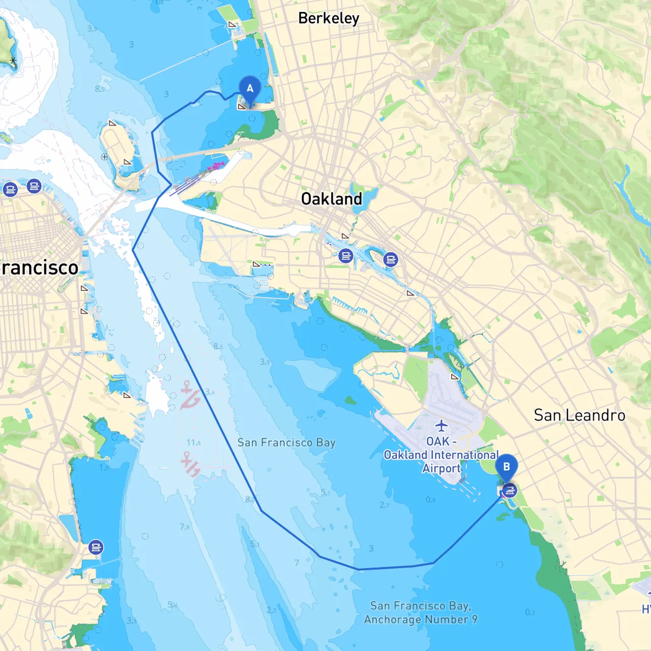
This boating trip from Emeryville to San Leandro is an enchanting excursion that showcases the San Francisco Bay's rich maritime heritage and natural beauty. Spanning approximately 10 nautical miles, this journey is suitable for recreational boaters who want a blend of coastal scenery, local attractions, and the capability to navigate safely. While primarily designed for experienced recreational boaters, beginners with prior nautical training will find it an accessible yet engaging experience.
1. Departure from Emeryville, CA - Start your adventure at the Emeryville Marina, conveniently located at coordinates 37.8377° N, 122.3094° W. - Before setting sail, ensure that you have all safety equipment onboard: life jackets, a VHF radio, flares, and first aid kits.
2. Navigational Aids and Hazards - As you leave the marina, be vigilant of the local boat traffic. The Emeryville area can be busy, especially with recreational boaters and fishing vessels. - Keep a close watch on navigational aids, especially the Emeryville Pier, which is marked with lights and buoys. The channel leading from the marina to the bay is well-marked, but ensure you're aware of low tides, which can affect certain areas.
3. Sausalito and Angel Island (Optional Detour) - If you're open to a slight detour, consider anchoring off Angel Island State Park for a picnic and a short hike; it’s easily reachable if you veer westward before heading down to San Leandro. The views of San Francisco from the island are breathtaking. - The ferry traffic around this area can be significant. Be cautious and keep a safe distance from ferry routes.
4. Navigating towards San Leandro - After enjoying the sights around the bay, you’ll head southeast toward San Leandro. Maintain a course that avoids the shallower waters, especially near Oyster Point, which can be tricky during low tides. - Your approach to the San Leandro area is marked by Bay Farm Island; keep it on your port side. Be cautious of the shallow waters surrounding the island and look out for commercial traffic coming from the Port of Oakland.
5. Points of Interest and Shelter - Barnabys is a popular stop should you wish to grab a bite. Located on the eastern shoreline, it’s a quick detour that promises delicious food and a local atmosphere. - If conditions turn unfavorable, look to take refuge in the San Leandro Marina, which has good facilities and protective harbors.
6. Arrival at San Leandro, CA - Upon arrival, the San Leandro Marina allows for docking and provides services like refueling and boat maintenance. Make sure to observe local regulations regarding docking and mooring.
This route from Emeryville to San Leandro showcases the best aspects of the San Francisco Bay Area while ensuring a safety-first approach to boating. It's an ideal trip for boaters seeking scenic navigation with opportunities for exploration and shelter. With meticulous planning and respect for the rules of the sea, this trip is sure to be memorable. For navigation assistance, consider using smart boating apps like savvy navvy, which features route planning, tidal information, and navigational aids, along with others such as Navionics and ActiveCaptain. Enjoy the adventure and stay safe on the water!