
Pilotage Plan: Eastham, Massachusetts to Provincetown, Massachusetts
Route OverviewThis scenic journey from Eastham to Provincetown is approximately 25 nautical miles across the picturesque waters of Cape Cod. The trip is well-suited for experienced boaters who are prepared to navigate the challenges of tidal currents and shallow areas. Along the way, you will encounter beautiful landscapes, charming seaside towns, and multiple points of interest that make this route a delight despite potential navigational challenges.
Departure from EasthamKick off your adventure in Eastham, known for its stunning Cape Cod National Seashore. As you prepare to leave, you'll want to make sure your boat is stocked with necessary safety equipment, including life jackets, flares, and a first-aid kit. Before heading out, check the weather and tide schedules, as they can affect your trip significantly.
Head south out of Eastham and watch for the Nauset Light, a well-known landmark that’s a lovely sight as you make your way into the Atlantic. Ensure safe passage by staying alert to your chart plotter and paying close attention to any navigational buoys marking the channel.
Possible Shelter PointsIf the weather turns rocky, consider making a stop at either Wellfleet Harbor or Pamet Harbor. These sheltered bays offer safe anchorages where you can ride out inclement weather. Wellfleet, nestled between the ocean and Cape Cod Bay, is not only a great interim stop but also provides fascinating opportunities for exploring tidal flats and sampling the local cuisine famous for its oysters.
Pamet Harbor serves as a well-protected haven, with picturesque views of the surrounding dunes. From here, you can check the local tide and weather conditions, ensuring a safe onward journey.
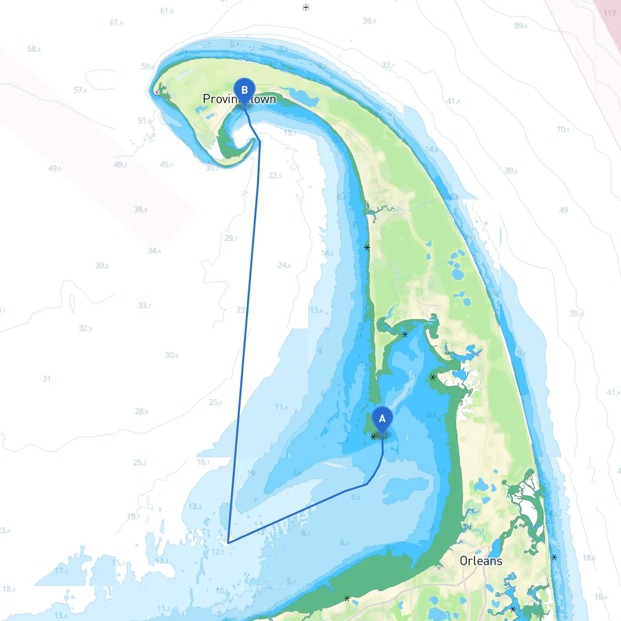
Navigational ConsiderationsAs you make your way southwards towards Provincetown, be especially mindful of the tidal currents, which can be strong in certain areas. The current flows generally towards Cape Cod Bay and can exceed 3 knots during peak tide times—planning your departure to avoid strong currents will make for an easier journey. There are also shallow areas to navigate, particularly near the approach to Provincetown. Familiarity with your nautical charts or using a GPS device is essential here.
Pay close attention to navigational aids like buoys and lights, specifically the well-marked channel leading to Provincetown Harbor. The “Long Point Light” is particularly significant – it’s a prominent landmark and a good point of reference as you make your approach.
Local Regulations and RestrictionsAbout a mile before entering Provincetown, you’ll notice the vessel traffic separation scheme; stay clear of the channel designated for navigation to ensure safe passage. It's also important to check for any local fishing regulations if you decide to drop a line along the way, as these can change based on the season.
Arrival in ProvincetownUpon arrival in Provincetown, you will be greeted by its vibrant cultural scene and impressive waterfront views. Explore the picturesque streets, visit the iconic Pilgrim Monument, or indulge in some local seafood at one of the many waterfront restaurants.
Provincetown offers a welcoming atmosphere for both sailors and tourists, making it an ideal destination to unwind after a day on the water. Don't miss the sweeping views of the sand dunes and the opportunity to visit nearby nature trails or enjoy water sports.
Final Notes and RecommendationsFor this trip, I recommend downloading navigation apps such as Navionics, Chartplotter Pro, and notably, Savvy Navvy; these apps will assist you with real-time navigation and tidal information to stay safe while planning your route.
As you prepare for this idyllic maritime journey, keep your safety equipment ready, navigate with precision, and let the beauty of Cape Cod enchant you. Happy sailing!