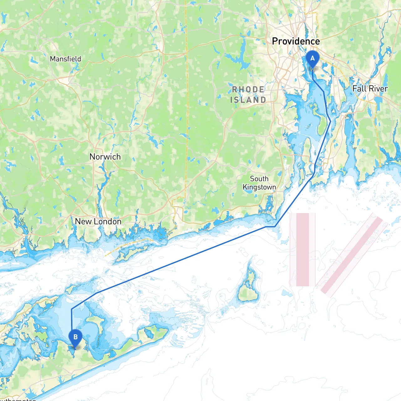
Pilotage Plan: East Providence, RI to Sag Harbor, NY
Overview
This journey from East Providence, Rhode Island, to Sag Harbor, New York, is a delightful cruise that offers mix of stunning coastal views, quaint towns, and charming checkpoints. The route crosses Narragansett Bay and the Long Island Sound, making it suitable for experienced boaters looking for a day trip or a leisurely multi-day excursion. However, safety should always be the top priority, and we’ll ensure that your route includes safe harbors and notable navigation aids.
Route Highlights
Your departure point, East Providence, is ideally situated with access to Narragansett Bay. The initial leg of the journey will take you through the bay, offering scenic vistas and opportunities to spot marine life.
Distance and Duration: The total distance of the trip is approximately 40 nautical miles, taking approximately 5 to 6 hours of cruising time, depending on your vessel’s speed and weather conditions.
Section 1: Departing East Providence, RI
As you set off from East Providence, you’ll navigate the Seekonk River, trending towards Narragansett Bay through Bullock’s Reach.
Navigational Aids:
- East Providence Bridge: Pay attention to this fixed bridge; passing beneath should present no height issues for most vessels.
- Conimicut Light: A prominent navigational aid guiding sailors into the bay. Keep this to port as you head out onto the open water.
Shelter Precaution: If weather begins to deteriorate, consider heading into Greenwich Bay for shelter. This well-protected area offers good anchorage and is an ideal stopover if necessary.
Section 2: Traversing Narragansett Bay
Upon clearing the bay, you will find yourself surrounded by soft hills and coastline dotted with mid-century homes and coastal communities. Along this route, you can spot notable landmarks such as:
- Fort Adams State Park: A historical site with stunning views of Newport Harbor, perfect for a brief exploration if tides permit.
- Newport Bridges: The magnificent bridges span the waterway. Keep a lookout for the air drafts under both bridges.
Navigational Aids:
- Newport Harbor Light: This light marks the entrance to Newport Harbor and helps in maintaining a safe course through incoming navigation.
Should the weather take a turn, the town of Newport itself offers safe mooring options along with vibrant shores and restaurants for respite.
Section 3: Entering the Long Island Sound
As you exit Narragansett Bay, you’ll enter the open waters of the Long Island Sound. Here, expect potentially choppier waters depending on wind and tide conditions.
- Recommended Area: Sakonnet Point and Cuttyhunk to your left provide ideal spots to rest, and the surrounding waters are worth exploring.
- Navigational Points: Be cautious of any traffic in this busy waterway; marine traffic is prevalent. Monitor your charts for any local navigation restrictions or regulations.
Section 4: Cruising Towards Sag Harbor
Your approach towards Sag Harbor will blend beautiful coastal scenery with quaint local boat traffic.
- Southampton: Before reaching Sag Harbor, passing near Southampton will offer additional opportunities for fun stops with shopping and fine dining.
- Hungry Point: Navigate carefully around this point, which can be tricky under certain tide conditions.
Navigational Aids:
- Sag Harbor Breakwater: This light is essential for safely identifying your harbor entrance. Be sure to keep it to starboard as you enter the harbor.
Make final adjustments for speed and direction as you maneuver into Sag Harbor, paying close attention to local vessels and any potential recreational boating traffic.
Arrival in Sag Harbor, NY
As you arrive in Sag Harbor, you're greeted by a picturesque town that boasts a rich whaling history and vibrant maritime atmosphere. The area is known for its deep-water marina and charming waterfront. Here you'll find dining options, small shops, and the famous Sag Harbor Cinema.
Safety and Navigation Apps
While on your journey, maintain updated weather information and navigational details through apps like:- Savvy Navvy: This application provides reliable navigation charts, weather updates, and trip planning tools specifically for boaters.
- Navionics: Offers comprehensive marine maps that can assist in finding safe routes.
- Windy: A fantastic tool for monitoring wind conditions which can greatly influence your passage.
This pilotage plan provides a blend of scenic delights and safety considerations, ensuring that your boating experience is both enjoyable and secure. As you prepare for this voyage, take the time to ensure your vessel is equipped with all necessary safety gear and navigation tools, and always plan for the unexpected. Safe travels!