
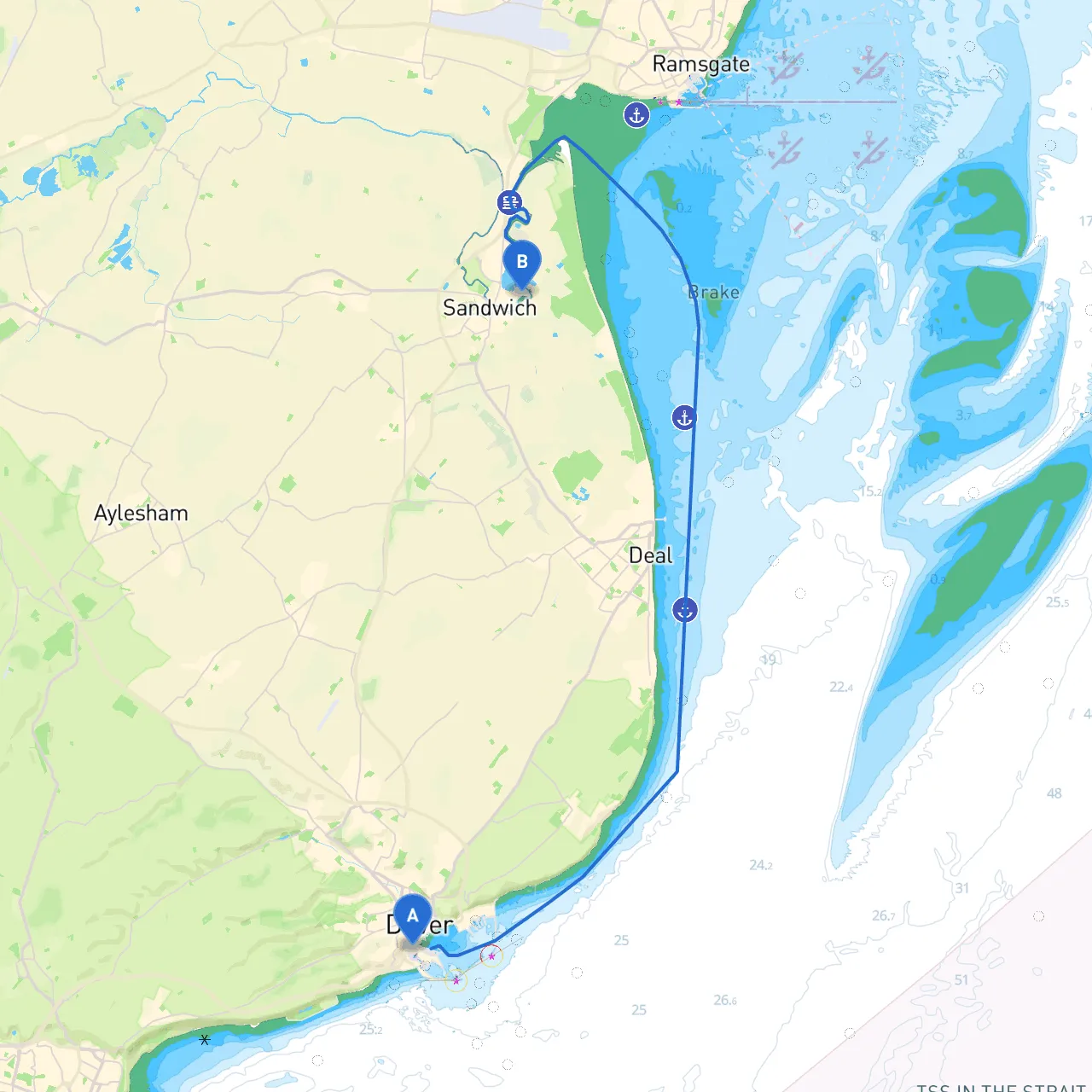
Embarking on a journey from Dover to Sandwich offers not just a thrilling experience of sailing along the southeast coast of England but also a chance to witness the magnificent landscapes and maritime heritage of the region. This route is particularly suitable for coastal cruisers and recreational sailors who appreciate both the joys of navigation and the importance of safety at sea.
Coordinates: 1.3108, 51.1192 Dover’s bustling harbor is a fitting starting point for your adventure. As you leave the marina or moorings, your first task is to ensure the weather conditions are favorable. The English Channel can be unexpectedly rough, so check the latest forecasts before setting out.
Notable Points:
As you navigate eastward, stay alert for the following:
Navigational Aids:
Hazards:
Approximately 5 nautical miles along your route, you’ll encounter St. Margaret’s Bay.
Shelter Opportunity:
Activities:
Continuing from St. Margaret’s Bay, set your course towards Sandwich, keeping an eye on the shoreline to maintain sight of landmarks.
Navigational Aids:
Local Points of Interest:
As you approach Sandwich, you’ll find the stunning Sandwich Bay and the River Stour.
Coordinates: 1.3534, 51.2782
1. Tides and Currents: The River Stour is affected by the tide, so plan your arrival considering the tidal schedule. Make sure you're up to date with local tide tables.2. Weather Conditions: Always check for updates. Conditions can shift quickly on the channel.3. Navigation Apps: Utilize apps like Savvy Navvy, which provides real-time data and navigational plotting, along with others such as Navionics and iNavX for additional support in planning your route.
This route from Dover to Sandwich promises a rewarding and picturesque journey, perfect for sailors who appreciate maritime history and natural beauty while being mindful of navigation and safety at sea. With adequate preparation, a watchful eye on local conditions, and a spirit of adventure, your trip will certainly be memorable.