
Overview This route takes you from the tranquil setting of Como to the lively beaches of Cronulla. It’s a journey that offers a blend of scenic landscapes, interesting landmarks, and safe havens if the weather decides to play tricks. The area is suitable for recreational boaters, especially those who enjoy a mix of nature and coastal attractions.
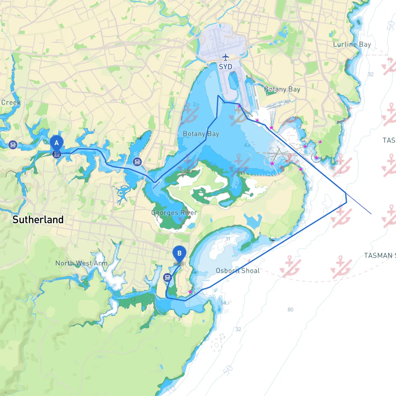
Departure from Como Starting at Como, you will navigate the Georges River, a meandering waterway providing picturesque views. Hat head upstream, ensuring to monitor the currents, especially after heavy rains, as they can make the river tricky to navigate. As you depart, watch for the distinctive COMO JETTY—a great landmark that signifies you are on course.
Safety Considerations The Georges River can be congested with small boats, kayakers, and jet skis. Maintain a safe distance and adjust your speed appropriately. Pay attention to the local speed limits, particularly around residential areas and jetties, to ensure the safety of both your crew and others on the water.
First Leg: Navigating the Georges River As you cruise down the Georges River, you'll pass some attractive spots. Keep an eye out for the Como Pleasure Grounds and the waterside eateries; these are excellent for a quick coffee or snack while you enjoy the scenery. If the weather turns foul, there are several bays along the river where you can drop anchor and seek shelter, particularly around the region where the river widens.
Approaching Botany Bay The transition from the river into Botany Bay is natural but should be approached with caution. Here, you will encounter a variety of maritime traffic, ranging from fishing vessels to larger commercial ships. Use your navigational charts wisely and remain aware of marine traffic signals and buoys indicating shipping lanes.
Navigating Dangers Watch for shallow patches, particularly near the mouth of the Georges River where it meets the bay. Local knowledge or a tide chart app can be invaluable here, as tides can shift the depths around the entrance. It’s advisable to enter Botany Bay at mid-tide to avoid grounding.
Key Landmarks Along the Route Upon entering Botany Bay, look for the iconic La Perouse headland. This historical site offers a glimpse into early Australian history and has several picnic spots, making it a wonderful place to stop and explore before heading towards Cronulla. Another notable landmark is the Bare Island Fort—a photo opportunity as you cruise past.
Shelter Points Should the weather deteriorate unexpectedly, consider stopping at the south side of Botany Bay, particularly near the Kurnell Peninsula, which offers some protection from wind and wave action. The sheltered bays here are well known by local boaters for their safe anchorage.
Final Leg to Cronulla Leaving Botany Bay, head towards the northern end of Cronulla. Stay vigilant for swimmers and surfers in the water, especially along the beaches. The Cronulla Beach area is well marked, and as you approach, the famous Cronulla Pavilion will be a prominent feature to guide you in.
Navigational Aids Throughout your journey, there are several navigational aids you should pay attention to:
Regulatory Considerations Fines can be imposed for anchoring in prohibited areas or driving over speed limits. Familiarize yourself with local boating regulations, which can be accessed via the New South Wales Maritime website.
Recommended Boating Apps To enhance your experience and ensure safety on the water, consider using boating apps like Savvy Navvy, which provides helpful navigation and route planning features, along with tide and weather information. Other useful apps might include Navionics and MarineTraffic for tracking other vessels.
In summary, this trip from Como to Cronulla is both safe and enjoyable, offering numerous opportunities to explore while ensuring you adhere to boating best practices. Get your crew ready, check your gear, and set out for an adventure you won’t forget! Safe boating!