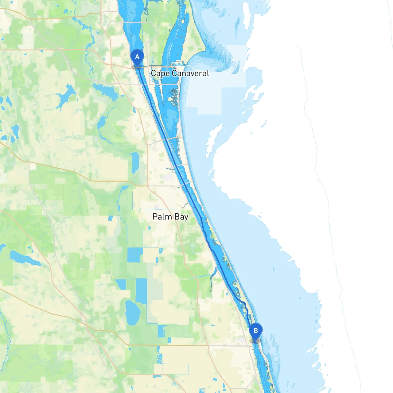
Starting Point: Cocoa, Florida (Coordinates: long/lat -80.7386, 28.4) Ending Point: Vero Beach, Florida (Coordinates: long/lat -80.3700, 27.6481)
This journey from Cocoa to Vero Beach spans approximately 51 nautical miles along the scenic Indian River Lagoon. It’s an ideal route for recreational boaters and those looking to enjoy the natural beauty and rich wildlife of Florida's east coast. The route is safe, with a mix of calm water, sheltered bays, and interesting points of interest to explore. It’s particularly suitable for family boaters and those looking for a day trip filled with relaxation and exploration.
1. Departing Cocoa Start your journey by heading south from Cocoa, navigating the calm waters of the Indian River. It’s essential to monitor your depth soundings as the Indian River can have certain shallow spots, especially around marked points. Pay attention to buoy markers as they guide you towards deeper channels.
2. Point of Interest: Merritt Island National Wildlife Refuge As you make your way south, you can catch glimpses of the Merritt Island National Wildlife Refuge on your port side. This vast area is a haven for birdwatchers and nature lovers. If time permits, consider a stop to explore some designated wildlife observation points or enjoy a picnic while taking in the natural scenery.
3. Navigating Through Canaveral National Seashore Continue southward, passing close to the Canaveral National Seashore. This area offers stunning views and an opportunity to anchor in the soft, sandy waters should the weather turn unfavorable. Keep an eye out for local wildlife, including dolphins and manatees, as this stretch of water is teeming with life.
4. Shelter Point: Pine Island About midway through your journey, Pine Island provides an excellent shelter option. If the weather starts to turn, this island gives you a safe anchorage with more than enough room to swing at anchor. It offers sandy shores, making it a fun stop to stretch your legs or throw in a line for fishing.
5. Important Navigational Aids As you approach the sections closer to Vero Beach, be mindful of the following navigational aids:
6. Arrival at Vero Beach As you approach Vero Beach, prepare for a gradual transition from the calm waters of the lagoon to the bustling shores. Vero Beach is known for its picturesque waterfront and exciting amenities, from charming cafes to places to shop or explore local art.
This trip is not just about the destination; it’s about the journey and the beauty waiting to be discovered. Whether you're a seasoned sailor or a novice boater, this route from Cocoa to Vero Beach promises a delightful adventure on the water. Safe travels!