
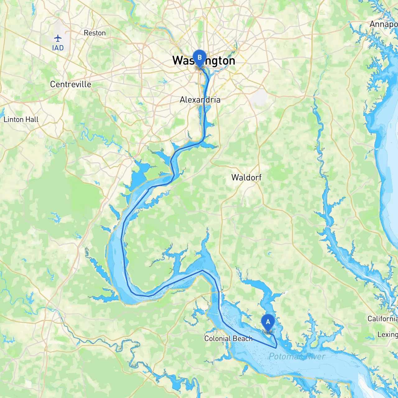
Pilotage Plan: Cobb Island, MD to Arlington, VA
Overview:This journey from Cobb Island, Maryland to Arlington, Virginia is a delightful exploration of the scenic waters of the Potomac River. The 60-plus nautical mile trek promises a varied experience with natural beauty, notable landmarks, and potential stops for shelter and enjoyment. This route is particularly suitable for leisure cruisers and day sailors looking for a mix of tranquility and vibrant sights along the way.
Departure from Cobb Island, MD:Starting your journey at Cobb Island, a quaint and picturesque departure point, you'll find the setting among marshes and wooded shorelines perfect for a serene getaway. As you leave the island, ensure you're aware of the surrounding waters where shallow depths are common. Use waypoints to guide your navigation effectively.
Navigating to the Potomac River:As you venture north from Cobb Island, keep an eye on the depth and consider your vessel's draft. Approximately 2 nautical miles from Cobb Island, you'll enter the Potomac River, which provides a wide and navigable channel. Be mindful of the tidal currents, especially near the river's mouth.
There are several navigational aids to keep you on course:
Points of Interest along the Route:1. Saint George Island: A perfect spot to drop anchor for a brief swim or picnic. Its secluded beaches provide a calm escape.2. Aquia Creek: If time permits, consider a detour up Aquia Creek. It offers good shelter and a beautiful natural landscape. 3. Quantico Marine Base: As you approach the base, you may see various military vessels. Keep a respectful distance while enjoying the sight.
Shelter Stops:
Navigating the Upper Potomac:As you proceed toward Arlington, keep a lookout for:
Regulations and Local Restrictions:Stay informed about Marine Regulations, particularly the slow-no-wake zones around marinas and residential areas. Be aware of wildlife protection areas, especially in the breeding season, and observe “No Wake” signs which help preserve both the environment and safety.
Approaching Arlington, VA:Your entry into Arlington offers stunning views of the D.C. skyline. The transition from open waters into urbanized areas requires heightened awareness:
Recommended Boating Apps:For navigation and safety, I highly recommend using the following apps:
With careful planning, this route from Cobb Island to Arlington should be both safe and enjoyable, filled with opportunities for exploration and leisure. Respecting the waterways' beauty and hazards will ensure a smooth journey! Safe boating!