
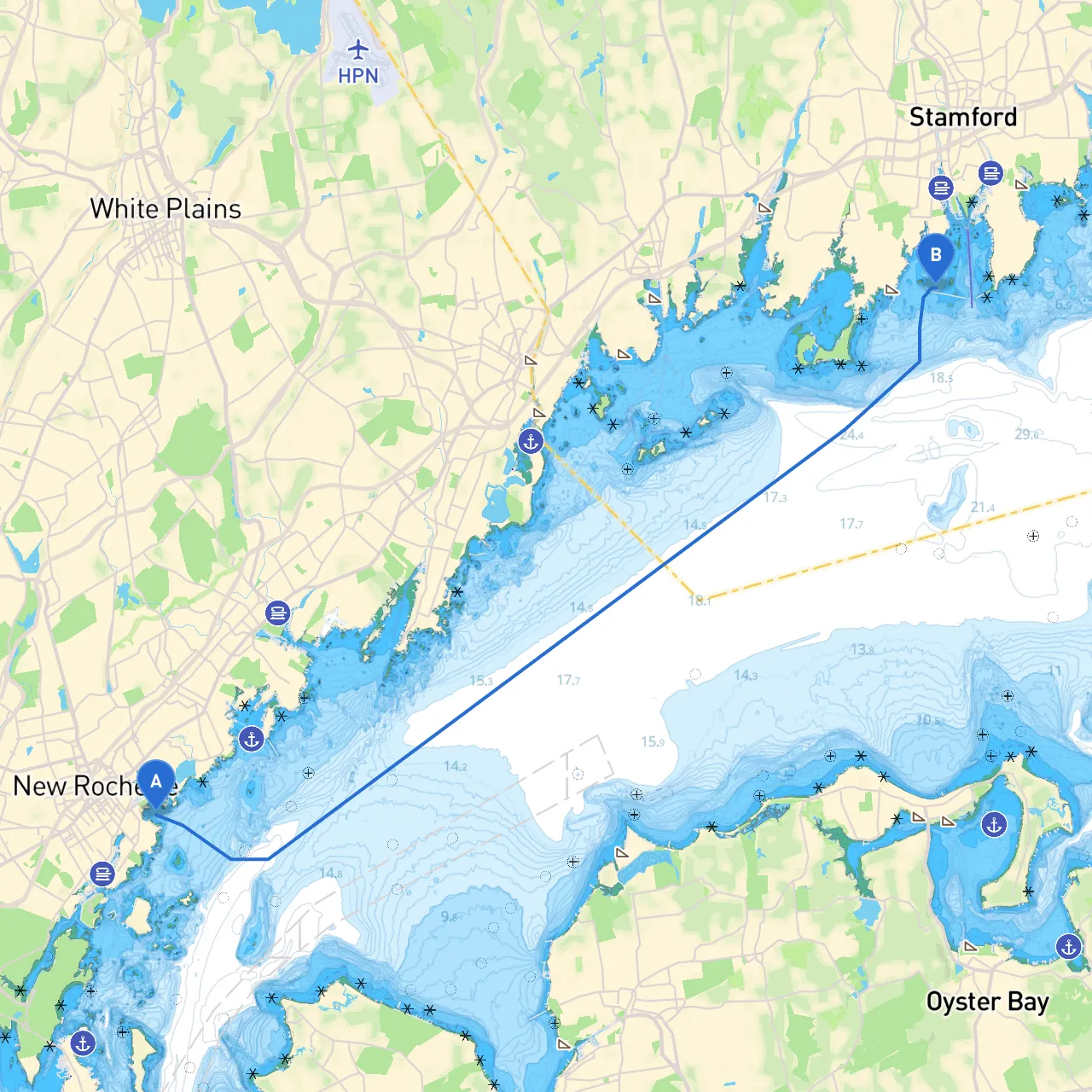
Pilotage Plan: New Rochelle, New York to Stamford, Connecticut
Overview:This trip from New Rochelle to Stamford is a delightful journey along the elegant shoreline of Long Island Sound. As you embark, expect a blend of rich maritime history, stunning views, and various navigational challenges. This itinerary caters to confident boaters seeking both safety and enjoyment, making it perfect for those familiar with coastal cruising.
Starting Point: City: New Rochelle Region: New York Country: United States Coordinates: (Longitude: -73.7655, Latitude: 40.9054)
Ending Point: City: Stamford Region: Connecticut Country: United States Coordinates: (Longitude: -73.5465, Latitude: 41.0172)
Distance: Approximately 12 nautical miles, depending on the route taken.
1. Departure from New Rochelle: Start your journey from New Rochelle Harbor by navigating past the marina and into the main channel. While headed southeast, ensure to observe the channel buoyage system, which consists of red and green buoys. These aids will guide you as you make your way into the Long Island Sound. Pay close attention to local vessel traffic, especially in busy weekends or during sailing regattas.
Navigational Notes:
2. Hudson Park to Port Chester: After leaving New Rochelle, you’ll pass by Hudson Park, offering a nice view of the waterfront and the City Island community across the way. As you proceed, keep an eye on the entrance to Port Chester, which serves as a useful sheltering bay should the weather take a turn.
Points of Interest:
Navigational Notes:
3. Crossing the Sound: Continue eastward, crossing the Long Island Sound—this is where you may start to experience notable currents. Maintain a steady heading towards Stamford, navigating with caution as wind and tide can influence the water conditions significantly.
Hazards & Regulations:
4. Approaching Stamford: As you get closer to Stamford, you’ll find several landmarks such as the Stamford Harbor Light, which serves as a helpful point of reference. The harbor entrance is marked by well-lit buoys; follow these to ensure a safe approach.
Shelter Considerations:
Navigational Aids and Restrictions:
For your navigation during this journey, I highly recommend equipping yourself with relevant boating apps. Particularly, savvy navvy will provide real-time navigation insights, tide predictions, and crucial weather updates to keep you informed and safe throughout your trip.
This route is not only picturesque but also a valuable learning experience for intermediate boaters navigating through busy waters and harbor entrances. Each segment offers unique opportunities for exploration, and with careful planning and awareness, you’ll enjoy a safe and exhilarating journey on the water. Safe travels!