
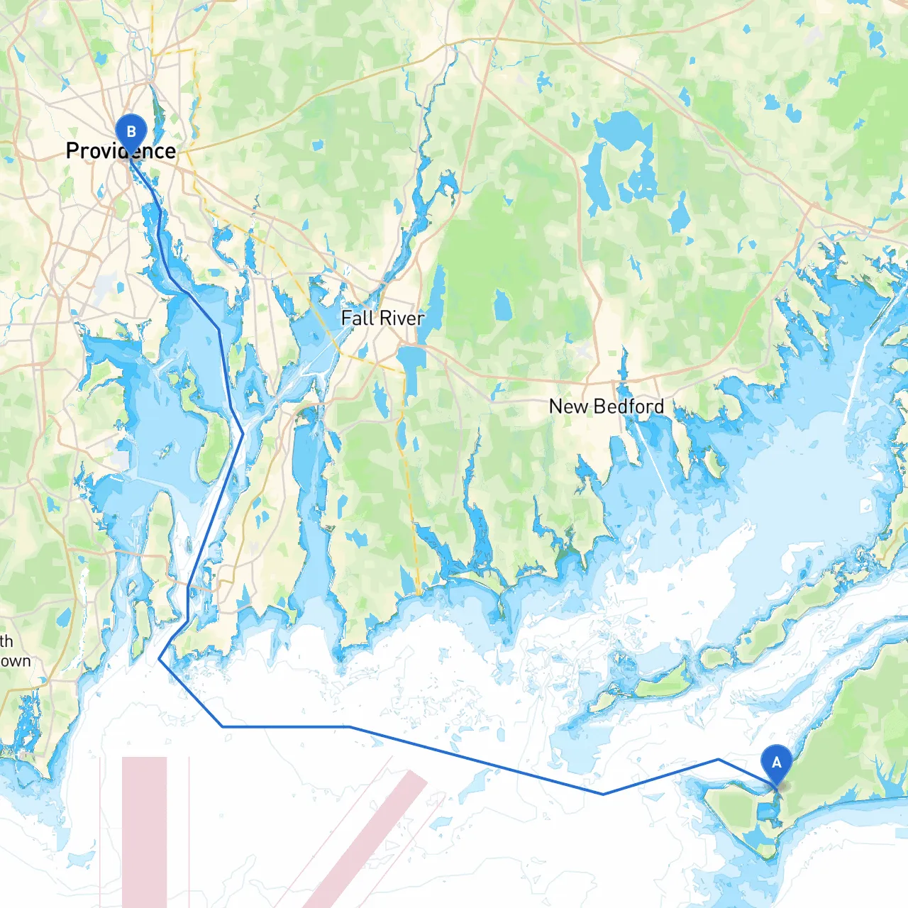
Route OverviewEmbarking on a journey from Chilmark, Massachusetts, to Providence, Rhode Island, is a fantastic boating experience ripe with opportunities for exploration and safe haven. This route spans a variety of scenic coastal landscapes, picturesque harbors, and charming seaside towns, ensuring both safety and enjoyment for boaters who crave adventure coupled with relaxation.
Starting Point: Chilmark, MA Coordinates: 41.35325, -70.7668666667
Before setting sail, it’s wise to check local weather conditions, tides, and currents, as they can greatly influence your journey. Chilmark's serene ambiance offers a perfect pre-trip pause, with opportunities to enjoy the tranquility of Martha's Vineyard. Take time to stock up on supplies or contemplate a quick visit to Menemsha Beach, known for its beautiful sunsets.
Route Navigation:1. Depart from Chilmark - Head east-northeast towards the Vineyard Sound, keeping the northern shores of Martha’s Vineyard close. Pay heed to the depth—staying aware of the local chart’s details will ensure you avoid shallows.
2. Vineyard Sound - As you traverse Vineyard Sound, mark your path using navigation aids like the West Chop Light (Fl W 15s) and the East Chop Light (Fl R 15s). - Look out for boat traffic, especially near ferry routes, and maintain a sharp lookout for fishing vessels and recreational boats. - Bear in mind that this area can experience significant tidal currents, particularly at the entrance and exit points of the Sound.
3. Buzzards Bay - After exiting Vineyard Sound, you may enter Buzzards Bay. This expansive body of water offers ample room to stretch your boat’s legs. - As you navigate through Buzzards Bay, be aware of the approach to the following notable points: - Ned's Point Lighthouse: A charming landmark that provides a great photo opportunity if conditions allow for a brief stop. - Marion Harbor: A potential sheltered stop to regroup or weather any sudden changes.
4. Cuttyhunk Island - If time permits and weather allows, consider a brief detour to Cuttyhunk Island, which sits at the mouth of Buzzards Bay. This island is a fantastic anchorage, often more solitary than other destinations. - The island offers a peaceful respite with hiking trails and stunning views—a perfect place for a picnic or a quick swim.
5. Entrance to Narragansett Bay - As you approach the south entrance of Narragansett Bay, it is crucial to keep a lookout for the numerous navigational buoys marking the entrance. The Sandy Point Light (Fl W 4s) will guide you along your way. - Beware of the strong tidal flows and potential fog, which can arise unexpectedly; maintaining a reliable radar and GPS navigation is highly recommended.
6. Providence River - Turning north into the Providence River, the urban landscape begins to unfold. The Aspray Boathouse offers a beautiful shoreline to explore. - The river's historical significance and its bustling waterfront are fascinating, with various restaurants and attractions lining the banks. Secure a spot at one of the marinas such as the Industry Wharf Marina that’ll offer you a warm welcome upon your arrival.
Bay Shelter Recommendations
Additional Navigational Considerations
This adventure from Chilmark to Providence is best suited for enthusiastic boaters who enjoy both the tranquility of nature and the vibrancy of coastal towns. With ample opportunities for scenic views and interesting stops, as well as safe havens along the way, this journey promises more than just a means of travel; it’s a beautifully woven tapestry of New England’s nautical heritage.