
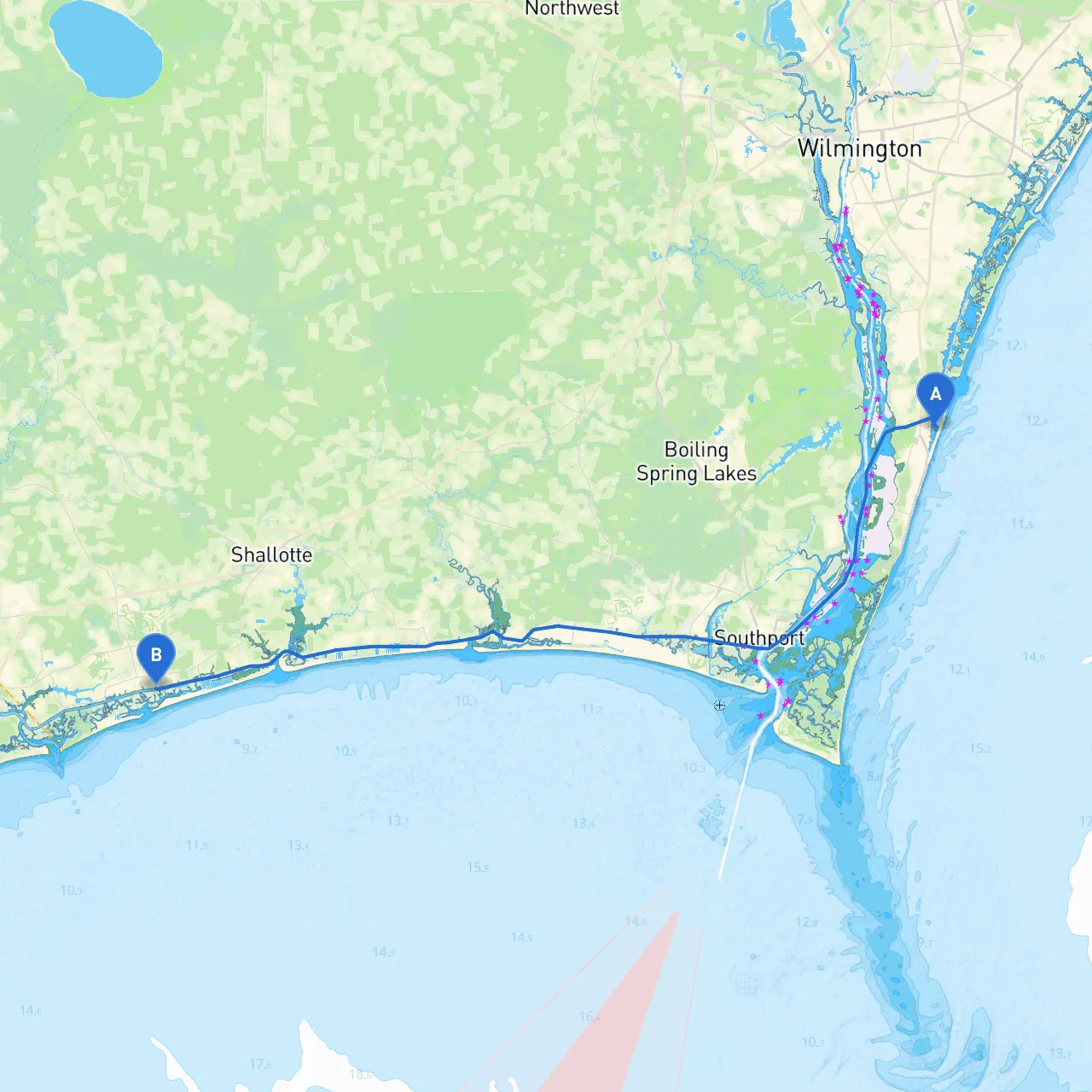
Pilotage Plan from Carolina Beach, North Carolina to Ocean Isle, North Carolina
Route Overview:Your journey begins in the picturesque waters of Carolina Beach and takes you on a charming course to Ocean Isle, North Carolina. This route provides not just a fantastic boating experience but also offers safe havens and delightful landmarks along the way. The distance between the two locations is approximately 22 nautical miles, making it suitable for both experienced and intermediate boaters looking for a day of adventure on the water.
Departure from Carolina Beach:As you set off from Carolina Beach, you’ll want to check the local weather conditions. The area can be influenced by coastal weather patterns, so it’s wise to monitor changes frequently. The beach area is well-marked and offers plenty of visibility, but as you head into open waters, be aware of breaking waves near the inlet. Ensure your navigation lights are functioning if you plan to return at dusk.
Before you leave, consider filling your vessel’s supplies at one of the local marinas. The Carolina Beach State Park is a great point of interest to explore if you have extra time. Here you can find hiking trails that lead to unique ecosystems, including longleaf pine forests.
Navigational Considerations:The key navigational aids to observe during your trip include:
1. Masonboro Inlet: This is a significant feature as you cross the inlet to the Atlantic Ocean. The channel can be shallow, especially on low tides, so always stay within the marked buoys.
2. Lighted Buoys: Pay close attention to the lighted buoys marking the shipping channel. These buoys guide you in and out of dangerous shallow spots, where navigation can be tricky. Awareness of your surroundings and regular chart monitoring (available on savvy navvy or paper charts) will help you prevent grounding.
3. Traffic Separation Schemes: Be mindful of any commercial traffic in the area, especially along the shipping lanes. Always maintain a lookout for larger vessels and adhere to the collision regulations to ensure safe passage.
Points of Interest Along the Route:As you navigate southwards, consider dropping anchor at any of these notable locations for shelter or enjoyment:
Arrival at Ocean Isle:Your final destination, Ocean Isle, awaits with its serene atmosphere and expansive beaches. As you approach Ocean Isle Beach, light up your chart plotters and follow the channel into the inlet. The area is well-marked, but keep an eye on the tides, as it can get shallow.
Local marinas like the Ocean Isle Fishing Center offer both transient dockage and amenities such as fuel and supplies. It's an excellent point for fishing, with opportunities for various local charters should you want to spend more time in the area.
Safety Precautions:Before and during your trip, ensure you have essential safety equipment on board, including:
Conclusion:This route is an ideal option for boaters who relish beautiful views and wish to explore the coastal waters while keeping safety at the forefront. With your planning and attention to navigational details, it promises to be a memorable day out. Happy boating!