
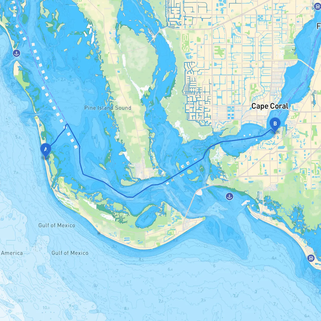
Route Overview:Embarking on this approximately 20 nautical mile journey from Captiva, Florida to Fort Myers, Florida, offers a delightful blend of scenic beauty, exploratory opportunities, and safe navigation. This route is ideally suited for recreational boaters, including families and individuals looking for a laid-back, enjoyable adventure on the water. With picturesque views, convenient stopping points, and manageable hazards, this is a perfect day trip for boaters of all experience levels.
Starting Point: Captiva Island
As you set your course from Captiva, a sanity check for weather conditions and tides is essential. Always review the marine forecast to ensure smooth sailing. The channel leading out of Captiva Pass is well-marked and provides a straightforward passage into the Gulf of Mexico.
First Leg: Navigating the Captiva Pass
Once you leave the dock, head southward into Captiva Pass. The navigational aids and buoys are clearly positioned, just make sure to steer clear of the shoals on either side of the pass. Keep an eye out for currents which can be strong, especially near the inlet.
Points of Interest:
Shelter Considerations:
As you round the southern tip of Captiva, look for Pine Island Sound which offers multiple bays for shelter. In the case of inclement weather, Bokeelia and Saint James City are prime spots to anchor down. Here you can find friendly locals and perhaps a quiet fishing spot to wait out any storms.
Second Leg: Through the Waters of Pine Island Sound
Continue navigating through Pine Island Sound, where the waters are relatively calm, but watch for small fishing vessels and kayakers. The sound is marked with several navigational aids—be sure to observe them closely.
Keep your eyes peeled for wildlife, such as dolphins and manatees, as well as the stunning coastal homes lining the shore. During your cruise, you have opportunities to explore Lover's Key and Estero Bay, known for their natural beauty.
Navigational Aids and Hazards:
Final Approach: Entering Fort Myers
As you approach Fort Myers, you'll observe the skyline of the city highlighting historic landmarks and bustling activity. Stay alert as you navigate the channels leading into the Fort Myers Marina.
Points of Interest:
Arriving in Fort Myers:
Upon reaching Fort Myers, you'll find well-maintained docks and facilities to ease your arrival. Before you dock, familiarize yourself with local regulations, including fishing limits and waste disposal procedures.
Safety Considerations:
1. Always check weather forecasts before departure and adjust your plans as necessary.2. Keep a good lookout for navigational aids and observe local navigational charts.3. Communicate your position and intentions if you encounter vessel traffic.4. Utilize buoyancy aids and safety gear, ensuring all aboard have life jackets within reach.
Recommended Apps:
To enhance your boating experience, consider using the following apps:
In summary, this route from Captiva to Fort Myers encapsulates a beautiful blend of safety, scenic enjoyment, and a touch of adventure. Perfect for all types of boaters, it ensures a memorable experience while keeping safety at the forefront. Happy boating!