
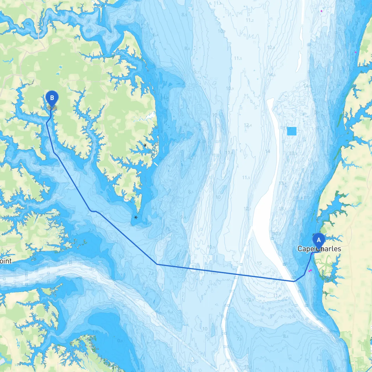
This journey from Cape Charles to North, VA, spans roughly 27 nautical miles, offering a fantastic blend of natural beauty and intriguing sights along the way. The route is suitable for intermediate to experienced boaters who are comfortable navigating through potentially busy waterways while keeping a keen eye on safety and maritime regulations.
Departing from Cape Charles, you’ll want to head out into the waters of the Chesapeake Bay. The plan is to follow the natural contours of the coastline, where you will encounter both bustling harbor areas and serene bays that provide safe haven if the weather turns south.
1. Point of Departure: Cape Charles Harbor (Coordinates: -76.0181666667, 37.2647333333) - Local Attractions: While you're here, take a quick stroll along the delightful beachfront or explore the charming downtown area filled with historic buildings and quaint shops.
2. Navigational Considerations: - Monitor your departure through the marked channel to ensure you avoid the adjacent shoals. Several navigational aids are in place to guide your exit, including buoys and markers.
3. Weather Monitoring: - Check local forecasts before you embark, as the weather can change rapidly in this region. Use a reliable app such as Savvy Navvy to stay updated on real-time weather and sea conditions.
4. Points of Interest Along the Way: - Wise Point: Approximately 6 nautical miles from Cape Charles, Wise Point offers a scenic view of natural wetlands and is home to various shorebirds. - Hog Island: After Wise Point, consider a brief stop at Hog Island. This area is perfect for a picnic or nature walk, taking in the stunning marshland scenery.
5. Bays for Shelter: - Cherrystone Inlet: This small inlet is situated about 12 nautical miles from Cape Charles. It provides excellent protection from winds and waves — a great place to seek refuge if conditions worsen. - Tangier Sound: As you approach nearer to North, VA, the Sound offers calm waters and beautiful vistas, ideal for navigation or hauling anchor for a short break.
6. Final Stretch: As you approach North (Coordinates: -76.4006, 37.42665), be mindful of your arrival at this busier section of the coastline. The area can be lively with various local vessels in transit.
This picturesque route from Cape Charles to North, VA, is not only scenic but also provides ample opportunities for both exploration and shelter in case of inclement weather. By remaining vigilant with navigational aids and regulations, you can enjoy a safe and fulfilling trip through the beautiful Chesapeake Bay region. Whether it's your love for nature or the joy of cruising, this journey encapsulates the perfect blend of adventure and comfort for boaters.