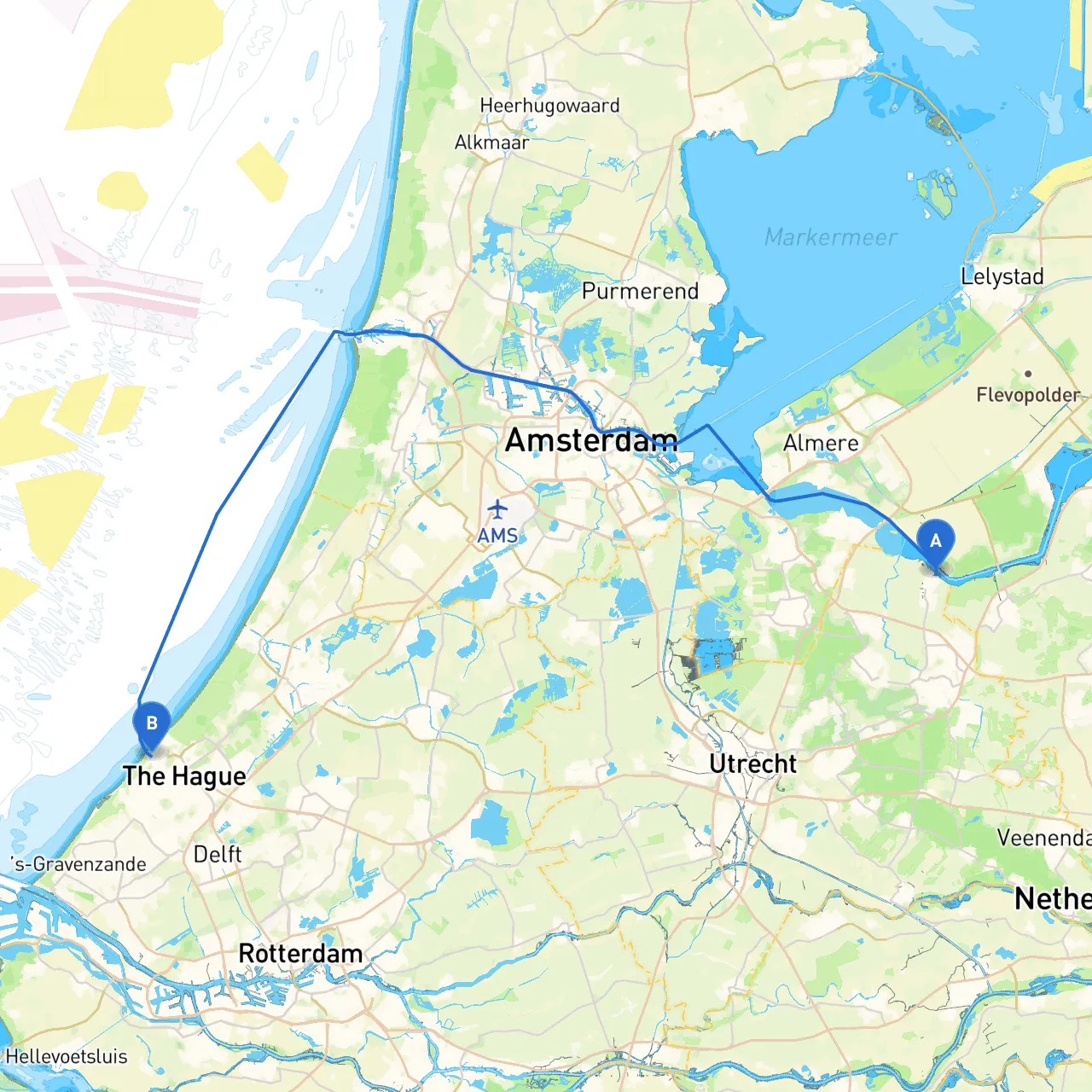
Pilotage Plan: Bunschoten Spakenburg to Den Haag
Starting Point: Bunschoten Spakenburg, NL Ending Point: Den Haag, NL
Embarking on this journey from Bunschoten Spakenburg to Den Haag, you will navigate a mix of inland waterways and the scenic Dutch coastline, making it a rewarding trip for boaters seeking exploration and a connection to the sea. This route is particularly suited for recreational sailors and motorboaters experienced in handling varied water conditions, as you will encounter both sheltered canals and open waters.
Route Overview
The journey approximately covers a distance of about 50 nautical miles, with opportunities to stop and explore charming towns and natural landmarks along the way. As you set off, preparation is key; check the tide schedules and weather conditions ahead to maximize safety and comfort.
Section 1: Bunschoten Spakenburg to Huizen (Approx. 6 NM)
Start your voyage by navigating the canals from Bunschoten Spakenburg towards Huizen. This part of the route is predominantly sheltered, making it a smooth departure.
Milestones & Considerations:
- Navigational Aids: Keep an eye out for the green and red buoys marking your way through the canals. It's crucial to adhere to the speed limits in these narrow sections to avoid disturbing local wildlife and nearby residents.
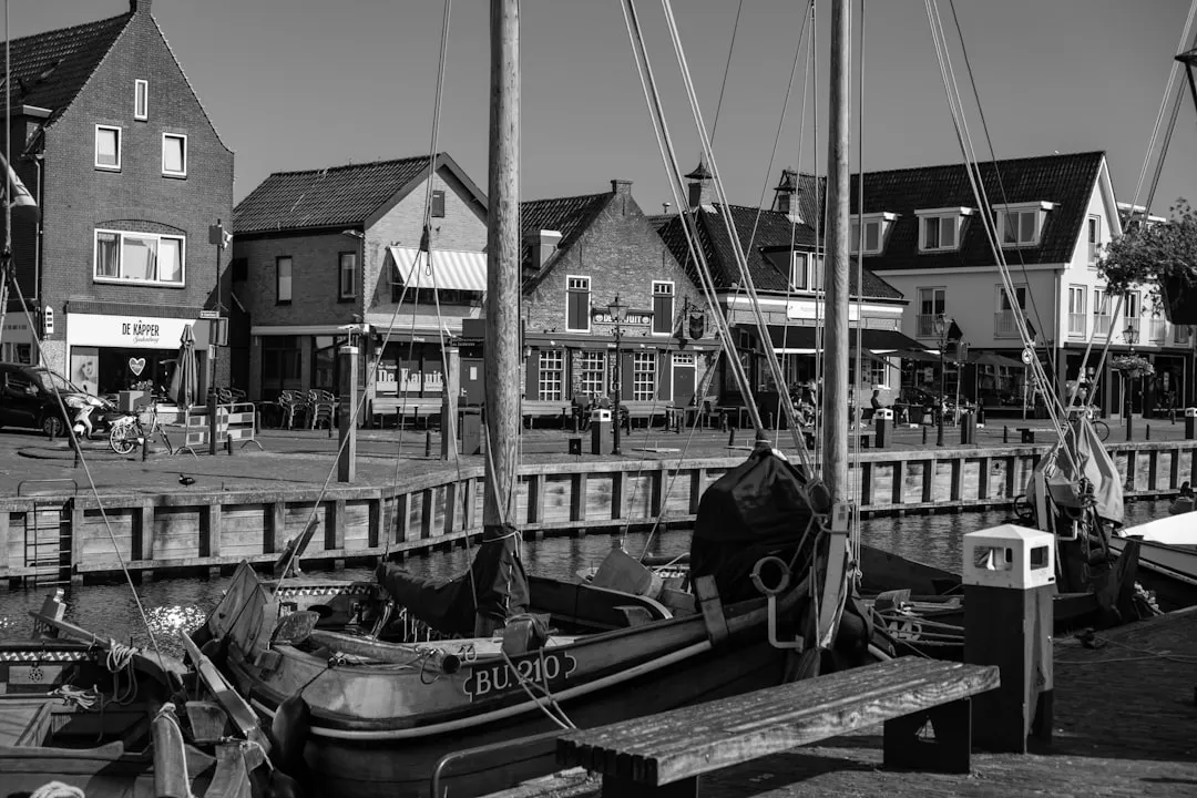
- Points of Interest: Huizen offers a lovely marina and picturesque old harbor area where you can take a short excursion to explore local eateries and shops known for their seafood.
Section 2: Huizen to Naarden (Approx. 3 NM)
After Huizen, a quick jaunt takes you to the historical town of Naarden, one of the best-preserved fortified towns in Europe.
Shelter Bay: Naarden has a sheltered harbor in the event of bad weather, making it a perfect spot to secure your vessel.
Activities: You can visit the Naarden Vesting, an impressive historical site; the town’s unique star-shaped layout is perfect for a leisurely stroll.
Section 3: Naarden to Almere (Approx. 7 NM)
Continue south to Almere, navigating through the Gooimeer. This area can be more exposed, so pay close attention to any changes in wind or sea conditions.
Important Considerations:
- Weather: Be particularly cautious of sudden weather changes. This stretch can experience stronger winds, so reef your sails or reduce speed if necessary.
- Navigational Aids: Look for GPS waypoints and local markers; they will be your best guide through this more dynamic part of the route.
Section 4: Almere to Amsterdam (Approx. 10 NM)
As you make your way to Amsterdam, you'll traverse the IJmeer, a larger body of water, suitable for confident boaters. Here you can experience the hustle and bustle of the city from the water.
Shelter Options: Amsterdam's several marinas offer a variety of facilities. In case of rough seas, staying in the capital for a night is a pleasant choice.
Points of Interest: Check out iconic sites like the Rijksmuseum and the picturesque canals.
Section 5: Amsterdam to Zandvoort (Approx. 15 NM)
Leave Amsterdam behind and head towards Zandvoort, famous for its beach. Here you'll transition from the bustling canals to the open sea.
Navigational Considerations:
- The approach to Zandvoort's beach can be tricky due to tidal currents, so paying attention to tidal charts becomes essential here.
- Prepare for larger vessels in this area; maintaining a safe distance is crucial.
Shelter Points: Zandvoort features several coves along the beach, ideal for seeking refuge if the weather turns nasty.
Final Destination: Den Haag (Approx. 10 NM)
Finally, your journey leads you to Den Haag, navigating through the Scheveningen harbor entrance—an iconic way to conclude your trip.
Regulations: This section may be subject to specific maritime traffic rules, so ensure your vessel complies with all local regulations.
Safety and Essential Apps
As you embark on this adventure, safety remains paramount:- Monitor weather forecasts regularly, as conditions can change rapidly.
- Always carry life jackets for all passengers and have a first aid kit on board.
- Use a reliable navigation app such as Savvy Navvy, as well as others like Navionics or OpenCPN for detailed maps and real-time weather updates.
This route is one filled with stunning sights, interesting ports of call, and ample opportunities for safe shelter. You're well on your way to not just a voyage but a delightful exploration of the Dutch waterways and coastal experiences. Enjoy the journey!