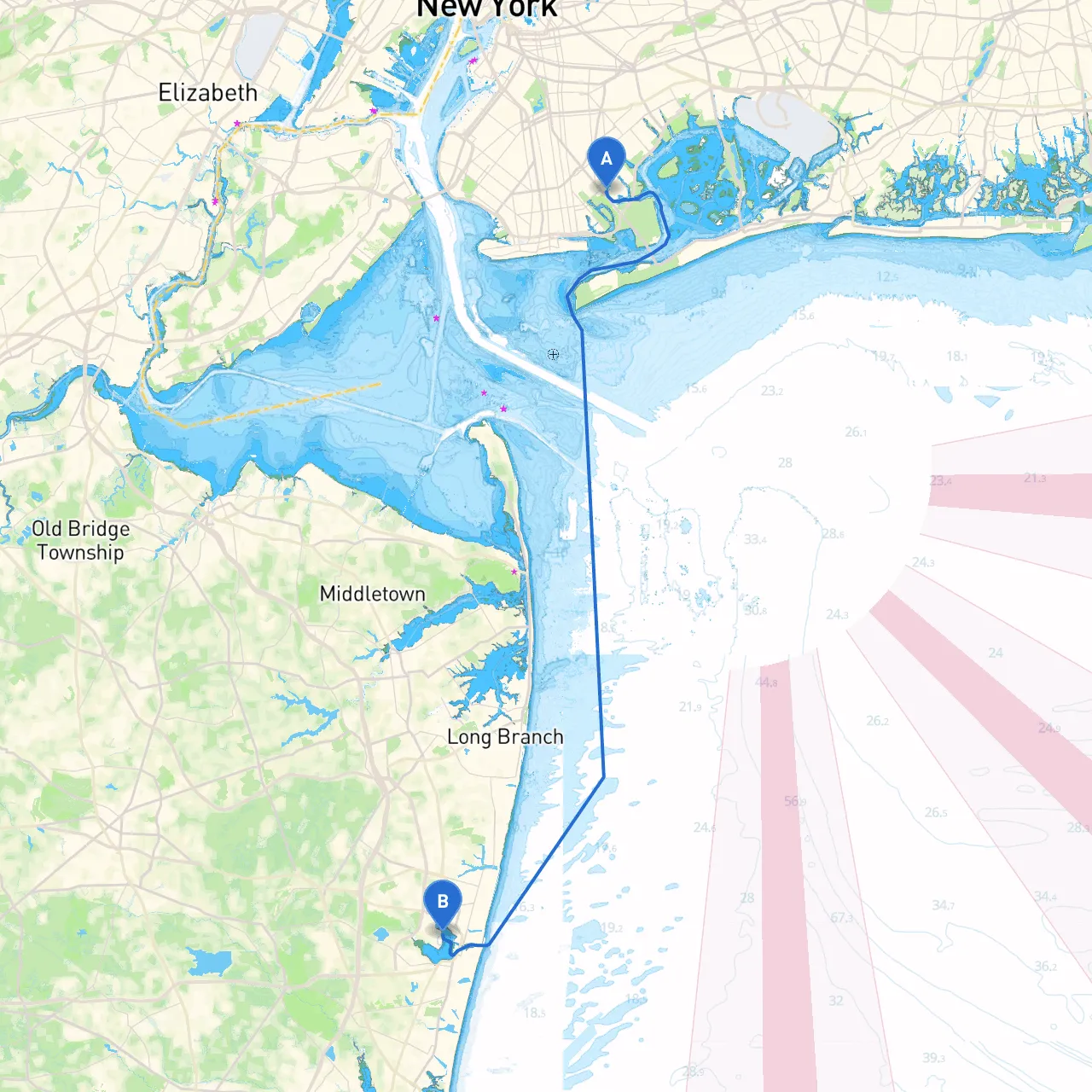
Pilotage Plan: Brooklyn, NY to Neptune, NJ
Overview:This scenic boating route from Brooklyn to Neptune offers a captivating blend of urban and natural landscapes. As you navigate from the bustling waters of New York Harbor through the Raritan Bay and shorelines of New Jersey, you’ll encounter various points of interest, charming towns, and safe anchorages, making it perfect for recreational boaters seeking adventure while prioritizing safety.
Route Description:
Departure Point: Brooklyn, NY
- Starting Location: East River, Brooklyn, NY (Coordinates: -73.9181666667, 40.6085)
- Recommended Departure: Early morning to avoid heavy traffic in and around New York Harbor.
First Leg: Navigate the East River and New York Harbor
- Navigational Aids: Maintain awareness of the numerous ferries and commercial vessels operating in this busy waterway. Keep an eye on navigation markers such as buoys and ranges guiding vessels safely to and from the harbor.
- Points of Interest: The Statue of Liberty and Ellis Island are breathtaking views along your route.
- Hazards: Be cautious of strong tidal currents and shallow waters as you get closer to Manhattan.
Transition to Lower New York Bay
- Route: A turn south will lead you towards Lower New York Bay.
- Navigational Consideration: Monitor the Staten Island Ferry route. Use VHF radio to communicate your position and intentions.
- Shelter Options: If conditions worsen, you can seek refuge in the Elizabeth River or Great Kills Harbor for a safe anchorage.
Second Leg: Raritan Bay
- Entering Raritan Bay: Once past the Lower Bay, steer towards the Raritan in a south-easterly direction.
- Points of Interest: The picturesque Sandy Hook provides a lovely stop for beach activities and a chance to explore its nature trails. There are facilities for rest and refreshments.
- Local Regulations: Adhere to the NJDEP guidelines regarding no-wake zones and restricted boating areas particularly close to Sandy Hook.
Final Leg: Approaching Neptune, NJ
- Navigational Aids: As you approach the Shark River and Neptune area, keep an eye out for buoy markers and channel markers leading you safely into the estuary.
- Safe Harbor: The Shark River offers several marinas where you can dock if needed—Spruce Run or Fisherman’s Cove are recommended stops with safe berthing.
- Arrival at Neptune: (Coordinates: -74.0385, 40.1931666667) The picturesque landscapes and opportunities to enjoy coastal towns await.
Return Considerations:
Plan your return route with an eye on changing weather conditions. Storms can develop quickly in this region, so always consult your weather app like Savvy Navvy before departure.
Safety Precautions:1. Weather Check: Before embarking, verify the latest weather updates. Conditions can change rapidly along the coast.2. VHF Radio Use: Keep a VHF radio on hand and monitor Channel 16 for emergency broadcasts and local vessel communications.3. Life Jackets: Ensure that all passengers have appropriate life jackets and are aware of safety procedures in case of emergency.4. Navigation Apps: Utilize navigational apps such as Savvy Navvy to stay informed about tides, currents, and safe passages.
Conclusion
This route from Brooklyn to Neptune showcases breathtaking scenery and vibrant coastal life, balanced with necessary precautions for a safe boating experience. Whether you’re an experienced sailor or a recreational boater, this trip promises memorable stops and the comfort of secure harbors while exploring the Atlantic coastline. Happy boating!