
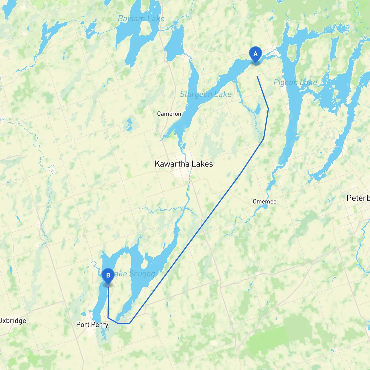
Pilotage Plan: Bobcaygeon, ON to Port Perry, ON
Overview: This route offers a beautiful passage through Ontario’s stunning waterways, transitioning from the Kawartha Lakes region to the shores of Lake Scugog. Suitable for intermediate to experienced boaters, it is an ideal choice for those looking to combine natural beauty with engaging navigation challenges.
Coordinates: Longitude -78.5808, Latitude 44.5180
Bobcaygeon serves as an excellent starting point, rich in history and culture. Before casting off, take a moment to explore the charming downtown area, visit the local shops, or grab a bite at one of the waterfront restaurants.
1. Departing Bobcaygeon: Start your journey on the Trent-Severn Waterway, heading east towards Pigeon Lake. This section offers well-marked channels, but be mindful of the floating debris, especially after storms.
2. Navigational Aids: Make use of buoys and markers along the Trent-Severn; these will guide you along the safest paths. Keep a close watch for marker number 51, which indicates the entrance of Pigeon Lake.
3. Navigating to Trent Lake: Continuing on Pigeon Lake, follow the channel into Trent Lake. This stretch may have strong currents, particularly after heavy rains, so proceed with caution.
4. Entering Canal to Lake Scugog: Once you navigate through Pigeon Lake, you’ll enter a canal leading to Lake Scugog. The canal is well-marked, but watch for the speed limit regulations as it can be narrow in certain sections.
5. Lake Scugog: Upon arriving at Lake Scugog, you'll experience a more open waterway. The beauty here is breathtaking, making it an excellent place for fishing, bird watching, or simply soaking in the scenery. Be aware of localized winds that can pick up in wide-open areas.
As you approach Port Perry, there is a well-protected bay just before venturing into the township. This bay is great for taking shelter, should conditions change unexpectedly.
Coordinates: Longitude -78.91165, Latitude 44.16198
Upon arriving in Port Perry, you’ll find a vibrant lakeside community with shops, restaurants, and entertainment options. Here, you can celebrate the successful completion of your journey, perhaps with a visit to the Scugog Shores Cultural Centre or the nearby marina facilities.
This proposed route from Bobcaygeon to Port Perry not only provides a safe passage through diverse waterways but also allows you to immerse yourself in the natural beauty of Ontario. The combination of planned stops, local attractions, and ample shelter possibilities makes it perfect for those seeking a getaway on the water. Remember to stay updated on weather conditions and local regulations. Boating apps like savvy navvy will be invaluable for navigating and ensuring a safe, enjoyable trip. Happy cruising!