
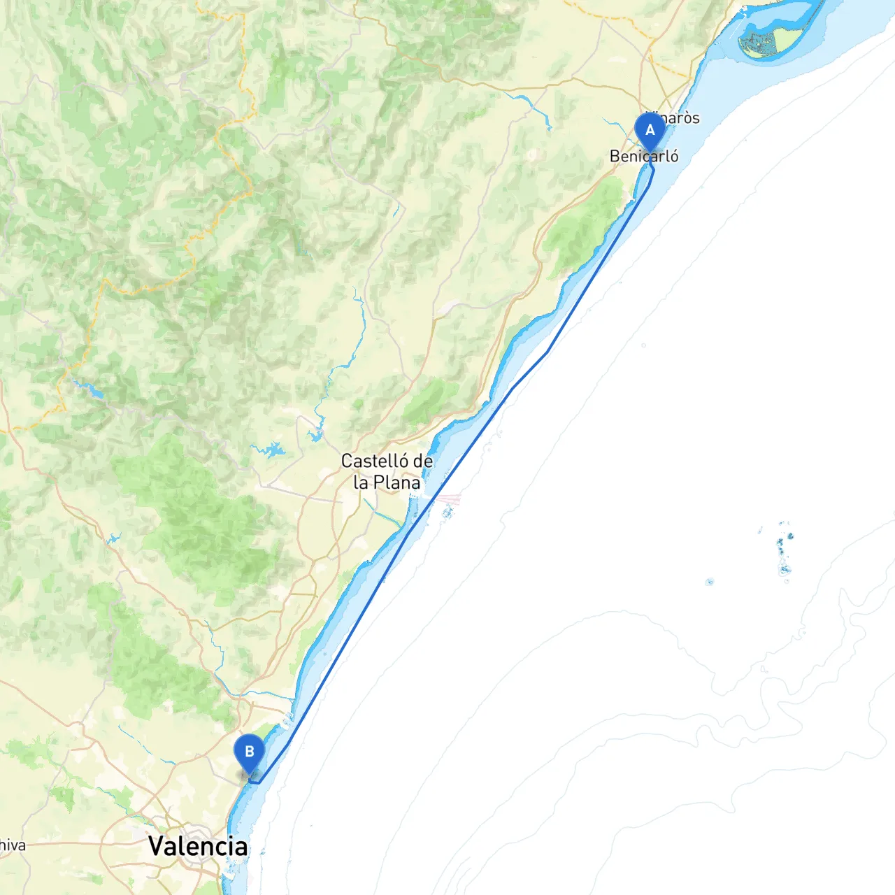
Pilotage Plan: Benicarlo, ES to Valencia, ES
Trip Overview:Embarking on a journey from Benicarlo to Valencia provides an exhilarating blend of stunning coastal landscapes, historical landmarks, and safe harbors. The route is approximately 70 nautical miles along the Mediterranean Sea, making it ideal for skilled sailors and cruising enthusiasts. With careful planning and attention to safety, this trip can be a memorable adventure.
Section 1: Departure from Benicarlo
Start Point: Benicarlo, ES (40.4163° N, 0.4342° E) Departure Considerations: Before setting sail, check the local weather conditions and ensure all safety equipment is on board, including life jackets, flares, a first aid kit, and a reliable means of communication such as a VHF radio.
Local Hazards: Watch for fishing vessels as this area is a popular fishing zone. Be cautious of any submerged structures, particularly near the entrance of the port. The port has a well-marked entrance, and it is advisable to make use of local navigation aids which include port markers.
Section 2: Points of Interest along the Route
1. Moraira (Approx. 26 NM from Benicarlo): A picturesque coastal town with beautiful beaches and charming restaurants. Ideal for a lunch stop or a quick refreshment break. Anchor in the calm waters of Moraira's harbor to enjoy the local cuisine or take a stroll along the promenade.
2. Calpe (Approx. 32 NM from Benicarlo): Recognized for the iconic Peñón de Ifach, a large rock formation that rises dramatically from the sea. This location offers breathtaking views and the chance for hiking. Sheltering in the Calpe harbor is advisable if weather conditions worsen, as it has reliable facilities.
3. San Antonio Cape (Cap de Sant Antoni): This natural park area offers beautiful views and the chance to explore its rugged coastline. Keep an eye on the nearby underwater reefs of red rocks. Be aware of strong currents in this region, especially near the rocks.
Shelter Options: If the weather turns bad, consider these bays and harbors for refuge:
Section 3: Navigational Aids and Considerations
Key Navigational Aids:
Navigational Strategies:
Local Regulations:
Conclusion:
This passage from Benicarlo to Valencia is not only a charming journey along the Spanish coast but also a pathway that enhances a sailor's skills and experience. It’s suitable for intermediate to experienced boaters who can navigate and adapt to varying weather and coastal conditions. With safe harbor options, breathtaking sights, and opportunities to explore coastal towns, this route promises adventure while prioritizing safety and enjoyment. Equip yourself with knowledge, resources, and the right navigation aids like savvy navvy, and you’re set for a thrilling maritime experience celebrating the beauty of the Mediterranean Sea. Safe travels!