Pilotage Plan from Atlantic City, NJ to Ship Bottom, NJ
Overview
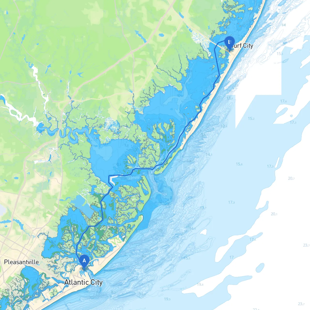
This waterway journey from Atlantic City to Ship Bottom is a delightful venture along the New Jersey coast, combining both safe navigation and opportunities to enjoy the stunning scenery and local attractions. While safety is paramount, this route brings together a variety of experiences for both novice and seasoned boaters alike.
Route Description
Starting from Atlantic City, known for its vibrant boardwalk and casinos, your cruise will initially navigate through the Atlantic City Inlet. This bustling area is often filled with both local fishermen and recreational day trippers, so maintaining a vigilant lookout for smaller vessels and kayakers is essential.
As you exit the inlet, you will enter the vastness of the Atlantic Ocean. Here, the water can be a little choppy depending on weather conditions, so it’s advisable to check local forecasts before setting out.
Navigation Aids: Pay close attention to the following aids:
- AC Buoy 4 (Lighted Buoy) guides boats out of the inlet and into deeper waters.
- AC Sea Buoy marks safe passage away from shoal waters on the approach to the coastline.
Notable Landmarks and Points of Interest
- Absecon Lighthouse: Located near the inlet, this historic lighthouse is not only picturesque but also open for climbing—offering stunning views from the top. It’s a great first stop if you have time to spare.
- Brigantine Northend: Just on your way, this tranquil beach is great for a short respite. It offers calm waters and is perfect for fishing or simply enjoying the beach.
Shelter and Safe Havens
As you continue southward along the coast, there are ideal spots to retreat to should the weather change:- Little Egg Harbor: A large bay with plenty of room to anchor and wait out rough weather. It’s optimal for a lunch stop and provides shelter from easterly winds.
- Great Bay: As you near Ship Bottom, this expansive bay also offers serene spots and anchorage options if conditions warrant a pause.
Local Regulations
Adhere to local speed limits when navigating near populated shorelines, especially in zones marked for slow speed, such as near residential areas and designated swimming zones. Be sure to take note of any seasonal restrictions on fishing, which can impact those looking to drop lines along the way.
Final Approach to Ship Bottom
As you near Ship Bottom, watch for the distinctive Long Beach Island (LBI) landmarks. The waters here become more populated with boats, especially on weekends. Keep an eye on the
for local traffic and use your VHF radio to communicate with other vessels as necessary.
Recommended Boating Apps
For the safest and most enjoyable experience, consider utilizing these apps:- Savvy Navvy: A fantastic navigation tool that simplifies route planning and provides important safety information while on the water.
- Navionics: Great for electronic charts and detailed nautical maps.
- Windy: Perfect for staying updated on weather changes that could affect your journey.
Conclusion
This journey between Atlantic City and Ship Bottom offers a blend of leisurely cruising with opportunities for exploration and escape should the weather not cooperate. It’s suited for intermediate and experienced boaters, but with preparation and attention to safety, novice crew can enjoy the venture as well. With picturesque views, ample opportunities for shelter, and a dash of adventure, you'll find this trip truly delightful. Safe travels!