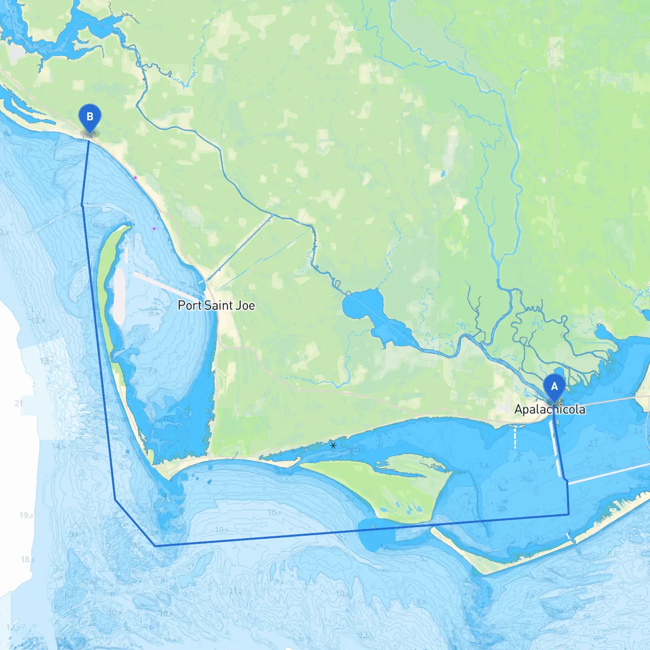
Pilotage Plan from Apalachicola, Florida to Mexico Beach, Florida
Starting Point: Apalachicola, Florida
Coordinates: Long -84.9787, Lat 29.7279
Your adventure begins in the quaint town of Apalachicola, known for its rich maritime culture and vibrant waterfront. As you prepare for your journey, be sure to maximize safety by checking weather conditions and ensuring all your safety equipment is in good order.
Route Overview
The distance between Apalachicola and Mexico Beach is approximately 23 nautical miles, depending on the specific track you choose. This route is ideal for experienced boaters, as it involves navigating open waters and requires attention to detail, particularly regarding navigational aids and local hazards.
Hazards and Navigation Considerations
- St. George Island: As you leave Apalachicola, keep an eye on the northern tip of St. George Island, which can create confusing waters depending on the tide and wind conditions.
- Navigational Aids: Watch for buoys marking the main channels, particularly the entrance barrels and the associated channel markers.
- Weather Awareness: Since weather can change swiftly in this region, maintaining a close watch on the forecast is vital. If storm clouds appear, consider heading toward one of your planned shelter locations.
Points of Interest
St. George Island State Park
: As you sail toward Mexico Beach, this state park presents an excellent opportunity for a stopover. The park offers beautiful natural beaches, nature trails, and picnic areas. It's a fantastic spot for a swim or a shore excursion.
2. Sandy Point: This small island offers a serene anchorage if the weather turns. The sandy beaches are perfect for beachcombing and enjoying a quiet moment away from the boat.
Route Section: Navigational Details
- Follow the channel markers as you exit the Apalachicola River toward the Gulf of Mexico. The entrance to the Gulf can be tricky, so heed the red and green markers.
- After exiting the river, head towards the designated navigation waypoints, keeping an ear tuned to VHF channel 16 for any navigational updates or local traffic advisories.
- As you approach Mexico Beach, keep an eye out for the Mexico Beach Pier – it’s a great landmark to confirm you are on the right track.
- Before entering the Mexico Beach marina, ensure you check the harbor entrance depth, especially if your vessel has a deeper draft.
Local Regulations and Considerations
- Be aware of no-wake zones, particularly near marinas and residential areas.
- Respect fishing zones and restrictions, especially during peak fishing seasons, as these can change based on local regulations.
Safety Recommendations
- Always ensure you have life jackets for everyone on board and that your first aid kit is stocked.
- Carry a reliable means of communication, such as a VHF radio or a satellite phone, especially for remote areas.
- Utilize boating apps like Savvy Navvy to stay aligned with your navigation plan and conditions offshore. Other useful apps include Navionics for detailed charts and Windy for wind and weather forecasts.
Conclusion
This route from Apalachicola to Mexico Beach is perfect for experienced boaters looking for a combination of beautiful scenery, opportunities for adventure, and safe anchorage options. With careful planning and attention to the conditions and navigational guides, this journey promises to be both exhilarating and safe. Enjoy your journey through the stunning waters of Florida's Gulf Coast!