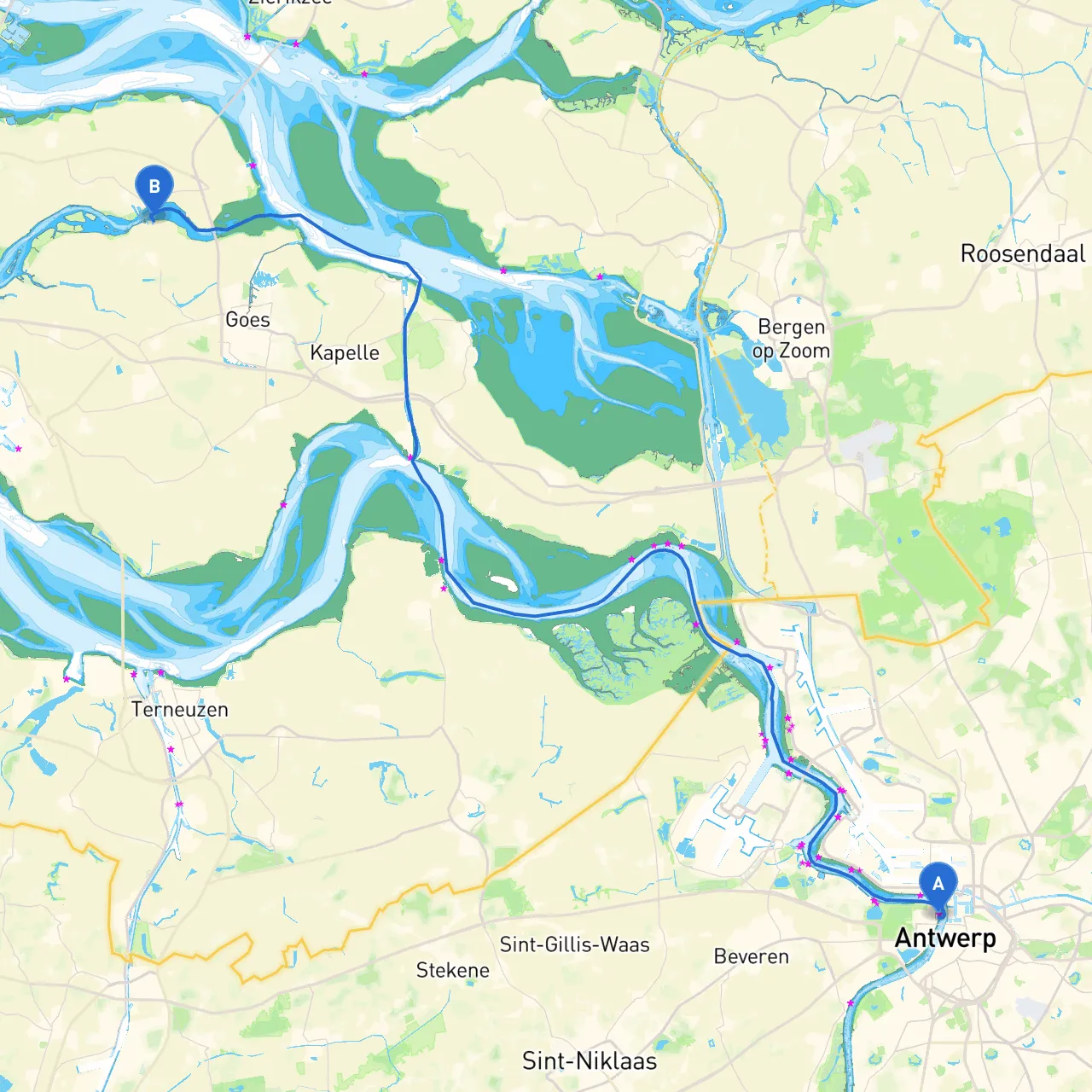
Pilotage Plan: Antwerp, BE to Wolphaartsdijk, NL
Route Overview:This boating journey will take you from the vibrant port city of Antwerp to the picturesque village of Wolphaartsdijk, traversing various waterways and channels. This route is particularly suitable for intermediate to experienced boaters who are comfortable navigating inland waterways and are mindful of local maritime conditions and regulations.
Section 1: Departure from Antwerp
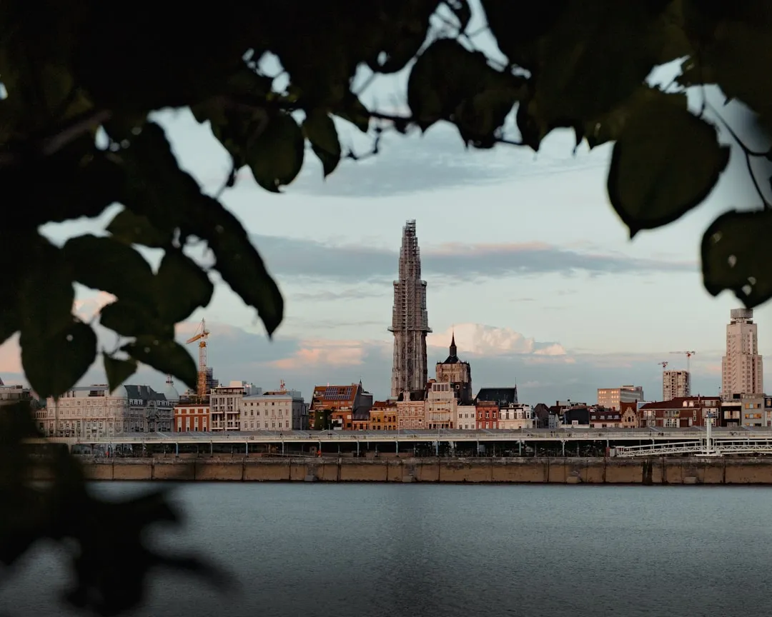
Start Point: Antwerp, Flanders, Belgium Coordinates: 4.3944° E, 51.2305° N
Antwerp is well-equipped with marinas and services catering to boaters. Before departure, ensure all safety gear is onboard, including life jackets, flares, and a first aid kit. As you set off, be aware of the commercial shipping traffic inherent in this bustling port city.
Navigational Aids: Pay close attention to the port’s navigation lights, especially in poor visibility conditions. Monitoring the AIS (Automatic Identification System) is highly advisable to avoid collisions with larger vessels.
Section 2: The Scheldt River Journey
Once you leave the marina, you will follow the Scheldt River northwards, meandering towards the Netherlands. The river can be busy with cargo vessels; keep a safe distance from them and navigate within the designated channels.
Points of Interest:
Hazards & Considerations: Watch for tidal changes along the Scheldt and respect any local speed restrictions to maintain safety and erosion control along the shorelines. Look out for small fishing boats and river traffic!
Section 3: Entering Belgium’s Canal System
After approximately 10 nautical miles on the Scheldt, make your way into the Antwerp-Rupel Canal. This shift could offer calmer waters but be mindful of the various locks along the way. In particular, the Verrebroek lock can be busy—prepare to wait for your turn.
Navigational Aids: Keep an eye out for canal markers and be mindful of the current, especially after periods of heavy rainfall.
Notable Shelters:
Section 4: Crossing into the Netherlands
As you continue through the network of canals leading to the western Scheldt, you will eventually cross the border into the Netherlands. Here, the landscape opens up, giving way to more scenic views. The town of Tholen is easily reachable and has excellent amenities if you’d like to dock for an overnight stay.
Caution: Be aware of the slower speed limits in residential and recreational areas, which are designed to ensure the safety of local water users.
Section 5: Towards Wolphaartsdijk
Continue northwest through the connecting waterways until you reach the entrance of the Oosterschelde estuary. This area can be quite exciting with tidal currents; paying close attention to your navigation and weather conditions is vital.
Shelter Points:
Attention: Adhere to navigation markers and be particularly vigilant about tidal schedules here—currents can be strong, especially during spring tides.
Destination: Arrival at Wolphaartsdijk
End Point: Wolphaartsdijk, Zeeland, Netherlands Coordinates: 3.8218° E, 51.5481° N
Upon arrival in Wolphaartsdijk, you’ll be greeted by quaint buildings and friendly locals. Explore by foot or check out one of the local dining options for fresh seafood. Enjoy the atmospheric marina, which is well-equipped for visiting boaters.
Regulations & Final Notes: Before leaving port, make sure to check for any local boating regulations or restrictions related to the Oosterschelde National Park.
Recommended Apps: For ease of navigation, I highly suggest using the following apps:
This trip promises beautiful scenery, an opportunity to engage with local culture, and well-founded safety considerations. For an experienced boater, this route provides an excellent blend of adventure and relaxation, with ample opportunities for safe harbor along the way. Enjoy your cruise!