Pilotage Plan: Anstruther to North Berwick
Overview
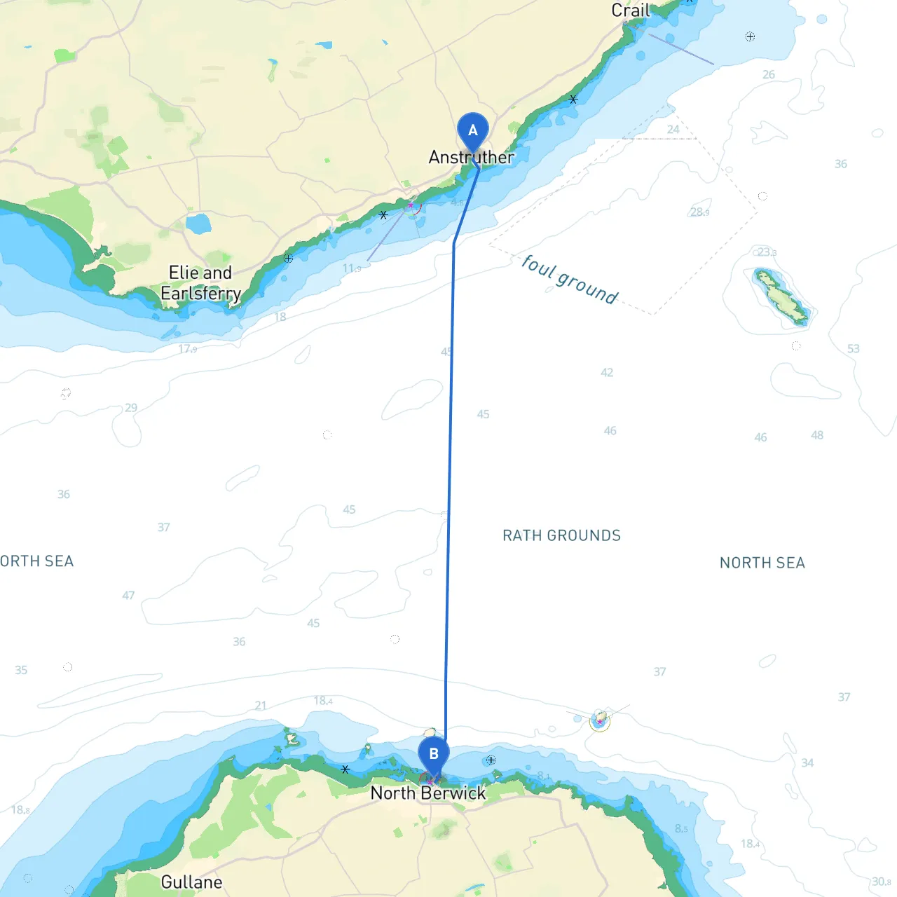
The journey from Anstruther to North Berwick encompasses approximately 25 nautical miles along the beautiful East Coast of Scotland. This route is particularly suitable for intermediate to experienced boaters, given the potential for varying weather conditions, tidal currents, and navigation around notable landmarks. The stunning coastal scenery, wildlife, and opportunities for safe stops make this a worthwhile endeavor for any sailor.
Departure from Anstruther
As you set off from Anstruther (56.2226° N, -2.6998° W), take a moment to enjoy the picturesque harbor surrounded by charming fishing cottages. Before leaving, ensure that you have reviewed the latest weather reports, as conditions can change swiftly.
Notable Hazards and Navigation Considerations
Heading east, pay attention to the following hazards and navigational considerations:
- Firth of Forth: As you exit the Firth of Forth, be wary of strong currents. The area can experience significant tidal flow. Consult tide tables for your departure time to determine optimal sailing conditions.
- Havens: If the weather does take a downturn, consider diverting to one of the local havens:
-
: A short detour to the south offers a sheltered anchorage, but be cautious of shallow areas. -
: Situated to the northwest of your route, this safe haven can provide refuge from rough seas and is a compact and welcoming harbor.
Route Highlights
As you sail towards North Berwick, you should aim to pass near or by several points of interest:
1. Crail Harbour: Known for its historic fishing port, this small village provides a charming area to explore, with its cobbled streets and seafood restaurants. A quick stop can reward you with local delicacies and stunning views.
2. The Isle of May: Approximately midway on your route, the Isle of May is a majestic nature reserve home to an array of seabirds and wildlife. While not a docking point, consider a detour for wildlife watching if weather permits and you have the time to spare.
3. Berwick Law: As you approach North Berwick, keep an eye out for Berwick Law, a dormant volcano marking the landscape. The distinctive shape is a great point of reference for navigation.
Navigational Aids
To ensure a safe passage:
- Use electronic navigation aids such as GPS along with paper charts to maintain situational awareness.
- Key navigational markers along your route include the May Island Light and North Berwick's Beacon, visible from a considerable distance.
Local Regulations
While en route, remember to observe local maritime rules:
- Maintain distance from marine protected areas, particularly around the Isle of May.
- Respect wildlife, especially during breeding seasons.
Arrival in North Berwick
Upon your arrival in North Berwick (56.0611° N, -2.7181° W), you will find a well-maintained marina that offers complete amenities, including mooring facilities, and access to local attractions such as the Scottish Seabird Centre. After mooring, take the opportunity to explore the local shops and enjoy the stunning coastal views.
Safety Recommendations
- Always wear your life jacket and ensure each crew member does the same.
- Carry a first aid kit and ensure that it is stocked and accessible.
- Keep a reliable communication device onboard at all times.
- Inform someone onshore of your route and expected arrival times.
Boating Apps
Consider utilizing the following apps for additional information and navigation support:- Navionics: Excellent for detailed marine charts and navigation.
- UKHO: Offers navigational updates and resources.
- Savvy Navvy: A comprehensive tool ideal for route planning, including weather forecasts and tidal predictions.
This pilotage plan outlines a splendid and scenic route from Anstruther to North Berwick. Keep safety as your top priority, and immerse yourself in the breathtaking views and natural beauty Scotland has to offer. Enjoy your trip!