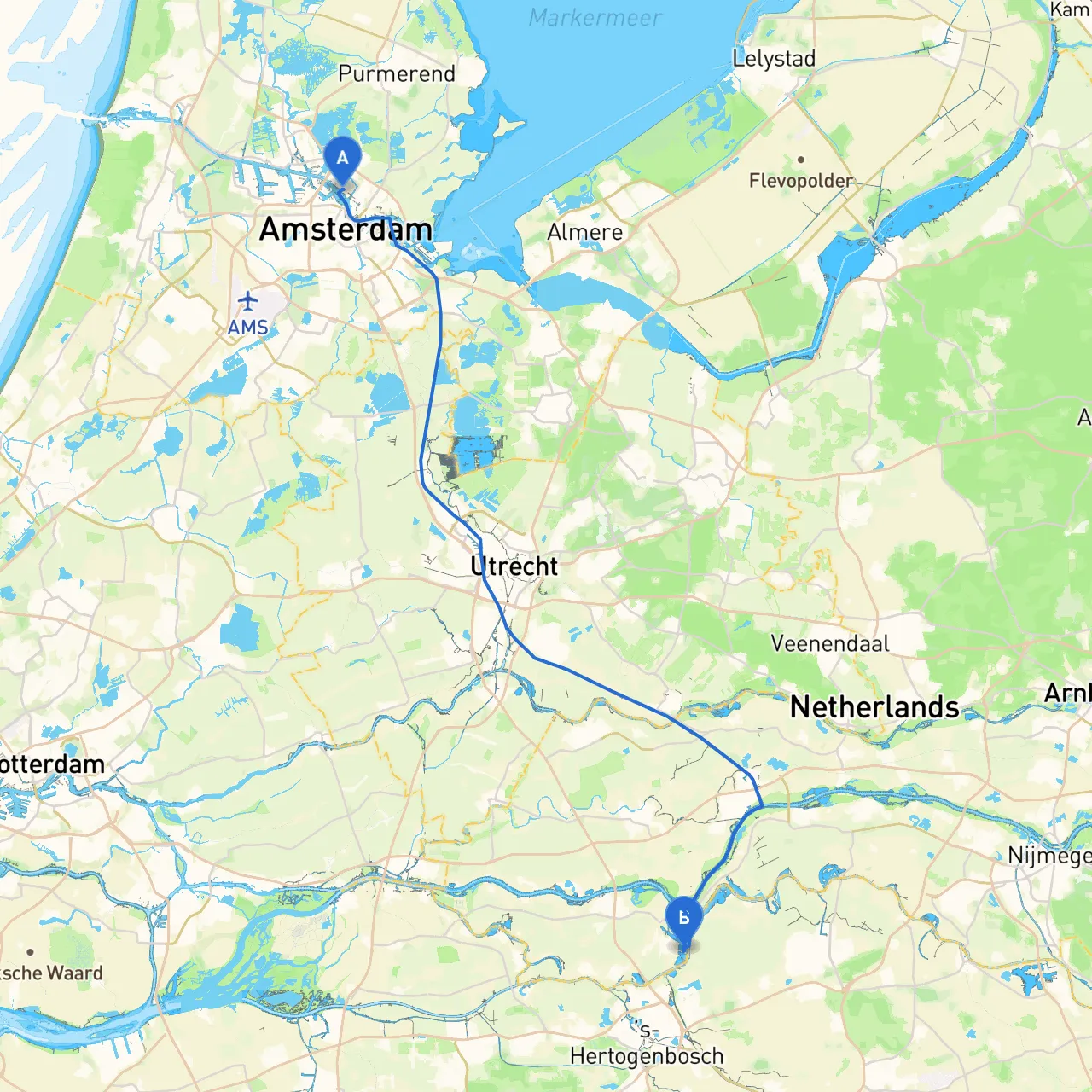
Pilotage Plan: Amsterdam, NL to Kerkdriel, NL
Route Overview:Embarking from the vibrant city of Amsterdam—famous for its canals and historic architecture—you’ll navigate through the picturesque Dutch waterways toward Kerkdriel, known for its charming villages and serene landscapes. This route is particularly suitable for recreational boaters seeking a blend of natural beauty, cultural experiences, and safe harbors.
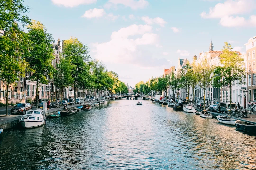
Starting Point: Amsterdam, NL Coordinates: 4.8873° E, 52.4046° N
As you set off, take a moment to enjoy the bustling atmosphere of Amsterdam. The city’s waterfront boasts numerous sights, including historical ships and waterfront cafés. A visit to the Rijksmuseum or a leisurely cruise through the canals is a nice prelude to your journey.
While exiting Amsterdam, keep an eye on the local traffic—both pleasure craft and commercial vessels. The IJ River can be busy, so prioritize following navigational markers and maintain a safe distance from larger ships.
Route to Zaanstad After navigating out of the Amsterdam canals, your first notable landmark will be Zaanstad. This area offers a glimpse into traditional Dutch culture with its historic windmills and wooden houses. Here, you can take shelter if the weather changes, as Zaanstad's harbors provide refuge.
Points of Interest:
Navigational Considerations:Pay attention to the severed locks and checking points along the Zaan River, and abide by local traffic rules. Maintain a lookout for “no wake” signs, particularly near residential areas.
Continuing on to Vreeland As you progress, you’ll venture onto the Vecht River. The gently flowing waters will lead you past stunning estates and lush landscapes. The charm of the Vreeland area offers excellent mooring options and quaint spots for lunch.
Points of Interest:
Navigation Tips:Watch for mooring restrictions and respect the local wildlife. The villages along this stretch promote a peaceful boating experience; keep your speed moderate and look out for kayakers and paddle boarders.
Transition to Woudrichem Your route takes you to the confluence of the Merwede River. This area can present some larger vessel traffic, so stay alert. The town of Woudrichem features a picturesque harbor, providing shelter in cases of inclement weather.
Points of Interest:
Important Navigational Aids:Look out for buoys and day markers as you navigate these wider waters, and pay attention to the tides.
Destination: Kerkdriel, NL Coordinates: 5.3542° E, 51.7663° N
As you approach Kerkdriel, you’ll find a tranquil setting adorned with greenery and waterways. The village is known for its welcoming atmosphere and offers various attractions for rest and relaxation.
Points of Interest:
Safety Measures:Upon arrival, check local harbor regulations for docking your vessel. The area also has specific waste disposal rules, so ensure to adhere to local environmental guidelines.
Useful Apps:Consider using navigation apps such as:
Safety Tips:
This route embodies a delightful blend of scenic beauty and safe navigation, making it ideal for both novice and experienced boaters. Enjoy the journey, and always prioritize safety on your adventurous boating trip!