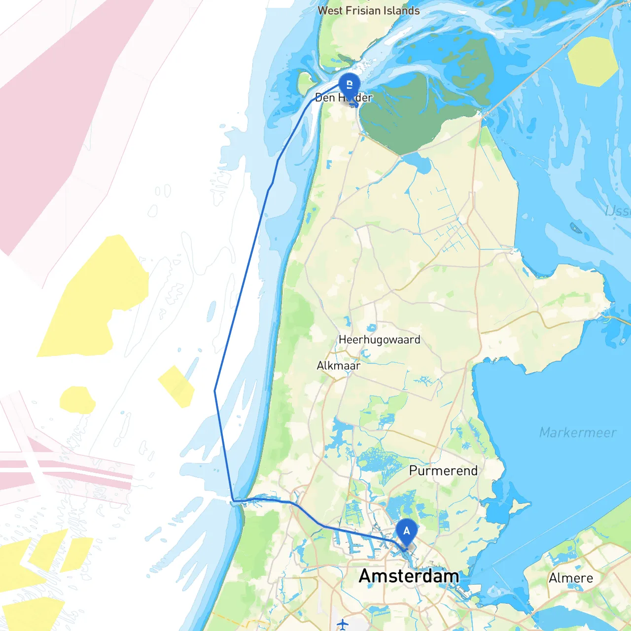
Pilotage Plan: Amsterdam to Den Helder
Route Overview:Embarking on a journey from Amsterdam to Den Helder offers a fascinating blend of urban canals, lush landscapes, and coastal beauty. By navigating through this route, boaters can enjoy a diverse range of experiences, from the historical charm of Amsterdam to the breezy waves of the North Sea near Den Helder. This itinerary is particularly suitable for intermediate to experienced cruisers who appreciate both scenic beauty and the nuances of maritime navigation.
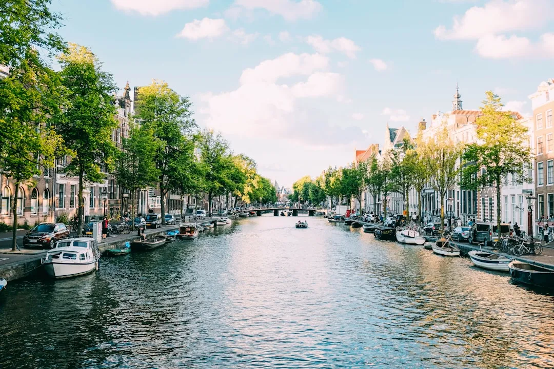
Section 1: Departure from Amsterdam
Starting Point: Amsterdam, NL
- Coordinates: 4.8874° E, 52.4046° N
- Notable Navigational Aids: As you leave, be mindful of the numerous canal traffic and local waterway regulations. The Amsterdam Canal Ring is protected as a UNESCO World Heritage site—keep your speed moderate and watch for other craft.
Navigational Considerations:
- Speed Limits: Generally, speed limits in the canals range from 4 to 6 km/h.
- Vessels: Look out for ferries and tour boats, particularly near main attractions like the Rijksmuseum and the Anne Frank House.
- Obstacles: Keep an eye on fixed bridges and mooring areas to prevent any collisions.
Section 2: Through the IJmeer and Markermeer
Leg to Almere (Approx. 30 km)
- Course: Exit through the Ij, navigate to the IJmeer, and continue towards Almere.
- Shelter Bay: Almere offers safe mooring in case of adverse weather. The Almere Haven is a delightful stop with dining options.
Points of Interest:
- Marker Wadden: This new nature reserve is an ideal pit stop for birdwatchers and those who enjoy nature. Keep the wadden area on your starboard side while maintaining a safe distance.
Section 3: Navigating towards Den Helder
Leg to Den Helder (Approx. 30 km from Almere)
- Course: Head northwest towards Den Helder, traversing open water. Maintain your navigation charts close by, as weather conditions can change swiftly.
Hazards:
- Shipping Lanes: Pay special attention to larger vessels as you approach the shipping lanes near the North Sea entry.
- Fisherman’s Nets: Look out for and avoid fishing areas marked by buoys.
Notable Navigation Aids:
- Lighthouses: The Noordhinder Lighthouse will be one of the prominent markers. Ensure your charts are updated to include this.
- Dredged Channels: Follow the marked channels; these maintain depth and are often dredged to facilitate navigation, especially for larger boats.
Section 4: Arrival at Den Helder
End Point: Den Helder, NL
- Coordinates: 4.7721° E, 52.9497° N
- Notable Landmarks: Upon arriving, explore the Naval Museum and the local beaches. Den Helder is known for its maritime history and scenic views of the Wadden Sea.
Section 5: Safety Considerations and Recommendations
Weather Monitoring:
- Always check the marine weather forecast before setting out, as conditions can change rapidly in the North Sea area.
- App Recommendation: Utilize boating apps like Savvy Navvy for real-time navigation updates and weather forecasts.
Local Regulations:
- Respect the fishing and swimming zones while in coastal areas.
- Keep noise levels down during the early morning and late evening in populated areas.
Communication:
- Maintain an operational VHF radio for updates and any emergencies. Monitor Ch16 for safety notifications.
Conclusion
This journey from Amsterdam to Den Helder is not only a practical route for reaching your destination, but it is also steeped in Dutch culture and natural beauty. Amidst safe harbors and meticulously charted paths, boater satisfaction and safety can coexist harmoniously. With advanced preparation, you can navigate this route confidently, enjoying both the tranquility and the adventures that await.