
25% off Premium membership
£89
£44.50
BLACK FRIDAY WEEK! We’re offering savvy navvy Premium at 25% discount price. This one-off deal is valid for your first year of subscription.

Over 3 Million Downloads

4.6 out of 5
Over 10,000 5 Star Reviews

Great and simple to use
I sail with friends and families and this app is a great way to illustrate “dads” boring chart work through a much more teenage friendly platform. I use both for cross reference and find it pretty accurate. Considering the price of charts it is extremely good value.
RAD NAV APP
I use Savvy Navvy daily for all my inshore fishing here in south Texas. Great for current conditions, including tides and wind direction. It’s like Google maps for boaters. Plan routes, mark your fishing spots and return to the dock in one piece. Every time! Great App 5 stars.
Lifesaver!
2 weeks ago during the heatwave, we were on the Solent and the temperature fried all our instruments including the GPS plotter. Thank god we had Savvy Navvy as it worked perfectly for the entire weekend and allowed us to do everything we wanted. People say these kind of apps aren’t meant to replace the instruments on board, well I can confirm that when they instruments on board all fail, this was an absolute lifesaver. Can’t wait to test it in other countries.
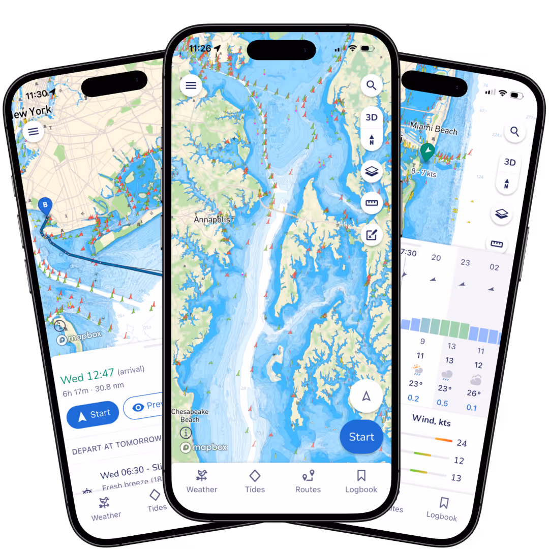
Powerful Tools to Supercharge Your Navigation.

Savvy Charts ™
We licence UKHO, NOAA and other official hydrographic office charts from around the globe. Our designers build savvy charts from the ground up to show essential marine information with a clean and easy-to-view interface.


Over the Horizon AIS (OHA)
Enhance safety with greater awareness of vessel movements around you. Using your phone’s internet connection we stream vessel data such as speed, distance, MMSI, position, COG and destination.

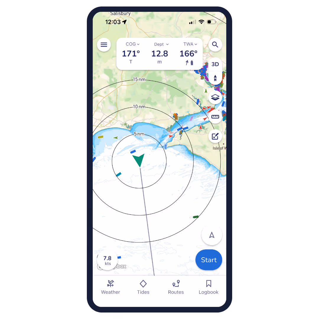
GPS Active Tracking
View your live position and check your Course Over Ground (COG) and Speed Over Ground (SOG) in real time. Concentric circles around your position quickly show the distance between you and key features around you.


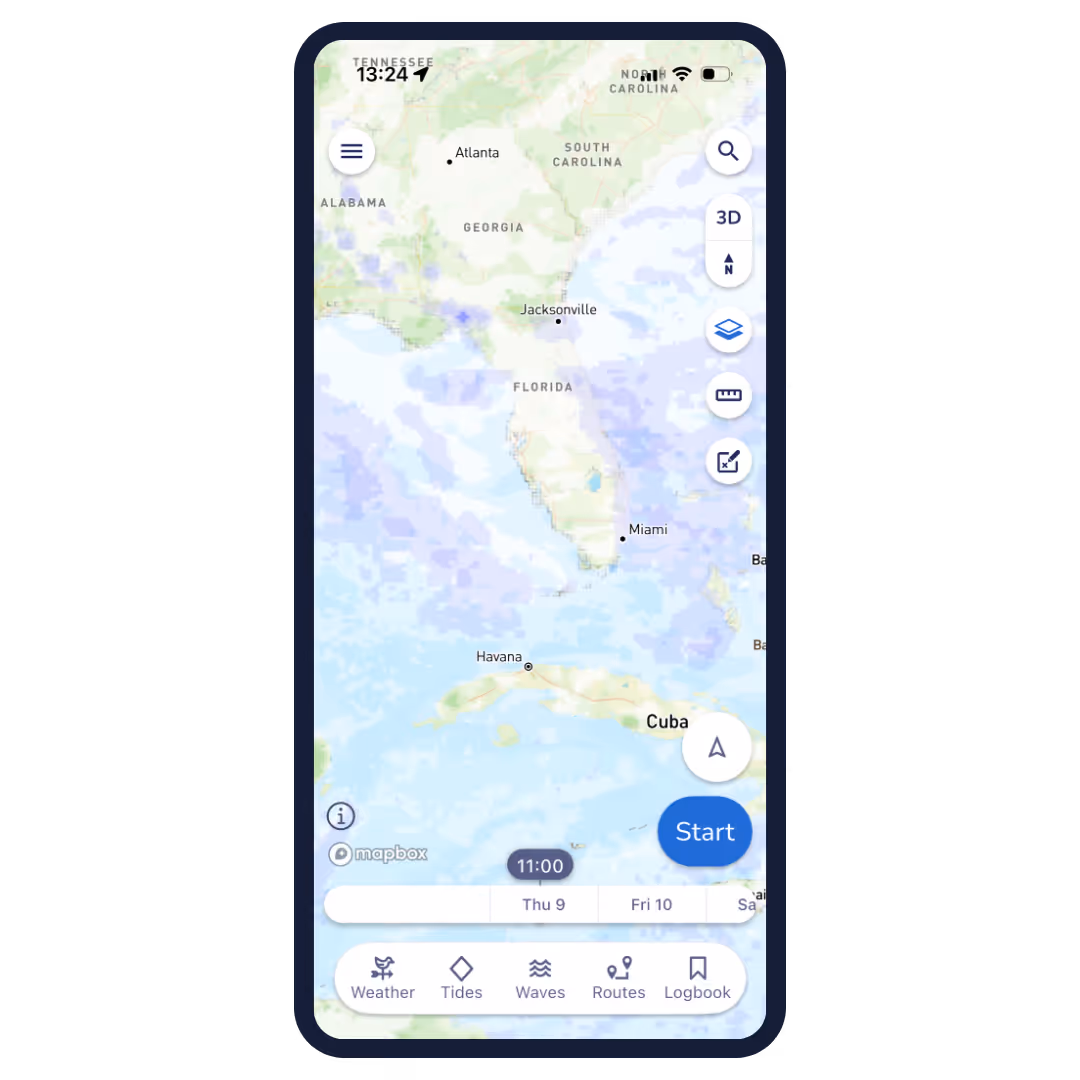
Marine Weather Forecast
We don’t expect you to be a metrologist to get the most out of your weather data. That’s why we use ECMWF technology to combine multiple weather forecasts for a more comprehensive forecast. Scroll through the coming days to view the changing wind direction, intensity and weather conditions.

Clouds and Rain Overlay
Use this overlay to view changing weather patterns within your area. This handy tool helps you avoid those pesky squalls and rain showers.
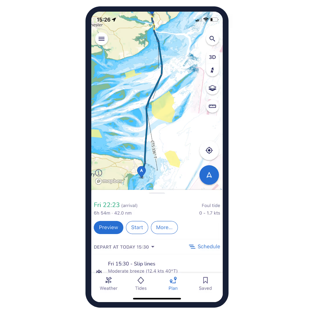

Smart Routing
Smart routing calculates the optimal journey by factoring in every detail that matters, such as your planned departure time, boat specifications, chart data, wind, weather, and tides. This provides a clear, reliable, and comprehensive passage plan tailored to you.

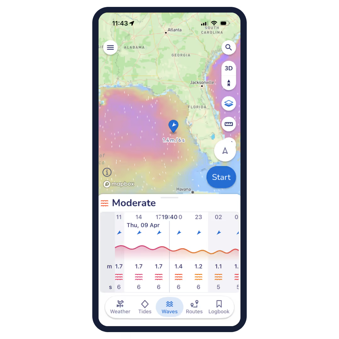
Waves
Our Waves feature brings sea state to life, combining wave height, period and direction to give you a simple comfort rating—so you can quickly see how conditions will really feel on the water, not just how they look on a forecast.
NMEA Connect
NMEA Connect brings your boat’s instruments straight into Savvy Navvy, streaming real-time data like depth, wind, speed and AIS alongside our smart routing—so everything you need is in one place, right in your pocket.

Estimate Your Arrival Time
For those who don’t like to be late! Plot a route from A to B to get a quick and easy estimation of your distance to travel, fuel requirements and time of arrival. You can then share your chosen route with friends and family so they know when to expect you.


Fuel Efficiency
No one likes that feeling of potentially running out of fuel. That’s why our custom boat settings let you estimate fuel usage for your intended route based on your engine cruising speed and boat fuel efficiency.
Schedule departure time
Pick the best time to leave the dock for a better day on the water. Simply plot your route and scroll through the departure times to see the effect on your route, then choose the one you like best! Check out the demo.

And Many More Amazing Features!
Tidal Data
Access to tidal data from eight thousand tidal stations around the globe. Savvy Navvy’s tidal graph also gives you a quick visual reference for tidal highs and lows throughout the day. Tap the tidal streams toggle to get a visual overlay of tidal strength and direction on your digital marine chart.
Course To Steer
Savvy routing provides you with an automatic Course to Steer, taking into account tide, weather and chart data. Thanks to preview mode you can also review every stage of your journey before you set off.
Import Markers
Import your markers from other navigational tools to view all your saved locations within your Savvy App. This ensures your valuable data will continue enhancing your boating experience while enjoying the Savvy features you love most! Boat smarter, not harder.
Marina & Anchorage Information
Boat like a local with key information on tap! Select the marina and anchorage icons to view essential information on seabeds, weather protection, amenities, number of berths, maximum boat length, contact information, and more. Boat global, think local.
Save Your Favourite Locations
Love that secluded bay? Got a restaurant on that island you just don’t want to forget? Save pins at your favourite locations so you never forget those special places.
Anchor Alarm
Sleep like a baby with the Savvy Anchor Alarm. This easy-to-use tool lets you set your safety parameters and happily sets off an alarm should you drift outside your comfort zone.
Satellite Mode
Get nosy when investigating the perfect spot with satellite mode. This handy overlay lets you take a more detailed look at marinas and anchorages so you can be sure you pick the best one.
Offline Charts & Weather
Wander where the WiFi’s weak with Savvy Offline. Download chart packs and weather data to your device so you can continue to use the features you love, even when you’re off-grid.
Export Routes
Plot your route with Savvy Navvy then export your route to a GPX file. This can be used with your onboard chart plotter for active navigation.
Dedicated Customer Support
We have a dedicated team on-call within the Savvy Navvy app to answer any questions you have, wherever and whenever you need us. We are not robots, our team love to help!

Frequently Asked Questions.
Have questions? We’ve answers. If you can’t find what you're looking for? Check out our knowledge base or feel free to get in touch