

Boat Navigation in the palm of your hand
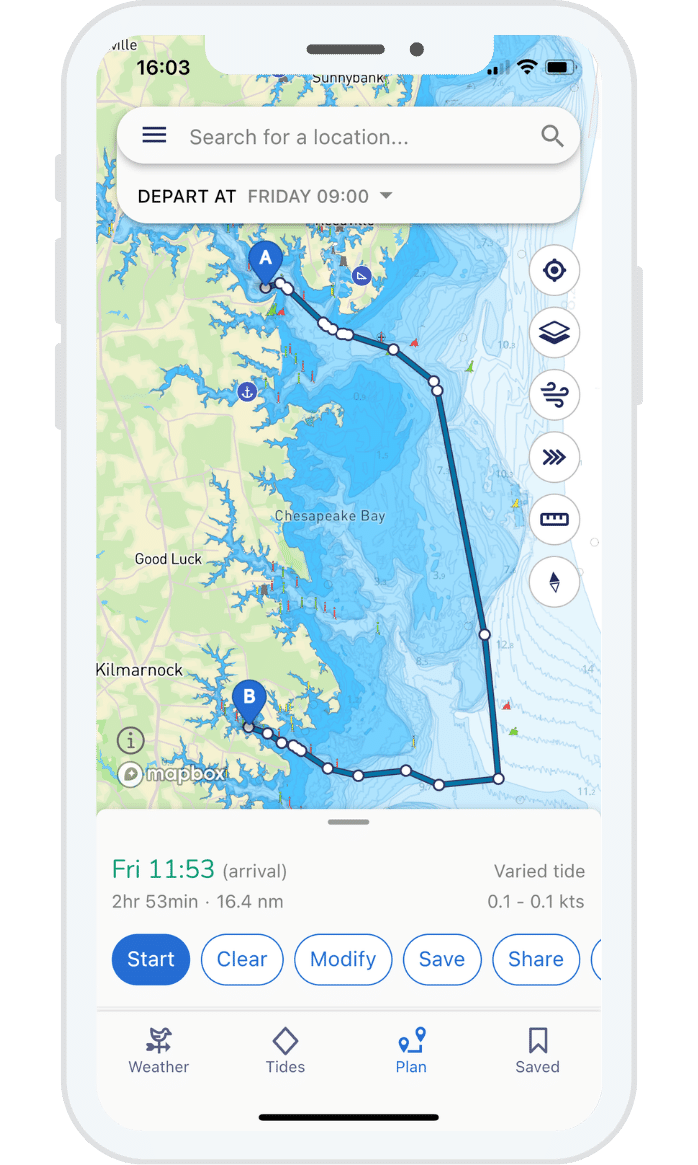
Sailing route planner - passage planning made easy 🧭
Our aim is to be an all-in-one boating app, that’s why we don’t just plot routes, we don’t just show you marine weather forecasts or digital chart data. We show you it all and then use our Savvy algorithm to crunch all this data into an easy-to-use interface. So when planning a route or checking your weather forecast, it’s using data from multiple sources to give you the best possible information.

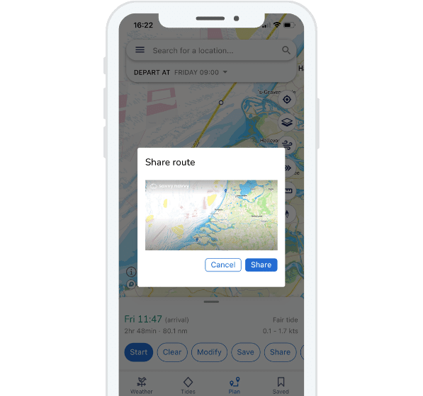
Share your route
Planned an amazing route? Why not share it with someone on land as an additional safety measure to let them know your plans? Or if you’re looking to bring friends with your simply share your route so they can see it in their Savvy app as well.
Export your route
Would you like to use your Savvy Navvy route with your boat chart plotter? Simply use the export route function to download the route and upload it to your chart plotter of choice.
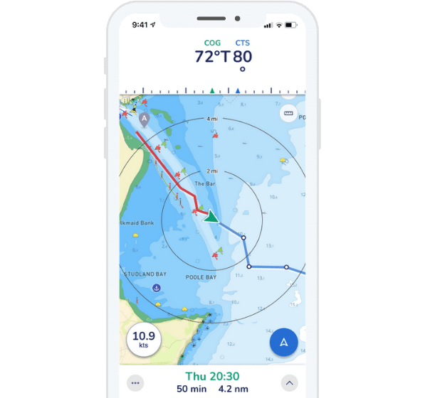
GPS location positioning
Using the “GPS” mode you can track your live location whilst underway. So for those of you who are in familiar waters but just want to check where you are, this is the perfect tool for you!
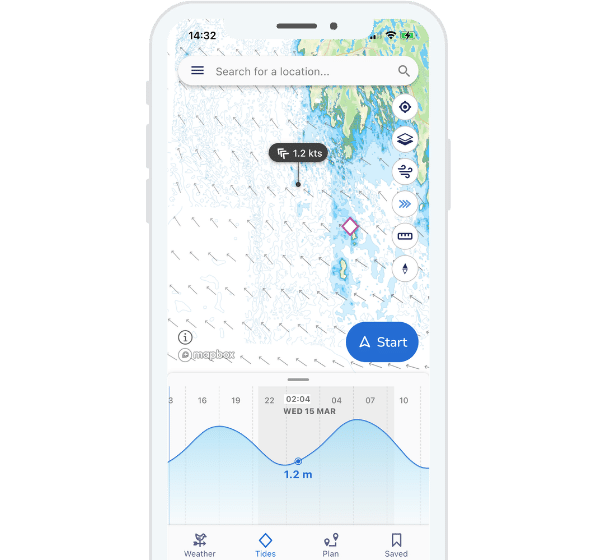
Tidal streams
Tap the “Tides” icon to see an easy to read graph of tidal highs and lows or toggle on the tidal streams animation to get a visual overlay of tide directions and strength throughout the day, overlaid on your chart.

Marine weather forecast
Weather forecasts are essential to effective boat navigation. That’s why we don’t just show you GFS data. We also partnered with Meteomatics to also provide the Meteomatics Mix. This means our weather forecasts are taken from a host of data sources to give you the most coherent data possible. Whichever model you prefer, it’s really up to you! Just toggle between the two…
Even more features to improve your time on the water
Choose your chart overlay
We provide a map, maxar satellite, USGS satellite and night mode overlay options on your Savvy charts™. So whether you’re underway at night, snooping around an anchorage or bay for a perfect spot or simply checking your position, you can choose the visuals that work best for you.
Recommended tracks
Identify recommended tracks which are easily visible in the Savvy Navvy app. By clicking the recommended track icon you can also view the name of the beacon as well as the light sequences.
We do more than boat navigation
We’re not just a boat navigation app! We also have variable modes for jet skiers, kayakers and paddle boarders. We’ve also found the occasional swimmer likes to use Savvy navvy!
Marina information - travel like a local
Looking for the perfect overnight stay or a spot for lunch? Tap marina icons to get detailed information such as reviews, facilities, restaurants, mooring buoys info and more…
Offline Charts & Weather
Download chart and weather data for use offline. Save chart packs for the areas where you’re sailing so you can continue to use all your favourite Savvy Navvy features even when sailing off-grid.
Dedicated Customer Support
We have a dedicated team on-call within the Savvy Navvy app to answer any questions you have, wherever and whenever you need us.