
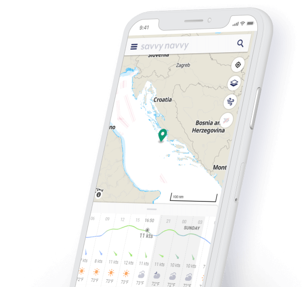
savvy charts™ are available throughout the Baltic region. Our Baltic sea map (chart) data is designed with usability in mind. In short, we show you what you need and avoid cluttering your screen with things you don’t. savvy charts™ use data from official hydrographic offices.


Alongside our detailed sea maps, get information on tidal data from thousands of tidal stations throughout the Baltic region and around the world. Easily view the date and time of high and low water with our savvy tidal graph or toggle “On” the tidal stream visual overall.

For greater peace of mind, you can easily check Baltic sea map information, view your GPS location, Course Over Ground (COG) and Speed Over Ground (SOG) in an instant.

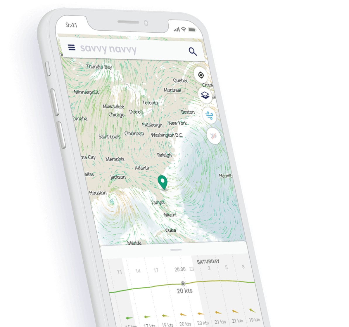

savvy navvy provides a visual wind overlay that lets you see the direction, changeability and strength of the Baltic Sea wind patterns over the course of a few days.

With our weather forecasts graph, you can cycle through various dates and times to see the changing effect of the wind, weather conditions and temperature, so you can make an informed decision about your trip


Plan a route to sail or motor taking into account your boat details, weather conditions, tidal information and Baltic sea map (chart) data. With savvy navvy you can plot a comprehensive route in seconds on your phone, tablet or computer, then save, share or export the route with your friends and family.

Visual displays show your estimated distance to travel and predicted arrival time, so you can adjust your route in the Baltic Sea as needed to take the uncertainty out of getting from start to finish.

Tired of worrying about whether you have enough fuel? Hop into your boat settings and set your fuel efficiency and cruising speed, savvy navvy will then show your predicted fuel usage for your planned journey in the Baltic.
See at a glance the best time to depart based on your route, wind & tidal conditions, see the demo.
savvy routing™ gives you an automatic Course to Steer (CTS) and an easy to view preview of your route, instantly.
Choosing the right anchorage or marina is essential for planning your perfect overnight stay. Whether you’re a local or a visitor you can easily check out essential information, such as the direction of wind protection, Baltic sea map information, fuel and water supplies, restaurants, moorings, harbour master information and more at the touch of a button thanks to our Navily integrations.
savvy night mode helps preserve your night vision when cruising the Baltic Sea in the dark whilst our satellite feature enables you to take a closer look at your destination for enhanced planning.
For those of our members that love to sail where the WiFi and phone signal is weak, we provide “Offline Mode” so you can download Baltic sea map (chart) and weather packs that enable you to use the boating app whilst our or range of signal. When you get a signal again you can update your packs to ensure you’re using the latest possible information.
Use savvy routing™ and view Baltic sea maps on your boat chart plotter, simply “Export your route” to download a GPX file that can then be uploaded to your Raymarine - or other - chart plotter.
savvy navvy have a dedicated customer support team for our members across the globe! You can contact us through the easy to use messaging system through the savvy navvy app or contact us at ahoy@savvy-navvy.com.
Our team believe in the freedom to roam. That’s why we provide access to savvy charts™ for all of our members wherever we have coverage, on any device. Click on our chart coverage map to all our locations.
Available on Android or iOS with a 14-day free trial.
Download savvy navvy on your iPhone or iPad today and start planning your next sail.

Download savvy navvy to your Android phone or tablet and supercharge your navigation.

savvy navvy also provides charts areas for other areas including Caribbean sea maps, Mediterranean Sea and North Sea Charts


